Click to visit the main New York Public Library Homepage
The New York Public Library
Digital Collections
About Digital Collections
Browse
Search only public domain materials
Items
Collections
Divisions
Home
Search
Browse
About
Search only public domain materials
Items
Collections
Divisions
Digital Collections
Using Images
Using Data
Search
Filtered search
Show filters
Hide filters
Show Only Public Domain
topic
Geography
114
Historical geography
57
Maps in education
56
Road maps
54
Atlases
53
More
Less
name
Faden, William, 1749-1836
75
Tiebout, Cornelius, 1777-1832
63
Stockdale, John, 1749?-1814
54
Colles, Christopher, 1738-1816
53
Sayer, Robert, 1725-1794
47
More
Less
collection
Bancker plans
579
Lawrence H. Slaughter Collection of English maps, charts, globes, books and atlases
264
Maps of North America
136
Atlases, gazetteers, guidebooks and other books
88
The antiquities, natural history, ruins and other curiosities of Egypt, Nubia and Thebes. Exemplified in near two hundred drawings taken on the spot
40
More
Less
place
United States
129
Great Britain
103
England
86
Middle Atlantic States
62
Egypt
42
More
Less
genre
Maps
1272
Surveys
578
land surveys
510
Documents
74
Prints
64
More
Less
publisher
Published by Wm. Faden, geographer to His Majesty, and His R.H. the Prince of Wales
53
Printed for Robert Sayer, No. 53, Fleet-Street
44
Printed for John Cary
43
Printed for Lockyer Davis
40
Chez Delamarche
30
More
Less
division
Manuscripts and Archives Division
588
Map Division
549
General Research Division
79
Pforzheimer Collection
32
Rare Book Division
19
More
Less
type
x
cartographic
text
136
still image
8
Date Range
to
1,313 results found
Filtering on:
x
Date
: 1780 - 1800
x
Type
: cartographic
Sort by:
Title
Date created
Date digitized
Sequence
Results 1001 - 1050
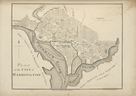
Plan of the city of Washingto…
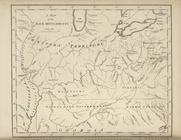
A map of the Back Settlements.
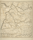
A map of Kentucky, drawn from…
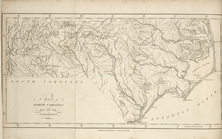
A map of North Carolina, from…
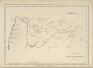
A map of the Tennessee Govern…
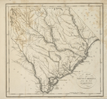
A map of South Carolina, from…
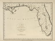
A map of the East and West Fl…
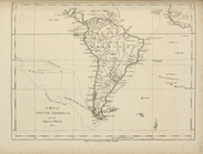
A map of South America and th…
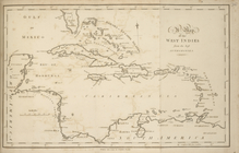
A map of the West Indies, fro…
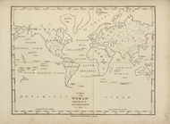
A map of the world, exhibitin…
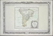
Chili, Paraguay, Bresil, Amaz…
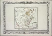
Nouveau Mexique, Louisiane, C…
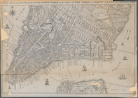
A New & Accurate Plan of the …
m
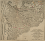
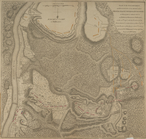
Plan of the encampment and po…
m
Plan of the encampment and po…
A chart of the bar of Sandy H…
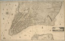
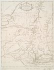
A new & accurate plan of the …
A new and accurate map of the…
m
The engagement on the White P…
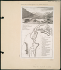
A perspective view of Lake Ge…
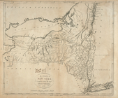
The state of New York, compil…
Chart and plan of the harbour…
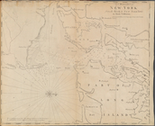
An Accurate map of New York i…
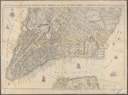
A new & accurate plan of the …
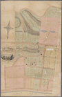
Map of property at New Bright…
A Draught of New York from th…
The United States according t…
Carte generale des colonies a…
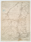
Map of the northern provinces…
A plan of part of the provin…
A New and accurate map of New…
m
Map of the state of Maryland …
A map and chart of those part…
Plan of the city of Philadelp…
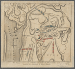
A map of the country in which…
A map of the seat of war in t…
Virginia, Marylandia et Carol…
Regni Mexicani seu Novae Hisp…
Map of the United States of A…
A map of the United States of…
Map of the southern provinces…
Carte des Etats-unis : provin…
A new map of North America wi…
New & accurate map of North A…
An accurate map of North Amer…
m
To Thomas Mifflin, governor a…
Plan of the city of Washingto…
The United States of North Am…
Carte générale des Etats Unis…
A map of the United States of…
1
2
3
4
5
6
Previous
Next
1
2
3
4
5
6
Previous
Next