Click to visit the main New York Public Library Homepage
The New York Public Library
Digital Collections
About Digital Collections
Browse
Search only public domain materials
Items
Collections
Divisions
Home
Search
Browse
About
Search only public domain materials
Items
Collections
Divisions
Digital Collections
Using Images
Using Data
Search
Filtered search
Show filters
Hide filters
Show Only Public Domain
topic
Road maps
54
Geography
15
Atlases, British
13
Business enterprises
3
Commerce
3
More
Less
name
Tiebout, Cornelius, 1777-1832
57
Colles, Christopher, 1738-1816
53
Sayer, Robert, 1725-1794
14
Dunn, Samuel, d. 1794
13
Harrison, John, active 1784-1792
3
More
Less
collection
Bancker plans
74
Lawrence H. Slaughter Collection of English maps, charts, globes, books and atlases
58
Atlases, gazetteers, guidebooks and other books
17
Maps of North America
6
New York City directories
3
More
Less
place
Middle Atlantic States
54
United States
53
Early works to 1800
3
Italy
3
Maps
3
More
Less
genre
x
Maps
Surveys
74
land surveys
72
Books
3
Directories
3
More
Less
publisher
Printed for Robert Sayer, No. 53, Fleet-Street
13
Published & sold by Matthew Clark
3
publisher not identified
3
J.M. Bruyset
2
Printed for Hodge, Allen, and Campbell, and sold at their respective stores
2
More
Less
division
Map Division
85
Manuscripts and Archives Division
76
Rare Book Division
7
Wallach Division: Art & Architecture Collection
3
Schomburg Jean Blackwell Hutson Research and Reference Division
2
More
Less
type
cartographic
176
text
6
still image
2
Date Range
to
176 results found
Filtering on:
x
Date
: 1788 - 1791
x
Genre
: Maps
Sort by:
Title
Date created
Date digitized
Sequence
A new map of Africa from the …
Chart of part of the Coast of…
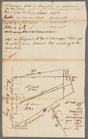
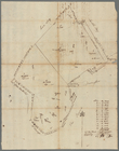
Survey of part of the Grange …
Atlas des enfans..., XVI
Atlas des enfans..., XV
Pianta del reale giardino di …
Plan des achats des compagnie…
Chart of the N.W. coast of Am…
m
Draft of square B of James De…
m
Plan of Mr. Mott and Mr. Sawy…
m
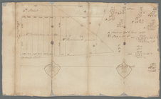
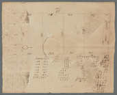
Quantity of lots in the unequ…
m
Measurement of De Lancey's gr…
m
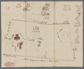
Continuation of Greenwich Str…
m
Mr. Brasier's lots south west…
m
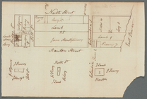
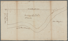
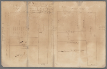
Wall Street
m
Leonard Lispenard's upland an…
m
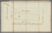
Part of Kip's Bay, north east
m
John Street near Queen Street…
m
Plan of a House at Number 5 H…
m
House and ground on north sid…
m
Foxcraft at Greenwich
m
Lots between Veasey and Barcl…
m
Land at Westchester belonging…
m
R. G. Livingston's houses etc…
m
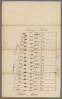
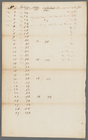
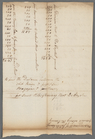
Maps
m
Water lots on Dey and Divisio…
m
Crown Point
m
Cove
m
Distances of the squares and …
m
Between Broadway, New Street,…
m
Captain De Lancey's ground - …
m
A. Hammond's ground
m
Lots 24, 25, 26 in the square…
m
Skinner and Queen Street
m
Queen and Skinner Street
m
John Robert Livingston's hous…
m
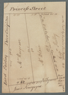
Lots in Princess Street
m
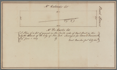
South side of Pearl Street
m
Nassau Street and Maiden Lane
m
Corner of William and Frankfo…
m
John Byvank's water lot on th…
m
Susquehanna - Winship
m
Pinhorn's Creek
m
Brookland
m
Kip's Bay
m
Yellis Mandeville homestead a…
m
Mrs. Foxcraft's Rose Hill at …
m
Water and ground belonging to…
m
Fresh Water
m
Valuation of Dutch Church hou…