Click to visit the main New York Public Library Homepage
The New York Public Library
Digital Collections
About Digital Collections
Browse
Search only public domain materials
Items
Collections
Divisions
Home
Search
Browse
About
Search only public domain materials
Items
Collections
Divisions
Digital Collections
Using Images
Using Data
Search
Filtered search
Show filters
Hide filters
Show Only Public Domain
topic
Description and travel
18
Antiquities
10
Real property
9
Landowners
8
Natural history
5
More
Less
name
Segato, Girolamo, 1792-1836
8
Valeriani, Domenico
8
Jomard, M. (Edme-François), 1777-1862
7
Napoleon I, Emperor of the French, 1769-1821
7
Catherwood, Frederick
6
More
Less
collection
Maps of North America
15
Atlante del basso ed alto Egitto
8
Description de l'Égypte: ou, Recueil des observations et des recherches qui ont été faites en Égypte pendant l'expédition de l'armée française
7
Incidents of travel in Yucatan: By John L. Stephens ... Illustrated by 120 engravings...
6
Oeuvres complètes de Buffon, augmentées par M. F. Cuvier ... de deux volumes supplementaires offrant la description des mammifères et des oiseaux les plus remarquables découverts jusqu'a ce jour
4
More
Less
place
Egypt
23
Yucatán (Mexico : State)
6
Ohio
5
United States
4
Africa
3
More
Less
genre
x
Illustrations
Maps
44
Prints
41
Cadastral maps
8
Plans
3
More
Less
publisher
nello stabilimento posto nei Fondacci di S. Spirito N. 1993
8
Impr. impériale
7
Harper & Brothers
6
F. D. Pillot
4
Girard
3
More
Less
division
General Research Division
23
Map Division
16
Rare Book Division
16
Schomburg Manuscripts, Archives and Rare Books Division
13
Dorot Jewish Division
2
More
Less
type
x
cartographic
still image
27
text
2
Date Range
to
71 results found
Filtering on:
x
Date
: 1789 - 1859
x
Genre
: Illustrations
x
Type
: cartographic
Sort by:
Title
Date created
Date digitized
Sequence
Turkey III: containing the So…
m
Atlas géologique
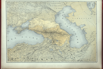
Carte generale du Caucase.
Carte de l'Ancien Continent.
Carte du Nouveau Continent.
[La Carte]
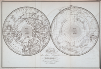
Carte des deux Régions Polair…
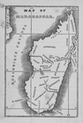
Map of Madagascar
Planta topografica della citt…
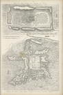
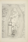
Rouine d'un Tempio d'Iside pr…
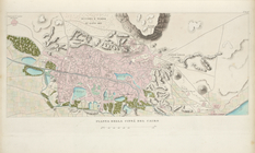
Pianta della città del Cairo.
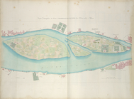
Pianta topografica di alcune …
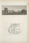
Altra veduta di Carnac; Piant…
Pianta del tempio di Luxor.
Piano generale di Tebe.
Pianta del tempio di File.
Map of free states, slave sta…
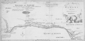
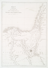
Dahomy and its environs by R.…
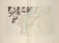
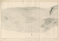
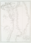
The Nile, from Assuan to the …
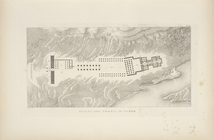
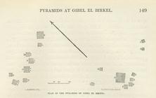
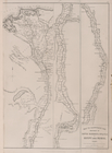
General plan of the pyramids …
Plan of the pyramids of Gibel…
m
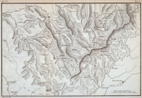
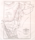
Topographical map of the coun…
m
City of Toledo, Lucas Co., Oh…
Map of Cleveland and its envi…
m
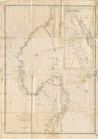
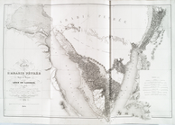
A correct map of the state of…
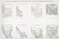
Reconnaissance of the western…
Map of Clinton County, Ohio
Reconnaissance of the western…
m
Map of Trumbull County, Ohio
Map of Perry County, Ohio
Reconnaissance of the S.E. en…
m
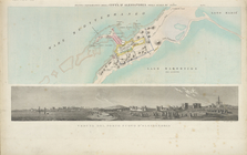
Constantinople and the scener…
Map of the city of Davenport …
Réduction à la meme échelle d…
Carte de l'Arabie Pétrée levé…
Carte de l'Arabie Pétrée indi…
Leavitt's map with views of t…
Map of Waldo County, Maine: f…
m
A topographical map of Lincol…
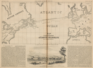
Map of the Submarine Atlantic…
A Map of America between lati…
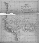
Map of the Western Coast of A…
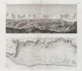
Map to illustrate the sketche…
Map to Illustrate the Route o…
Map to illustrate the sketche…
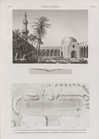
Antinoë [Antinoöpolis]. 1. Pl…
Alexandrie [Alexandria]. 1. V…
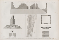
Environs d'Alexandrie [Alexan…
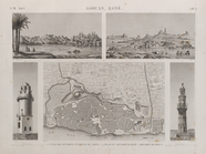
Asouan [Aswân], Esné [Isnâ]. …
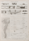
Égypte Moyenne. 1-28. Plan et…