Click to visit the main New York Public Library Homepage
The New York Public Library
Digital Collections
About Digital Collections
Browse
Search only public domain materials
Items
Collections
Divisions
Home
Search
Browse
About
Search only public domain materials
Items
Collections
Divisions
Digital Collections
Using Images
Using Data
Search
Filtered search
Show filters
Hide filters
Show Only Public Domain
topic
Geography
72
Maps
58
Historical geography
56
Atlases
55
Maps in education
55
More
Less
name
Jomard, M. (Edme-François), 1777-1862
86
Napoleon I, Emperor of the French, 1769-1821
84
Carey, Mathew, 1760-1839
78
Faden, William, 1749-1836
62
De Witt, Simeon, 1756-1834
58
More
Less
collection
Bancker plans
521
Lawrence H. Slaughter Collection of English maps, charts, globes, books and atlases
243
Maps of North America
235
Maps of New York City and State
94
Atlases, gazetteers, guidebooks and other books
89
More
Less
place
New York (State)
131
United States
118
New York (N.Y.)
117
Great Britain
106
Egypt
100
More
Less
genre
Maps
1664
Surveys
522
land surveys
449
Prints
128
Documents
79
More
Less
publisher
Impr. impériale
84
M. Carey
60
Published by Wm. Faden, geographer to His Majesty, and His R.H. the Prince of Wales
53
Printed for John Cary
43
V Morskoi Tipografii
38
More
Less
division
Map Division
783
Manuscripts and Archives Division
533
General Research Division
118
Rare Book Division
116
Wallach Division: Art & Architecture Collection
39
More
Less
type
x
cartographic
text
145
still image
17
Date Range
to
1,690 results found
Filtering on:
x
Date
: 1790 - 1830
x
Type
: cartographic
Sort by:
Title
Date created
Date digitized
Sequence
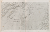
Carte figurative de l'instruc…
Townships of Franklin and Som…
m
Carte trigonométrique des côt…
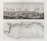
Map of the countries of Fergh…
Carte pour servir a l'itenera…
Sketch of the Northern Part o…
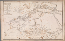
Afrique, par J. B. Poirson
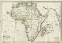
Map of the Western Coast of A…
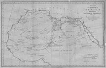
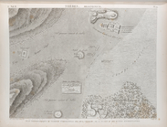
Plan of Africa
A general sketch of the Harbo…
A map of Barbary comprehendin…
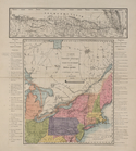
Map of the United States and …
Great Falls of Columbia River
Map of the American Coast, fr…
Karta Shelekhova. Stranstvova…
A1
m
A New and Accurate Map of the…
Map of the seat of the War in…
m
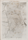
Abbington and Fitzroy Roads
Plan of Conewago Canal
m
A new map of Europe : exhibit…
Ægyptus antiqua
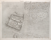
Île de Philæ. Plan général de…
Île d'Éléphantine et Syène [A…
m
Anne Street
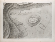
Thèbes. Plan général de la po…
Thèbes. Medynet-Abou [Medinet…
Thèbes. Memnonium [Ramesseum]…
Thèbes. Memnonium [Ramesseum]…
Thèbes. Qournah [Qurna]. Plan…
Thèbes. Bybân el-Molouk [Bîbâ…
Thèbes. Louqsor [Luxor]. Plan…
Thèbes. Karnak. Plan topograp…
m
Francis Johnson dispute with …
Denderah [Dandara] (Tentyris)…
Abydus [Abydos]. Plan des rui…
Achmouneyn (Hermopolis Magna)…
Antinoë [Antinoöpolis]. Plan …
Antinoë [Antinoöpolis]. 1. Pl…
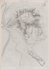
Memphis et environs. Plan gén…
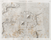
Pyramides de Memphis. Plan to…
Tanis (Sân). Plan des ruines …
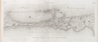
Alexandrie [Alexandria]. Cart…
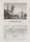
Alexandrie [Alexandria]. 1. V…
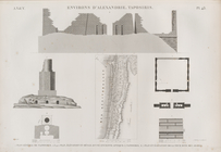
Environs d'Alexandrie [Alexan…
A map of the world from the b…
m
Lots near Amity Street, Broad…
Plan of the town of York Haven
m
Webber and Van Arden
m
1801 December 21
1
2
3
4
5
6
7
Previous
Next
1
2
3
4
5
6
7
Previous
Next