Click to visit the main New York Public Library Homepage
The New York Public Library
Digital Collections
About Digital Collections
Browse
Search only public domain materials
Items
Collections
Divisions
Home
Search
Browse
About
Search only public domain materials
Items
Collections
Divisions
Digital Collections
Using Images
Using Data
Search
Filtered search
Show filters
Hide filters
Show Only Public Domain
topic
x
History
Cartography
104
Real property
75
Business enterprises
67
Fortification
29
More
Less
name
Beers, F. W. (Frederick W.)
67
American Civil War (1861-1865)
51
Beauplan, Guillaume Le Vasseur, sieur de, approximately 1600-
21
United States. Army. Corps of Topographical Engineers
19
United States Coast Survey
14
More
Less
collection
Maps of North America
192
Materīaly po istorīi russkoĭ kartografīi
103
Atlases of the United States
67
Maps of New York City and State
49
Pamiatniki stariny v zapadnykh guberniakh imperii
9
More
Less
place
United States
129
New York (State)
108
Russia
105
Virginia
80
Orange County
67
More
Less
genre
Maps
431
Atlases
67
Prints
44
Illustrations
15
Military maps
15
More
Less
publisher
Tip. S.V. Kulʹzhenko
103
Andreas, Baskin & Burr
67
publisher not identified
37
Harper & Brothers
11
Corps of Topographical Engineers
10
More
Less
division
Map Division
316
General Research Division
110
Rare Book Division
19
Schomburg Jean Blackwell Hutson Research and Reference Division
6
Pforzheimer Collection
4
More
Less
type
x
cartographic
text
20
still image
7
Date Range
to
465 results found
Filtering on:
x
Date
: 1791 - 1950
x
Topic
: History
x
Type
: cartographic
Sort by:
Title
Date created
Date digitized
Sequence
Map of Camp Chase. Drawn on a…
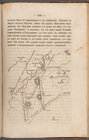
Map illustrating the operatio…
Plan Borodinskago srazheniia,…
aert vande Svyd Rivier in Nie…
m
Township of Franklin situate …
m
Franklinville with privileges…
A perspective view of Lake Ge…
Ancient Italy
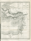
Countries adjacent to the Med…
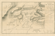
Bataille de Beylan
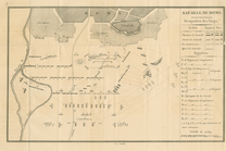
Bataille de Homs
Bataille de Konieh
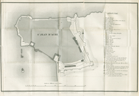
St. Jean D'Acre
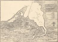
Carte du Théatre de la Guerre
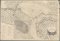
Siege of Fort Meigs
Detroit River and vicinity
Plan of the Tippecanoe camp a…
Plan of the Battle of Fallen …
Battle of the Thames
Map of the battlefield of Fre…
To accompany Willard's histor…
Sketch of the Battle of Bunke…
Map showing route of marches …
Map of the frontiers of the n…
Sketch of the action on the h…
m
Dakota Territory
Plan of the French and Americ…
m
Map of the St. Clair River : …
m
Map of the river Sainte Mary …
Lake St. Clair
No. 3, map of Isle Royale in …
Detroit 1820
A plan of the operations of t…
Works at Stony Point and Verp…
m
Copy of section of photograph…
Map shewing the position of t…
Map of Richmond, Va. : and su…
A sketch of the siege of Fort…
Position de l'armée Américain…
Parts of Ohio & Pennsylvania …
A sketch of the operations of…
Map of New York City and of M…
Plan of the Battle of Long Is…
A topographical map of the no…
Battle of Long Island: from S…
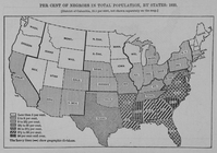
Per cent of Negroes in total …
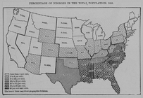
Percentage of Negroes in the …
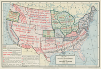
Status of slavery in the Unit…
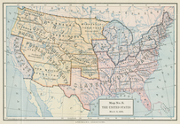
The United States, March 4, 1…
Boston with its environs
1
2
Previous
Next
1
2
Previous
Next