Click to visit the main New York Public Library Homepage
The New York Public Library
Digital Collections
About Digital Collections
Browse
Search only public domain materials
Items
Collections
Divisions
Home
Search
Browse
About
Search only public domain materials
Items
Collections
Divisions
Digital Collections
Using Images
Using Data
Search
Filtered search
Show filters
Hide filters
Show Only Public Domain
topic
Real property
9573
Fire insurance
5288
Cities & towns
4997
Administrative and political divisions
879
Railroads
774
More
Less
name
Sanborn Map Company
5090
G.W. Bromley & Co
1284
Bromley, George Washington
797
Bromley, Walter Scott
797
Austro-Hungarian Monarchy. Militärgeographisches Institut
773
More
Less
collection
Atlases of New York City
8738
Atlases of the United States
3645
Maps of North America
2930
Maps of New York City and State
1944
Spezialkarte der Osterreichisch-Ungarischen Monarchie
773
More
Less
place
New York (State)
10724
New York
2999
New York (N.Y.)
1442
Manhattan (New York, N.Y.)
1339
Brooklyn (New York, N.Y.)
1160
More
Less
genre
Maps
19663
Atlases
3571
Topographic maps
1031
Cadastral maps
613
Surveys
533
More
Less
publisher
Sanborn Map Company
5126
G.W. Bromley & Co
1107
E. Belcher Hyde
778
K.u.K. Militargeographisches Institut
773
publisher not identified
419
More
Less
division
Map Division
18550
Manuscripts and Archives Division
511
General Research Division
321
Rare Book Division
123
Schomburg Jean Blackwell Hutson Research and Reference Division
102
More
Less
type
x
cartographic
text
302
still image
155
Date Range
to
19,877 results found
Filtering on:
x
Date
: 1794 - 1922
x
Rights
: Public Domain
x
Type
: cartographic
Sort by:
Title
Date created
Date digitized
Sequence
m
Maps of property in the city …
m
Nuevo mapa topográfico de la …
m
Map of the Cedar Knolls, at B…
m
Report on the work of the com…
Plan of the town of Paramarib…
m
Mapah derekh emet : Mapa Dere…
Isothermal chart, or, View of…
An old map of Heijokyo (Heijo…
An old map of Heiankyo (Heian…
Plan of the Central Park, Cit…
Map of Camp Chase. Drawn on a…
Map illustrating the operatio…
Saratoga Springs [Township]
Schuylerville Business Direct…
Saratoga [Township]
Stillwater [Township]
References; Waterford [Villag…
Waterford [Township]
Beechers Hollow [Village]; Be…
Wilton [Township]
Map of Saratoga County
Residence of James Carrigan, …
Ballston [Township]
Ballston Spa Business Directo…
Charlton [Township]
Grangerville [Village]; Grang…
Clifton Park [Township]
Corinth [Township]; Palmer Fa…
Clifton Park [Village]; Clift…
Day Corners Business Director…
Edinburgh [Township]
Crescent [Village]; Crescent …
Galway [Township]; Yorks Corn…
Greenfield [Township]; Pages …
Bloodville [Village]; Bloodvi…
Hadley [Township]; Hadley Bus…
Half Moon [Township]
Factory Village [Village]; Fa…
Malta [Township]
Burnt Hills [Village]; Burnt …
Milton [Township]
Moreau [Township]
Conklingville [Village]; Conk…
Northumberland [Township]
Providence [Township]; Hagedo…
References; Saratoga Springs …
Map of the borough of Brookly…
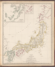
Empire of Japan
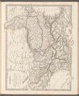
Turkey I: containing the nort…
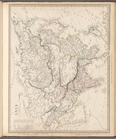
Asia
1
2
3
4
5
6
7
8
9
10
…
79
80
Previous
Next
1
2
3
4
5
6
7
8
9
10
…
79
80
Previous
Next