Click to visit the main New York Public Library Homepage
The New York Public Library
Digital Collections
About Digital Collections
Browse
Search only public domain materials
Items
Collections
Divisions
Home
Search
Browse
About
Search only public domain materials
Items
Collections
Divisions
Digital Collections
Using Images
Using Data
Search
Filtered search
Show filters
Hide filters
Show Only Public Domain
topic
x
Real property
Fire insurance
5198
Cities & towns
5007
Business enterprises
468
Landowners
425
More
Less
name
Sanborn Map Company
5103
G.W. Bromley & Co
2177
Ullitz, Hugo
606
E.B. Hyde & Co
545
E. Belcher Hyde Map Company
488
More
Less
collection
Atlases of New York City
8459
Atlases of the United States
1821
Maps of North America
322
Maps of New York City and State
288
Collection of broadside real estate maps announcing auctions of lots in early 19th century New York City
67
More
Less
place
New York (State)
10390
New York
3144
Manhattan (New York, N.Y.)
1971
Brooklyn (New York, N.Y.)
810
New York (N.Y.)
804
More
Less
genre
Maps
10650
Atlases
1818
Cadastral maps
558
Indexes
126
Title pages
81
More
Less
publisher
Sanborn Map Company
5009
G.W. Bromley & Co
1997
E. Belcher Hyde
425
E. Robinson Co
246
F. W. Beers & Co
148
More
Less
division
Map Division
10800
Milstein Division
52
Manuscripts and Archives Division
18
Schomburg Jean Blackwell Hutson Research and Reference Division
10
No Division
1
type
cartographic
10723
text
350
still image
81
Date Range
to
11,011 results found
Filtering on:
x
Date
: 1831 - 1965
x
Topic
: Real property
Sort by:
Title
Date created
Date digitized
Sequence
Results 501 - 550
Map of the town of Natick, Mi…
Plan of house lots in South F…
Map of the town of Ipswich, c…
Map of Boston and vicinity
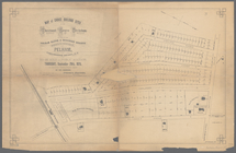
180 lots on the Marsellis Tra…
Map of Black Point property n…
Oil lands, Prentice Angell & …
The early purchasers of Hills…
m
Map of Suffolk Co., L.I., New…
m
Map of Tioga County, New York…
Map of lands in the town of Y…
Town & village of Ovid, Senec…
m
Map of choice building sites …
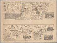
Map showing location of lands…
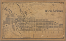
Map of the village of Syracus…
Map of Webster Lake, Franklin…
Map of Swanzey, 1890: [New Ha…
Plan of Bar Harbor, Mount Des…
Map of Bar Harbor, Maine, 1896
Webster Park, Franklin, N.H.
m
A topographical map of Lincol…
Historical maps of Sanbornton
Historical map of Sanbornton
Map of Bar Harbor, Maine, 1895
Plan of Suffolk Street Distri…
Plan of Church St. district: …
Map of the County of St. Lawr…
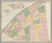
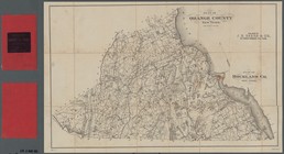
Plan of Orange County, New Yo…
Map of the county of Herkimer
Map of the village at Little …
Map of Dobbs Ferry and Hastin…
Country-seat of Danl. P. Barn…
Historical sketch map of King…
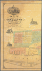
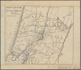
Map of the city of Albany
m
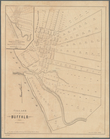
Village of Buffalo
Map of the city of Buffalo
m
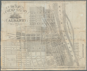
Map of the city of Albany: wi…
m
Map of the village & town of …
m
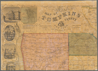
Map of Tompkins County, New Y…
m
Map of the City of Utica, One…
m
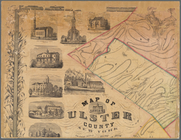
Map of Ulster County, New York
m
Castle Ridge, Tarrytown, West…
m
Map of Mount Vernon and envir…
Map of Chenango County, New Y…
Charles River embankment, sec…
Map of Knollwood, Elmsford, W…
Centennial map of Concord, 17…
m
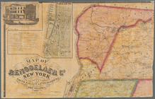
Map of Rensselaer Co., New Yo…
m
Gillette's map of Oneida Co.,…
m
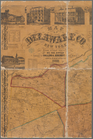
Map of Delaware Co., New York
1
2
3
4
5
6
7
8
9
10
…
44
45
Previous
Next
1
2
3
4
5
6
7
8
9
10
…
44
45
Previous
Next