Click to visit the main New York Public Library Homepage
The New York Public Library
Digital Collections
About Digital Collections
Browse
Search only public domain materials
Items
Collections
Divisions
Home
Search
Browse
About
Search only public domain materials
Items
Collections
Divisions
Digital Collections
Using Images
Using Data
Search
Filtered search
Show filters
Hide filters
Show Only Public Domain
topic
Real property
34
Landowners
23
Administrative and political divisions
21
Real propery auctions
14
Railroads
7
More
Less
name
Burr, David H., 1803-1875
8
J.H. Colton & Co
8
James Bleecker & Sons
8
S. Stiles & Co
7
Franklin & Jenkins
6
More
Less
collection
Maps of North America
58
Maps of New York City and State
28
Collection of broadside real estate maps announcing auctions of lots in early 19th century New York City
14
Atlases of the United States
3
place
New York (State)
38
New York
19
United States
19
Manhattan (New York, N.Y.)
15
Lower Manhattan (New York, N.Y.)
7
More
Less
genre
Maps
103
Cadastral maps
26
Bathymetric maps
4
Nautical charts
4
Facsimiles
1
More
Less
publisher
publisher not identified
20
Published by J.H. Colton & Co
3
S. Augustus Mitchell
3
s.n
3
J.H. Colton & Co
2
More
Less
division
x
Map Division
type
cartographic
103
still image
1
text
1
Date Range
to
103 results found
Filtering on:
x
Date
: 1835 - 1836
x
Division
: Map Division
x
Rights
: Public Domain
Sort by:
Title
Date created
Date digitized
Sequence
m
A map shewing the extent of t…
m
3 three story brick houses in…
Executors sale of part of the…
Map of 14 lots in the 9th war…
m
51 lots to be sold by R.R. Mi…
Peremptory sale of valuable r…
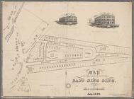
Valuable property for sale Th…
m
Map of 5 valuable lots of gro…
Executors sale of valuable re…
m
Map & plan of the contemplate…
Map & plan of the contemplate…
Map of valuable property in t…
Valuable property to be sold …
Lot no. 78 to be sold at the …
Map of valuable property in t…
Improved map of the territori…
m
An improved edition of a map …
Ohio boundary, no. 111, south…
Sketch of the public surveys …
Survey of the mouth of Galien…
Ohio lands to be sold by Irvi…
Map of Cleveland and its envi…
A map of part of Alabama & Fl…
The town of Boston: in New En…
Mississippi & Alabama [1835]
m
Map of the states of Kentucky…
Map of Great Barn Island, New…
Illinois & Missouri
m
A plan of the boundary lines …
Map of parts of Escambia and …
New sectional map of the stat…
A new map of Illinois and par…
Map of Illinois with parts of…
Map of the town of Taunton: w…
Map & profile of a ship canal…
Map of the breach at the head…
The tourist's pocket map of t…
City of Apalachicola and its …
m
Map of Dunkirk
Survey for a ship canal aroun…
Georgia
Florida
Map of the upper part of the …
Map of property at Van Buren …
Map of the village of Waterto…
Map of Schuylerville: exhibit…
Map exhibiting the route of t…
Plan of Springfield: [Massach…
A new map of Arkansas
Map of the town of Needham, M…