Click to visit the main New York Public Library Homepage
The New York Public Library
Digital Collections
About Digital Collections
Browse
Search only public domain materials
Items
Collections
Divisions
Home
Search
Browse
About
Search only public domain materials
Items
Collections
Divisions
Digital Collections
Using Images
Using Data
Search
Filtered search
Show filters
Hide filters
Show Only Public Domain
topic
Real property
622
Fire insurance
125
Landowners
79
Railroads
59
Real propery auctions
35
More
Less
name
Perris, William
269
Perris & Browne
141
G.M. Hopkins & Co
101
Pidgeon, R. H. (Roger H.)
86
Robinson, E. (Elisha)
86
More
Less
collection
Atlases of New York City
606
Maps of New York City and State
174
Collection of broadside real estate maps announcing auctions of lots in early 19th century New York City
35
A miscellaneous collection of pamphlets, broadsides, etc., relating to the projects of the New York District Railway Company
1
Maps of North America
1
More
Less
place
x
New York
New York (State)
818
Manhattan (New York, N.Y.)
314
Brooklyn (New York, N.Y.)
300
New York (N.Y.)
127
More
Less
genre
Maps
816
Cadastral maps
53
Index maps
16
Title pages
13
Manuscript maps
9
More
Less
publisher
Perris & Browne
124
William Perris
104
G.M. Hopkins & Co
101
E. Robinson Co
85
G. W. Bromley & E. Robinson
78
More
Less
division
Map Division
685
Manuscripts and Archives Division
1
No Division
1
Rare Book Division
1
type
x
cartographic
text
21
Date Range
to
818 results found
Filtering on:
x
Date
: 1836 - 1886
x
Place
: New York
x
Type
: cartographic
Sort by:
Title
Date created
Date digitized
Sequence
m
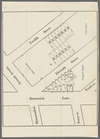
Maps of property in the city …
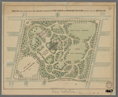
Plan of the Central Park, Cit…
Property in the towns of Cast…
Sketch map of the City of New…
Sketch map of the city of New…
Map of the Hackensack & New Y…
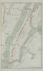
Map showing the present dista…
Map of the country thirty thr…
Map of the country thirty thr…
Map of the country thirty thr…
Map of New York and vicinity …
Map of the country thirty thr…
New-York and vicinity as prop…
New map of the great metropol…
New York City and environs : …
m
Taunton new guide map and dir…
m
Sanitary & topographical map …
Map of property in the 19th w…
m
Topographical map of New York…
Design for laying out the gro…
m
Map of the city of Brooklyn
m
Map of the consolidated City …
m
Map of the City of Brooklyn a…
m
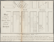
Peremptory sale of a suburban…
m
Robinson's map of New York Ci…
Flushing
City guide
Colton's New York City, Brook…
m
Watson's new map of New York …
m
Watson's new map of New York …
m
Map of the City of New York a…
m
Watson's new map of New York,…
m
A map shewing the extent of t…
City railway: route of the ce…
Map of the port & vicinity of…
Horatio Street, Hudson Street…
Gansevoort Street, 9th Avenue…
Jane Street, Eighth Avenue, T…
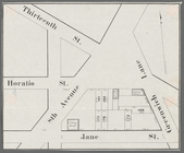
Thirteenth Street, Greenwich …
m
Hammond Street, Perry Street,…
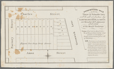
Peremptory sale these 15 valu…
Executors sale of part of the…
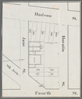
Hudson Street, Horatio Street…
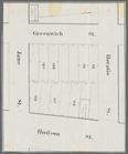
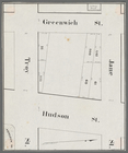
Greenwich Street, Troy Street…
m
Map of 19 lots in the fifteen…
Map of property in the 9th wa…
13 lots of ground to be sold …
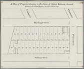
A map of property belonging t…
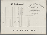
La Fayette Place map of lots …
Map of property in the eleven…
1
2
3
4
Previous
Next
1
2
3
4
Previous
Next