Click to visit the main New York Public Library Homepage
The New York Public Library
Digital Collections
About Digital Collections
Browse
Search only public domain materials
Items
Collections
Divisions
Home
Search
Browse
About
Search only public domain materials
Items
Collections
Divisions
Digital Collections
Using Images
Using Data
Search
Filtered search
Show filters
Hide filters
Show Only Public Domain
topic
x
Real property
Fire insurance
105
Landowners
11
Buildings
5
Historical geography
4
More
Less
name
Perris, William
258
Perris & Browne
130
Dripps, M. (Matthew)
4
American Photo-Lithographic Company
2
Astor family
1
More
Less
collection
Atlases of New York City
258
Maps of New York City and State
13
Maps of property in the city of New York belonging to John J. Astor Esq
1
place
x
Manhattan (New York, N.Y.)
New York (State)
272
New York
265
New York (N.Y.)
14
Bronx (New York, N.Y.)
4
More
Less
genre
Maps
271
Index maps
13
Title pages
13
Cadastral maps
6
Manuscript maps
1
More
Less
publisher
Perris & Browne
124
William Perris
105
Lith. by Korff Brothers
23
William Perris, Civil Engineer
23
Perris & Browne
6
More
Less
division
Map Division
141
No Division
1
type
cartographic
270
text
14
Date Range
to
272 results found
Filtering on:
x
Date
: 1838 - 1885
x
Place
: Manhattan (New York, N.Y.)
x
Topic
: Real property
Sort by:
Title
Date created
Date digitized
Sequence
m
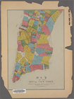
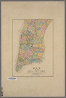
Maps of property in the city …
m
Topographical map of New York…
Topographical map of New York…
m
Map of the City of New York n…
Map of the City of New York /…
Peremptory sale at auction : …
Map of the cities of New York…
Map of the City of New York: …
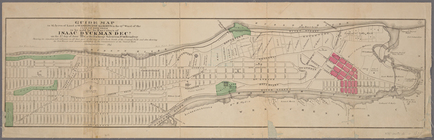
Guide map to 92 acres of land…
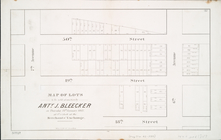
Map of lots to be sold at auc…
m
Map of the city of New-York e…
Map of the City of New York: …
m
Map of the City of New York n…
Map of land to be acquired un…
Map bounded by West 42nd Stre…
Map bounded by West 47th Stre…
Map bounded by West 47th Stre…
Map bounded by West 47th Stre…
Map bounded by West 52nd Stre…
Map bounded by West 52nd Stre…
Map bounded by West 52nd Stre…
Map bounded by West 57th Stre…
Map bounded by West 57th Stre…
Map bounded by West 57th Stre…
Map bounded by West 57th Stre…
Map bounded by East 57th Stre…
Map bounded by East 57th Stre…
Map bounded by East 62nd Stre…
Map bounded by East 62nd Stre…
Map bounded by East 62nd Stre…
Map bounded by West 59th Stre…
Map bounded by West 62nd Stre…
Map bounded by West 64th Stre…
Map bounded by West 72nd Stre…
Map bounded by West 67th Stre…
Map bounded by West 72nd Stre…
Map bounded by East 67th Stre…
Map bounded by East 67th Stre…
Map bounded by East 72nd Stre…
Map bounded by East 72nd Stre…
Map bounded by East 72nd Stre…
Map bounded by Battery Place,…
Map bounded by Rector Street,…
Map bounded by Dey Street, Br…
Map bounded by Maiden Lane, S…
Map bounded by Frankfort Stre…
Map bounded by City Hall Squa…
Map bounded by Murray Street,…
Map bounded by Duane Street, …
Map bounded by Pearl Street, …
1
2
Previous
Next
1
2
Previous
Next