Click to visit the main New York Public Library Homepage
The New York Public Library
Digital Collections
About Digital Collections
Browse
Search only public domain materials
Items
Collections
Divisions
Home
Search
Browse
About
Search only public domain materials
Items
Collections
Divisions
Digital Collections
Using Images
Using Data
Search
Filtered search
Show filters
Hide filters
Show Only Public Domain
topic
Railroads
7
Boundaries
5
Indians of North America
3
Transportation
3
Canals
2
More
Less
name
Breese, Samuel, 1802-1873
18
Morse, Sidney E. (Sidney Edwards), 1794-1871
18
Atwood, John M., approximately 1818-
4
Blake, Jacob Edmund, 1811 or 12-1846
3
Mitchell, S. Augustus (Samuel Augustus), 1792-1868
3
More
Less
collection
Maps of North America
32
Atlases of the United States
18
Maps of New York City and State
3
The Legion of liberty! : and force of truth, containing the thoughts, words, and deeds of some prominent apostles, champions and martyrs
1
place
x
United States
Mexico
7
Texas
7
Maps
6
Distances, etc
3
More
Less
genre
Maps
54
Strip maps
3
Early maps
1
Facsimiles
1
Geological maps
1
More
Less
publisher
S. E. Morse & co.,
18
s.n
5
Published by Ensigns & Thayer, 36 Ann Street
2
Published by J. H. Colton, No. 86 Cedar St
2
... bei Gebrüder Locher, in Commission bei Huber & Cie
1
More
Less
division
Map Division
53
Schomburg Manuscripts, Archives and Rare Books Division
1
type
x
cartographic
Date Range
to
54 results found
Filtering on:
x
Date
: 1841 - 1849
x
Place
: United States
x
Type
: cartographic
Sort by:
Title
Date created
Date digitized
Sequence
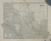
Map of Texas and the countrie…
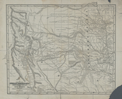
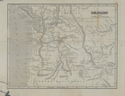
Map of the Oregon Territory
Topographical sketch of the s…
Map of New Netherland which w…
A map of the confluence of th…
Part of the boundary between …
Part of the boundary between …
Part of the boundary between …
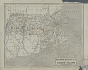
Map of Massachusetts, Connect…
Geology of the Genesee River
Extract from a map of the Bri…
Map of the western and middle…
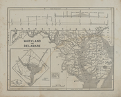
Maryland and Delaware.
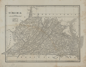
Virginia
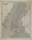
New York and vicinity.
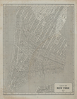
City of New York, 1843.
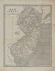
New Jersey.
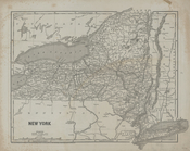
New York
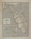
Florida.
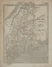
Maine.
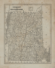
Vermont and New Hampshire.
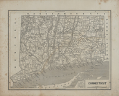
Connecticut.
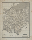
Ohio.
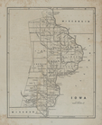
Iowa.
Map of the Indian Territory, …
Central America and Yucatan (…
Oregon.
Massachusetts and Rhode Islan…
verso title page
The cerographic atlas of the …
Ornamental map of the United …
Map of the United States and …
Skeleton map showing the rail…
Map of the Vermont Central Ra…
Skeleton map showing the rail…
Mitchell's travellers guide t…
Ensign's Travellers' guide an…
Phelps's Karte der Vereinigte…
Map of the United States and …
Ensign's Travellers' guide an…
m
Map of the United States of A…
1841, showing the dates of th…
Karte der katholischen Dioece…
United States.
Map of the United States show…
The United States & the relat…
Map of the United States show…
Map of the United States, the…
Skeleton map showing the rail…
Complete railway map designed…