Click to visit the main New York Public Library Homepage
The New York Public Library
Digital Collections
About Digital Collections
Browse
Search only public domain materials
Items
Collections
Divisions
Home
Search
Browse
About
Search only public domain materials
Items
Collections
Divisions
Digital Collections
Using Images
Using Data
Search
Filtered search
Show filters
Hide filters
Show Only Public Domain
topic
Real property
34
Administrative and political divisions
29
Railroads
25
Landowners
16
Nautical charts
16
More
Less
name
Breese, Samuel, 1802-1873
18
Morse, Sidney E. (Sidney Edwards), 1794-1871
18
United States Coast Survey
14
Bache, A. D. (Alexander Dallas), 1806-1867
11
Mitchell, S. Augustus (Samuel Augustus), 1792-1868
9
More
Less
collection
Maps of North America
113
Maps of New York City and State
68
Atlases of the United States
18
Denkmaeler aus Aegypten und Aethiopien nach den Zeichnungen der von seiner Majestat dem Koenige von Preussen Friedrich Wilhelm IV nach diesen Landern gesendeten und in den Jahren 1842-1845 ausgefuhrten wissenschaftlichen Expedition ..
3
Atlases, gazetteers, guidebooks and other books
2
More
Less
place
New York (State)
42
United States
40
New York (N.Y.)
34
New York
20
Brooklyn (New York, N.Y.)
16
More
Less
genre
x
Maps
Cadastral maps
11
Nautical charts
5
Geological maps
4
Prints
4
More
Less
publisher
publisher not identified
22
S. E. Morse & co.,
18
s.n
7
Surveyor General's Office
6
S. Augustus Mitchell
5
More
Less
division
Map Division
203
General Research Division
4
Wallach Division: Picture Collection
3
Schomburg Manuscripts, Archives and Rare Books Division
2
Berg Collection
1
More
Less
type
cartographic
210
text
7
still image
4
Date Range
to
215 results found
Filtering on:
x
Date
: 1845 - 1849
x
Genre
: Maps
Sort by:
Title
Date created
Date digitized
Sequence
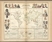
Geographische Verbreitung der…
Histoire de la catographie de…
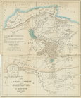
Carte des Parties Centrales D…
H Diagram of the state of Mis…
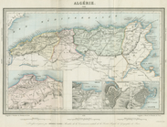
Algerie
Map of the territory of Minne…
Plat of a survey of land "for…
Chicago : correctly copied fr…
A sketch of the public survey…
Sketch of the public surveys …
Map of the mouth of St. Clair…
Geological map of Keweenaw Po…
Diagram of part of the State …
Geological map of Isle Royale…
Diagram of the state of Michi…
Sketch of the claims to land …
Township no. 74 N. range no.…
Geological map of the distric…
Private claims at Michilimack…
Geological map of Isle Royale…
Map of the state of Georgia :…
A new sectional map of the st…
Map of that part of the miner…
Map of part of Monroe County,…
Map of Chicago and vicinity
Sketch of the public surveys …
m
Map of Oregon and upper Calif…
Map of the canals and rail ro…
Alexander von Humboldt's Syst…
Sketch of the battle ground a…
Sketch of the battle ground a…
Chart of Green Bay
A correct map of the Bay of S…
Sketch of the route of Capt. …
Map showing the route pursued…
Positions of the upper and lo…
Topographical sketch of the g…
Topographical sketch of the s…
The Sacramento Valley from th…
Map of the city of Chicago
Plan of Ohio City in the stat…
Whitesboro, Brown Co., W.T.
Diagram of the state of Illin…
G, diagram of the state of Il…
New sectional map of the stat…
m
Bonner's pocket map of the st…
Map of Louisiana : representi…
A Plan of the action at Bunke…
A plat exhibiting the state o…
The state of Florida