Click to visit the main New York Public Library Homepage
The New York Public Library
Digital Collections
About Digital Collections
Browse
Search only public domain materials
Items
Collections
Divisions
Home
Search
Browse
About
Search only public domain materials
Items
Collections
Divisions
Digital Collections
Using Images
Using Data
Search
Filtered search
Show filters
Hide filters
Show Only Public Domain
topic
Real property
278
Nautical charts
152
Landowners
137
Administrative and political divisions
109
Fire insurance
104
More
Less
name
United States Coast Survey
168
Perris, William
167
Bache, A. D. (Alexander Dallas), 1806-1867
152
New York (N.Y.). Common Council
88
Mathiot, G
34
More
Less
collection
Maps of North America
501
Maps of New York City and State
355
Atlases of New York City
226
Atlases, gazetteers, guidebooks and other books
3
Maps of Central America
2
More
Less
place
New York (State)
356
New York
202
Manhattan (New York, N.Y.)
155
New York (N.Y.)
151
Brooklyn (New York, N.Y.)
77
More
Less
genre
Maps
1095
Nautical charts
132
Cadastral maps
112
Bathymetric maps
67
Geological maps
15
More
Less
publisher
William Perris
142
U.S. Coast Survey
90
publisher not identified
89
U.S. Coast Survey Office
42
Perris & Browne
32
More
Less
division
x
Map Division
type
x
cartographic
still image
36
text
14
Date Range
to
1,095 results found
Filtering on:
x
Date
: 1849 - 1859
x
Division
: Map Division
x
Type
: cartographic
Sort by:
Title
Date created
Date digitized
Sequence
Ethnographic map of the world…
m
Mercator projection exhibitin…
m
Map of the city of Brooklyn, …
Property in the towns of Cast…
Map of the country thirty-thr…
Map of the country thirty-thr…
Map of the country thirty-thr…
Map of property in the 19th w…
m
Topographical map of New York…
m
Map of the consolidated City …
m
Map of the City of Brooklyn a…
m
Topographical map of the city…
m
Peremptory sale of a suburban…
m
Plan of property situate in t…
Plan of the town of Brooklyn …
Flushing
City guide
m
Reynolds' map of modern Londo…
Map of Philadelphia
m
Map of the southern part of W…
m
Map of Ulster County, New York
m
Map of Washington County, New…
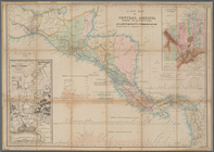
A new map of Central America …
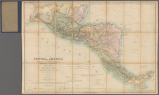
Map of Central America includ…
Map of the Great Salt Lake an…
Sketch of the public surveys …
Colton's Georgetown and the c…
Phelps's national map of the …
Skeleton map of the overland …
Plan of Charles River and War…
Plan of extension of Devonshi…
Plan of extension of Devonshi…
Map of the frontiers of the n…
Map of the port & vicinity of…
Plan of the city of Philadelp…
Chengwatana, Pine County, M.T…
Map of the territory of Minne…
Map of the general government…
Chicago harbor
Subdivision of Block 5 of the…
The city of Chicago, Cook Co.…
Geological map of the distric…
Sketch of the public surveys …
To the citizens of Philadelph…
Sketch I, showing the progres…
m
Topographical map of the coun…
m
Map of Rockingham Co., New Ha…
Map of the southern part of M…
m
Map of the states of Michigan…
Sketch of the public surveys …
1
2
3
4
5
Previous
Next
1
2
3
4
5
Previous
Next