Click to visit the main New York Public Library Homepage
The New York Public Library
Digital Collections
About Digital Collections
Browse
Search only public domain materials
Items
Collections
Divisions
Home
Search
Browse
About
Search only public domain materials
Items
Collections
Divisions
Digital Collections
Using Images
Using Data
Search
Filtered search
Show filters
Hide filters
Show Only Public Domain
topic
Real property
105
City planning
69
Fire insurance
60
Historic sites
50
Nautical charts
45
More
Less
name
New York (N.Y.). Common Council
70
Perris, William
60
United States Coast Survey
47
Bache, A. D. (Alexander Dallas), 1806-1867
43
New York (N.Y.). Croton Aqueduct Department
21
More
Less
collection
Maps of New York City and State
184
Maps of North America
173
Atlases of New York City
81
Cigarette cards
51
Sobranie kart i risunkov k izledovaniam o drevnostiakh IUzhnoi Rossii i beregov Chernago Moria
12
More
Less
place
New York (State)
159
New York (N.Y.)
122
New York
104
Manhattan (New York, N.Y.)
74
Central Park (New York, N.Y.)
61
More
Less
genre
Maps
524
Advertisements
51
Advertising cards
51
Cards
51
Cigarette cards
51
More
Less
publisher
William Perris
60
publisher not identified
46
U.S. Coast Survey
22
J.E. Serrell
21
U.S. Coast Survey Office
12
More
Less
division
Map Division
445
George Arents Collection
51
Rare Book Division
13
General Research Division
10
Milstein Division
4
More
Less
type
x
cartographic
still image
71
text
56
Date Range
to
531 results found
Filtering on:
x
Date
: 1850 - 1853
x
Type
: cartographic
Sort by:
Title
Date created
Date digitized
Sequence
Ethnographic map of the world…
m
Map of the city of Brooklyn, …
Property in the towns of Cast…
m
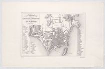
Plan of property situate in t…
Plan of the town of Brooklyn …
City guide
Map of Philadelphia
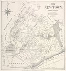
Map of Newtown, Long Island :…
m
Map of the southern part of W…
m
Map of Washington County, New…
Planta da Cidade de Sebastiao…
Maryland in Liberia
A new map of Central America …
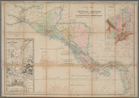
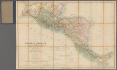
Map of Central America includ…
Map of the Battery in 1786 an…
General views, W, 39th St.
Map of 7 Washington Sq.
Map, Copake (Columbia County,…
Map of the Great Salt Lake an…
Sketch of the public surveys …
Phelps's national map of the …
Plan of Charles River and War…
Map of the frontiers of the n…
Chicago harbor
Geological map of the distric…
To the citizens of Philadelph…
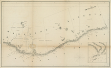
Preliminary chart of Ship Isl…
Diagram of the state of Misso…
Plan of the city of Philadelp…
Section and diagram illustrat…
Survey of the mouth of Clinto…
Map of the northern peninsula…
Map of the city of Saint Paul…
Wisconsin, a sectional map wi…
Barometric profile of the rou…
Map of the tertiary of Essex …
m
City of Toledo, Lucas Co., Oh…
Sea Coast of Delaware, Maryla…
A plat exhibiting the state o…
Geological map of the Lake Su…
A sketch of the public survey…
Preliminary chart of San Luis…
Preliminary sketch of Galvest…
Plan No. 3 : Milwaukee Harbor…
Survey of the entrance to Mil…
A new map of the state of Ohio
Harbor of Manitowoc, Wis. : t…
Galveston entrance, Texas: fr…
Survey of the Battery
m
Map of Kings and part of Quee…
1
2
3
Previous
Next
1
2
3
Previous
Next