Click to visit the main New York Public Library Homepage
The New York Public Library
Digital Collections
About Digital Collections
Browse
Search only public domain materials
Items
Collections
Divisions
Home
Search
Browse
About
Search only public domain materials
Items
Collections
Divisions
Digital Collections
Using Images
Using Data
Search
Filtered search
Show filters
Hide filters
Show Only Public Domain
topic
Real property
356
Nautical charts
122
Fire insurance
104
Landowners
95
City planning
76
More
Less
name
Perris, William
297
United States Coast Survey
136
Perris & Browne
130
Bache, A. D. (Alexander Dallas), 1806-1867
120
New York (N.Y.). Common Council
84
More
Less
collection
Atlases of New York City
356
Maps of North America
333
Maps of New York City and State
245
Denkmaeler aus Aegypten und Aethiopien nach den Zeichnungen der von seiner Majestat dem Koenige von Preussen Friedrich Wilhelm IV nach diesen Landern gesendeten und in den Jahren 1842-1845 ausgefuhrten wissenschaftlichen Expedition ..
39
Voyage en Perse de mm. Eugène Flandin, peintre, et Pascal Coste, architecte: entrepris par ordre de m. le ministre des affaires étrangères, d'après les instructions dressées par l'Institut. Publié sous les auspices de m. le ministre de l'intérieur
3
More
Less
place
New York (State)
409
New York
308
Manhattan (New York, N.Y.)
279
New York (N.Y.)
119
Central Park (New York, N.Y.)
62
More
Less
genre
Maps
954
Nautical charts
109
Cadastral maps
79
Bathymetric maps
54
Prints
48
More
Less
publisher
William Perris
142
Perris & Browne
124
U.S. Coast Survey
76
publisher not identified
45
Nicolaische Buchhandlung
39
More
Less
division
Map Division
808
General Research Division
50
Schomburg Jean Blackwell Hutson Research and Reference Division
3
Schomburg Manuscripts, Archives and Rare Books Division
2
Manuscripts and Archives Division
1
More
Less
type
x
cartographic
still image
26
text
18
Date Range
to
996 results found
Filtering on:
x
Date
: 1852 - 1858
x
Type
: cartographic
Sort by:
Title
Date created
Date digitized
Sequence
Map of the Butterfield Overla…
Subdivision of Block 5 of the…
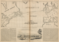
Map of the Submarine Atlantic…
Topographical map showing the…
Preliminary chart of York Riv…
Map of the Albany Rural Cemet…
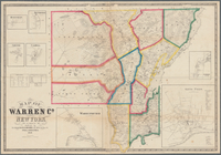
Map of Warren Co., New York
m
D.B. Cooke & Co.'s great west…
Map illustrating the general …
Albemarle and Chesapeake Cana…
Map of Franklin County, Massa…
Biloxi Bay, Mississippi : fro…
Topographical map showing the…
Map of the town of Huron, Mic…
California, Utah, Lr. Califor…
Map of Brooklyn at the time o…
Map of routes & distances to …
Reconnaissance of Semi-ah-moo…
Route through Mexico, Guatema…
m
Map of Vigo County, Indiana
Preliminary chart of Frying P…
m
Military map of Nebraska and …
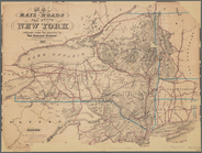
Map of the rail-roads of the …
Geer's new map of the city of…
Americae septentrionalis pars…
m
Map of the county of Berkshir…
m
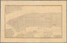
Map of the city of New York
Preliminary Chart of Atchafal…
Preliminary map of the wester…
Map of Northumberland County,…
Map of the county of Berkshir…
m
Clark's map of Fairfield Coun…
Town & village of Ovid, Senec…
m
Map of the territory of the U…
Rio Colorado of the West.
m
New map of Burlington County:…
Map of the United States and …
m
Map of Suffolk Co., L.I., New…
Map exhibiting the lines of m…
Atherton, St. Lawrence County…
Map of Essex Co., New York
Country-seat of Danl. P. Barn…
Geological and topographical …
m
Map of Dutchess Co., New York…
m
Map of the city of Newark, N.…
Map of the state of New York …
m
Gillette's map of Oneida Co.,…
Map of part of Orange County,…
Geological map of the state o…
Map no. 1 of the El Paso & Fo…
1
2
3
4
Previous
Next
1
2
3
4
Previous
Next