Click to visit the main New York Public Library Homepage
The New York Public Library
Digital Collections
About Digital Collections
Browse
Search only public domain materials
Items
Collections
Divisions
Home
Search
Browse
About
Search only public domain materials
Items
Collections
Divisions
Digital Collections
Using Images
Using Data
Search
Filtered search
Show filters
Hide filters
Show Only Public Domain
topic
Real property
356
Nautical charts
122
Fire insurance
104
Landowners
95
City planning
76
More
Less
name
Perris, William
297
United States Coast Survey
136
Perris & Browne
130
Bache, A. D. (Alexander Dallas), 1806-1867
120
New York (N.Y.). Common Council
84
More
Less
collection
Atlases of New York City
356
Maps of North America
333
Maps of New York City and State
245
Denkmaeler aus Aegypten und Aethiopien nach den Zeichnungen der von seiner Majestat dem Koenige von Preussen Friedrich Wilhelm IV nach diesen Landern gesendeten und in den Jahren 1842-1845 ausgefuhrten wissenschaftlichen Expedition ..
39
Voyage en Perse de mm. Eugène Flandin, peintre, et Pascal Coste, architecte: entrepris par ordre de m. le ministre des affaires étrangères, d'après les instructions dressées par l'Institut. Publié sous les auspices de m. le ministre de l'intérieur
3
More
Less
place
New York (State)
409
New York
308
Manhattan (New York, N.Y.)
279
New York (N.Y.)
119
Central Park (New York, N.Y.)
62
More
Less
genre
Maps
954
Nautical charts
109
Cadastral maps
79
Bathymetric maps
54
Prints
48
More
Less
publisher
William Perris
142
Perris & Browne
124
U.S. Coast Survey
76
publisher not identified
45
Nicolaische Buchhandlung
39
More
Less
division
Map Division
808
General Research Division
50
Schomburg Jean Blackwell Hutson Research and Reference Division
3
Schomburg Manuscripts, Archives and Rare Books Division
2
Manuscripts and Archives Division
1
More
Less
type
x
cartographic
still image
26
text
18
Date Range
to
996 results found
Filtering on:
x
Date
: 1852 - 1858
x
Type
: cartographic
Sort by:
Title
Date created
Date digitized
Sequence
Maryland in Liberia
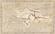
Map of Hispaniola. Hayti or S…
Map of free states, slave sta…
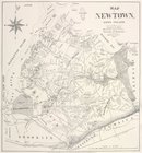
Map of Newtown, Long Island :…
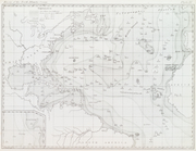
Basin of the North Atlantic O…
m
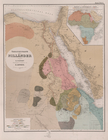
Atlas géologique
Plan d'ensemble de la cité ou…
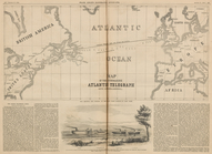
Map of the Submarine Atlantic…
Übersichtskarte der Nilländer
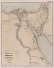
General-Karte von Aegypten un…
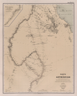
Karte von Aethiopien .
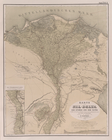
Karte vom Nil-Delta, dem Isth…
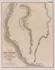
Karte des Nil-Thals in Mittel…
Karte der ostaegyptischen Wüs…
Karte der Sinai-Halbinsel.
Routen in der Sinai-Halbinsel.
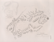
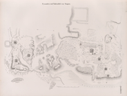
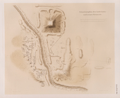
Situationsplan der Tempelruin…
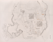
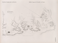
Situationsplan der Pyramiden-…
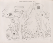
Situationsplan des Pyramidenf…
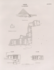
Giseh [Jîzah]: Grab 86., 87.,…
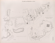
Pyramiden und Todtenfeld von …
Pyramiden und Todtenfeld von …
Nördlichste Ziegelpyramide vo…
Pyramiden und Todtenfeld von …
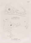
Situationsplan der Pyramiden-…
Situationsplan des Pyramiden-…
Fayyûm: Situationsplan des La…
Situationsplan der Ruinen von…
Situationsplan der Ruinen von…
Novi Belgii: Tabula ad N. J. …
Americae septentrionalis pars…
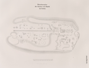
Situationsplan der Umgebungen…
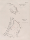
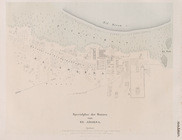
Specialplan der Ruinen von El…
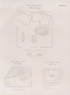
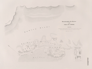
Situationsplan der Ruinen von…
m
New map of that portion of No…
m
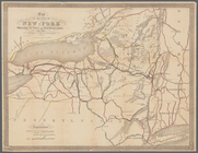
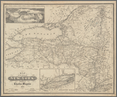
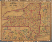
Map of the state of New-York:…
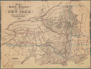
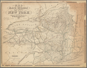
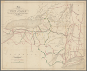
Map of the rail-roads of the …
Map of the state of New-York …
Map of the rail-roads of the …
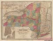
Map of the state of New York …
Map of the State of New York
Map showing the position of t…
Map of the state of New York …
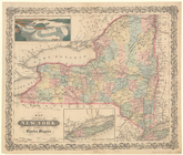
Map of the State of New York
Map of the State of New-York:…
Mitchell's county and townshi…
Diagram showing the relative …
m
Diagrams of the New-York and …
Diagrams of the New-York and …
Map of the boundary between t…
1
2
3
4
Previous
Next
1
2
3
4
Previous
Next