Click to visit the main New York Public Library Homepage
The New York Public Library
Digital Collections
About Digital Collections
Browse
Search only public domain materials
Items
Collections
Divisions
Home
Search
Browse
About
Search only public domain materials
Items
Collections
Divisions
Digital Collections
Using Images
Using Data
Search
Filtered search
Show filters
Hide filters
Show Only Public Domain
topic
Real property
356
Nautical charts
122
Fire insurance
104
Landowners
95
City planning
76
More
Less
name
Perris, William
297
United States Coast Survey
136
Perris & Browne
130
Bache, A. D. (Alexander Dallas), 1806-1867
120
New York (N.Y.). Common Council
84
More
Less
collection
Atlases of New York City
356
Maps of North America
333
Maps of New York City and State
245
Denkmaeler aus Aegypten und Aethiopien nach den Zeichnungen der von seiner Majestat dem Koenige von Preussen Friedrich Wilhelm IV nach diesen Landern gesendeten und in den Jahren 1842-1845 ausgefuhrten wissenschaftlichen Expedition ..
39
Voyage en Perse de mm. Eugène Flandin, peintre, et Pascal Coste, architecte: entrepris par ordre de m. le ministre des affaires étrangères, d'après les instructions dressées par l'Institut. Publié sous les auspices de m. le ministre de l'intérieur
3
More
Less
place
New York (State)
409
New York
308
Manhattan (New York, N.Y.)
279
New York (N.Y.)
119
Central Park (New York, N.Y.)
62
More
Less
genre
Maps
954
Nautical charts
109
Cadastral maps
79
Bathymetric maps
54
Prints
48
More
Less
publisher
William Perris
142
Perris & Browne
124
U.S. Coast Survey
76
publisher not identified
45
Nicolaische Buchhandlung
39
More
Less
division
Map Division
808
General Research Division
50
Schomburg Jean Blackwell Hutson Research and Reference Division
3
Schomburg Manuscripts, Archives and Rare Books Division
2
Manuscripts and Archives Division
1
More
Less
type
x
cartographic
still image
26
text
18
Date Range
to
996 results found
Filtering on:
x
Date
: 1852 - 1858
x
Type
: cartographic
Sort by:
Title
Date created
Date digitized
Sequence
Results 251 - 300
Sketch E no. 2 : showing the …
Mississippi City harbor, Miss…
Preliminary chart of Key-West…
Preliminary reconnaissance of…
Reconnaissance of the entranc…
Map of Northumberland County,…
Preliminary reconnaissance of…
Biloxi Bay, Mississippi : fro…
Sketch F showing the progress…
Map of Bennington County, Ver…
Map of the head waters of the…
A prospective view of the bat…
A map of a tract of land in t…
Geological map of the state o…
Map of the State of Florida :…
A plat exhibiting the state o…
m
Map of the State of Rhode Isl…
m
New map of Burlington County:…
m
A new map of Arkansas with it…
m
Map of the city of Newark, N.…
Preliminary survey of harbors…
Colton's Georgetown and the c…
A new map of the city of Buff…
Map of Buffalo Harbor, N.Y., …
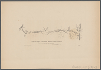
Communication between Albany …
Colton's railroad & township …
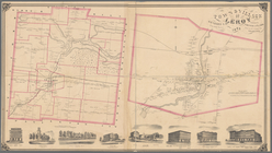
Town & Village of Leroy, Gene…
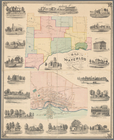
Map of the town of Waterloo, …
Town & village of Seneca Fall…
Town of Greenburgh: Westchest…
Atherton, St. Lawrence County…
Topographical map of New York…
Map of the city of Concord, N…
A map of the White Mountains …
Plan of the cemetery of Mount…
Preliminary chart of Ipswich …
Arkansas
m
A topographical map of Lincol…
m
Colton's railroad & township …
A map of the original allotme…
Preliminary chart of Stellwag…
Map of Jersey City, Hoboken &…
Map of the town of Tiverton, …
Plan of Boston comprising a p…
Map of the Boston water works
Plan of the cemetery of Mount…
Preliminary chart no. 4 of th…
Map of the town of Concord, M…
m
Map of Tolland County, Connec…
Map of the country between th…
1
2
3
4
Previous
Next
1
2
3
4
Previous
Next