Click to visit the main New York Public Library Homepage
The New York Public Library
Digital Collections
About Digital Collections
Browse
Search only public domain materials
Items
Collections
Divisions
Home
Search
Browse
About
Search only public domain materials
Items
Collections
Divisions
Digital Collections
Using Images
Using Data
Search
Filtered search
Show filters
Hide filters
Show Only Public Domain
topic
Real property
262
History
119
Landowners
105
Administrative and political divisions
90
Nautical charts
82
More
Less
name
Perris, William
142
Perris & Browne
141
United States Coast Survey
106
Bache, A. D. (Alexander Dallas), 1806-1867
85
Mitchell, S. Augustus (Samuel Augustus), 1792-1868
50
More
Less
collection
Maps of North America
484
Atlases of New York City
196
Maps of New York City and State
163
Atlases, gazetteers, guidebooks and other books
52
Atlases of the United States
42
More
Less
place
New York (State)
318
New York
189
Manhattan (New York, N.Y.)
152
United States
111
Virginia
89
More
Less
genre
Maps
963
Cadastral maps
85
Nautical charts
71
Prints
49
Bathymetric maps
43
More
Less
publisher
Perris & Browne
124
publisher not identified
65
S. A. Mitchell, jr
49
U.S. Coast Survey
46
C.K. Stone
42
More
Less
division
Map Division
810
General Research Division
46
Wallach Division: Print Collection
4
Schomburg Jean Blackwell Hutson Research and Reference Division
3
Schomburg Manuscripts, Archives and Rare Books Division
3
More
Less
type
x
cartographic
still image
25
text
16
Date Range
to
1,000 results found
Filtering on:
x
Date
: 1856 - 1864
x
Type
: cartographic
Sort by:
Title
Date created
Date digitized
Sequence
Map of free states, slave sta…
Das freie und das Sklaverei-G…
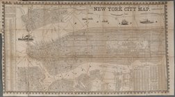
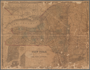
New York City Map
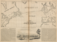
Map of the Submarine Atlantic…
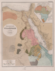
Übersichtskarte der Nilländer
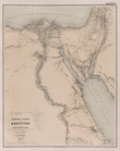
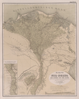
General-Karte von Aegypten un…
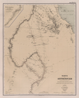
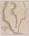
Karte von Aethiopien .
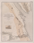
Karte vom Nil-Delta, dem Isth…
Karte des Nil-Thals in Mittel…
Karte der ostaegyptischen Wüs…
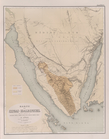
Karte der Sinai-Halbinsel.
Routen in der Sinai-Halbinsel.
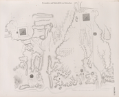
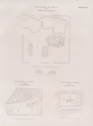
Situationsplan der Tempelruin…
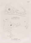
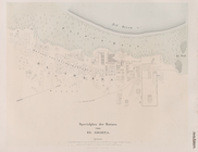
Situationsplan der Pyramiden-…
Situationsplan des Pyramidenf…
m
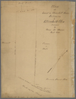
Plan of the Land in Haverhill…
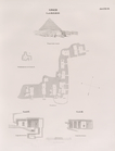
Giseh [Jîzah]: Grab 86., 87.,…
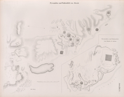
Pyramiden und Todtenfeld von …
Pyramiden und Todtenfeld von …
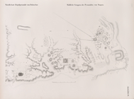
Nördlichste Ziegelpyramide vo…
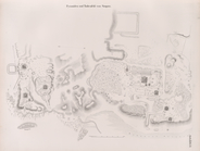
Pyramiden und Todtenfeld von …
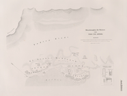
Situationsplan der Pyramiden-…
Situationsplan des Pyramiden-…
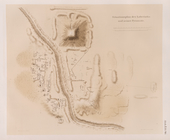
Fayyûm: Situationsplan des La…
Situationsplan der Ruinen von…
Situationsplan der Ruinen von…
m
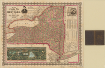
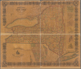
A new township map of the sta…
Americae septentrionalis pars…
Situationsplan der Umgebungen…
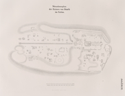
Specialplan der Ruinen von El…
Situationsplan der Ruinen von…
Colton's new illustrated & em…
Colton's railroad & township …
m
Johnson's new illustrated & e…
m
Johnson's new illustrated & e…
Colton's North America
Engineers map of the state of…
m
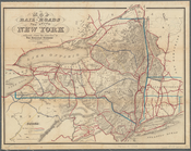
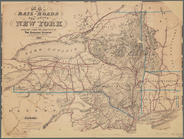
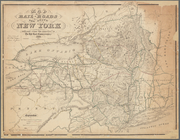
Map of the rail-roads of the …
Map of the rail-roads of the …
Map of the rail-roads of the …
m
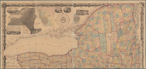
The State of New York: from n…
Map of the state of New York …
Grover & Baker's map of the s…
Diagram showing the relative …
m
Diagrams of the New-York and …
Diagrams of the New-York and …
Map of the boundary between t…
Census of the State of New Yo…
m
The State of New York: from n…
m
The State of New York: from n…
1
2
3
4
Previous
Next
1
2
3
4
Previous
Next