Click to visit the main New York Public Library Homepage
The New York Public Library
Digital Collections
About Digital Collections
Browse
Search only public domain materials
Items
Collections
Divisions
Home
Search
Browse
About
Search only public domain materials
Items
Collections
Divisions
Digital Collections
Using Images
Using Data
Search
Filtered search
Show filters
Hide filters
Show Only Public Domain
topic
Real property
706
Business enterprises
314
Description and travel
144
Administrative and political divisions
139
Railroads
119
More
Less
name
Beers, F. W. (Frederick W.)
500
J.B. Beers & Co
154
D.G. Beers & Co
118
Beers, Comstock & Cline
97
Nichols, Beach
92
More
Less
collection
Atlases of the United States
865
Maps of North America
345
Atlases of New York City
302
Maps of New York City and State
211
Pamiatniki stariny v zapadnykh guberniakh imperii
9
More
Less
place
New York (State)
813
Westchester County (N.Y.)
120
New Jersey
109
Long Island (N.Y.)
101
New York (N.Y.)
86
More
Less
genre
Maps
1696
Atlases
835
Prints
84
Cadastral maps
74
Manuscript maps
22
More
Less
publisher
Beers, Comstock & Cline
97
Andreas, Baskin & Burr
67
publisher not identified
67
Walker & Jewett
54
D.G. Beers
52
More
Less
division
Map Division
1726
Rare Book Division
14
General Research Division
13
Schomburg Jean Blackwell Hutson Research and Reference Division
8
Dorot Jewish Division
2
More
Less
type
x
cartographic
text
29
still image
13
Date Range
to
1,766 results found
Filtering on:
x
Date
: 1867 - 1875
x
Type
: cartographic
Sort by:
Title
Date created
Date digitized
Sequence
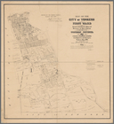
Map of the city of Yonkers, F…
Map of the centennial grounds…
Map showing the distribution …
Map of the centennial grounds…
New York to New Rochelle: fro…
Gen. Washington's Revolutiona…
Map of Rockingham County, Vir…
Map of the state of Wisconsin…
Map of the state of Florida
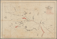
Map showing water shed of the…
Map of the New York & Boston …
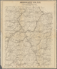
Allegany Co., N. Y. to accomp…
District of New Mexico
Hunt's map of Philadelphia : …
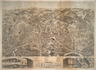
City of Taunton, Mass.
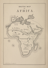
Sketch map of Africa
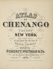
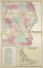
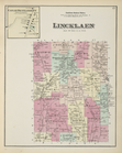
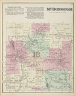
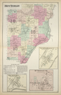
Atlas of Chenango County, New…
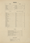
Index.
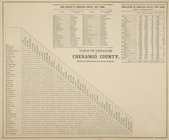
Table of Distances for Chenan…
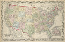
Map of the United States, and…
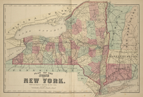
Plan of the State of New York.
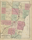
Outline Plan of Chenango Co.,…
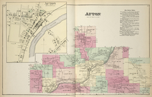
Afton [Village]; Afton [Towns…
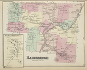
Bennettsville [Village]; Bain…
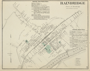
Bainbridge Village Business N…
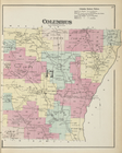
Columbus [Township]; Columbus…
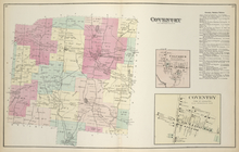
Coventry [Township]; Coventry…
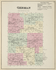
German [Township]; German Bus…
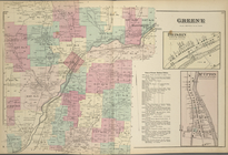
Greene [Township]; Brisbin [V…
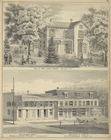
Res. of Mrs. Jane Grant, Gree…
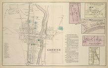
Greene [Village]; Rockwells M…
Guilford [Township]; Guilford…
Catlin Settlement [Village]; …
Mc Donough Business Notices.;…
New Berlin [Township]; New Be…
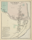
New Berlin [Village]; New Ber…
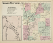
North Norwich [Township]; Nor…
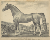
Factory Boy. The Property of …
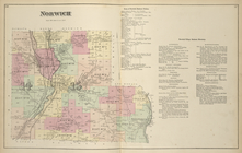
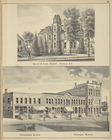
Norwich [Township]; Town of N…
Res. of B. Gage Berry, Norwic…
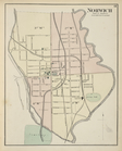
Norwich [Village]
Res. & Office of Dr. H.K. Bel…
Otselic [Township]; Otselic B…
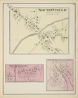
South Otselic [Village]; Nort…
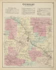
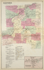
Oxford [Township]; Oxford Vil…
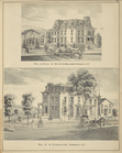
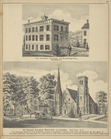
The Oxford Academy and Boardi…
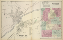
Oxford [Village]; Pitcher Bus…
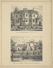
Res. of A.D. Harrington, Oxfo…
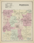
Pharsalia Business Notices.; …
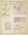
East Pharsalia [Village]; Ply…
1
2
3
4
5
6
7
8
Previous
Next
1
2
3
4
5
6
7
8
Previous
Next