


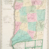
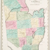
![Atlas of Chenango County, New York [Title page]](https://images.nypl.org/index.php?id=1576052&t=b)
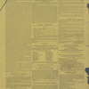
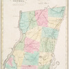
![Afton [Village]; Afton [Township]; Afton Business Notices.](https://images.nypl.org/index.php?id=1576058&t=b)
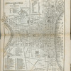
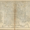
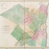
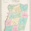
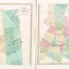
![Bennettsville [Village]; Bainbridge [Township]](https://images.nypl.org/index.php?id=1576059&t=b)
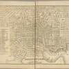
![Bainbridge Village Business Notices.; Bainbridge [Village]; Bainbridge Business Notices.](https://images.nypl.org/index.php?id=1576060&t=b)
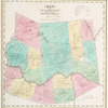
![Columbus [Township]; Columbus Business Notices.](https://images.nypl.org/index.php?id=1576061&t=b)
![Coventry [Township]; Coventry Business Notices.; Columbus [Village]; Coventry [Village]](https://images.nypl.org/index.php?id=1576062&t=b)
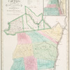
![German [Township]; German Business Notices.](https://images.nypl.org/index.php?id=1576063&t=b)
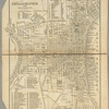
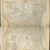
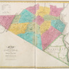
![Greene [Township]; Brisbin [Village]; Mt. Upton [Village]; Town of Greene Business Notices.](https://images.nypl.org/index.php?id=1576064&t=b)
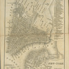
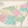
![Greene [Village]; Rockwells Mills [Village]; Greene Village Business Notices.; Guilford Centre [Village]; Chenango Forks [Village]; East Guilford [Village]; Rockdale [Village]](https://images.nypl.org/index.php?id=1576066&t=b)
- The Library Shop
- Privacy Policy
- Rules and Regulations
- Using the Internet
- Website Terms and Conditions
- Gifts of Materials to NYPL
-
© The New York Public Library, 2024
The New York Public Library is a 501(c)(3) | EIN 13-1887440
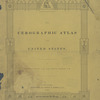
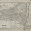
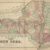
Atlas of Chenango County, New York, from actual surveys by and under the direction of Beach Nichols.
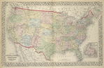
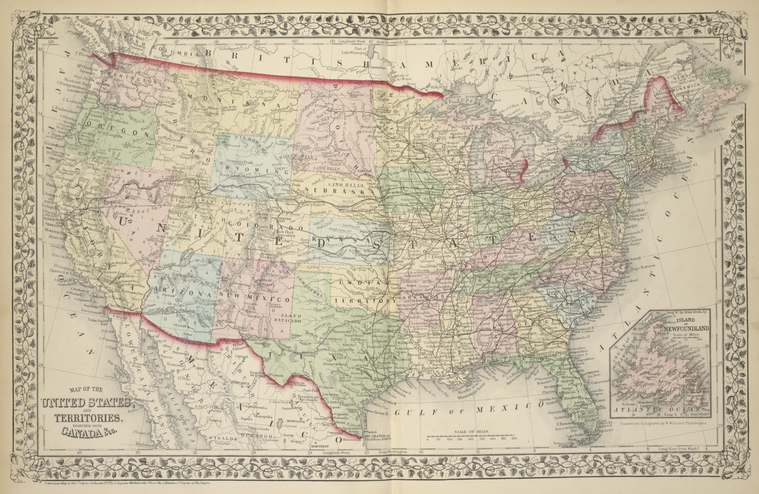
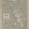
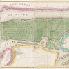
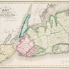
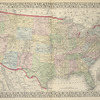
Lionel Pincus and Princess Firyal Map Division, The New York Public Library. "Map of the United States, and Territories. Together with Canada & c.; Island of New Foundland." The New York Public Library Digital Collections. 1875. https://digitalcollections.nypl.org/items/510d47e3-1bfe-a3d9-e040-e00a18064a99
Lionel Pincus and Princess Firyal Map Division, The New York Public Library. "Map of the United States, and Territories. Together with Canada & c.; Island of New Foundland." New York Public Library Digital Collections. Accessed April 26, 2024. https://digitalcollections.nypl.org/items/510d47e3-1bfe-a3d9-e040-e00a18064a99
Lionel Pincus and Princess Firyal Map Division, The New York Public Library. (1875). Map of the United States, and Territories. Together with Canada & c.; Island of New Foundland. Retrieved from https://digitalcollections.nypl.org/items/510d47e3-1bfe-a3d9-e040-e00a18064a99
<ref name=NYPL>{{cite web | url=https://digitalcollections.nypl.org/items/510d47e3-1bfe-a3d9-e040-e00a18064a99 | title=
(cartographic)
Map of the United States, and Territories. Together with Canada & c.; Island of New Foundland., (1875)
|author=Digital Collections, The New York Public Library |accessdate=April 26, 2024 |publisher=The New York Public Library, Astor, Lenox, and Tilden Foundations}}</ref>