Click to visit the main New York Public Library Homepage
The New York Public Library
Digital Collections
About Digital Collections
Browse
Search only public domain materials
Items
Collections
Divisions
Home
Search
Browse
About
Search only public domain materials
Items
Collections
Divisions
Digital Collections
Using Images
Using Data
Search
Filtered search
Show filters
Hide filters
Show Only Public Domain
topic
Libraries
953
Branch libraries
736
Buildings, structures, etc
667
Buildings, structures, etc
562
Historic buildings
522
More
Less
name
New York Public Library
941
New York Public Library. Branch Libraries
736
Wurts Bros. (New York, N.Y.)
537
New York Public Library. Humanities and Social Sciences Library
119
Stephen A. Schwarzman Building (New York, N.Y.)
114
More
Less
collection
New York Public Library Visual Materials
942
Photographic views of New York City, 1870's-1970's, from the collections of the New York Public Library. Supplement
667
Collection of photographs of New York City
522
Photographic views of New York City, 1870's-1970's, from the collections of the New York Public Library
190
Scrapbooks of New York City views
169
More
Less
place
x
New York (N.Y.)
New York (State)
1913
New York
1820
Manhattan (New York, N.Y.)
689
Brooklyn (New York, N.Y.)
99
More
Less
genre
Photographs
2565
Maps
149
Stereographs
113
Prints
76
Clippings
49
More
Less
publisher
E. Robinson Co
67
The Trow City Directory Company
16
G.W. & C.B. Colton & Co
4
G.W. and C.B. Colton & Co
4
Cushing & Bardua
3
More
Less
division
Milstein Division
1565
NYPL Archives
942
Map Division
154
Wallach Division: Photography Collection
105
Wallach Division: Picture Collection
94
More
Less
type
still image
2763
cartographic
150
text
60
Date Range
to
2,966 results found
Filtering on:
x
Date
: 1874 - 1888
x
Place
: New York (N.Y.)
Sort by:
Title
Date created
Date digitized
Sequence
Results 501 - 550
m
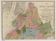
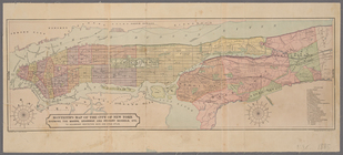
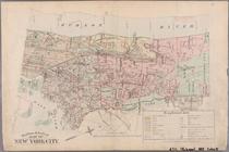
Map of Kings County: showing …
Sketch showing the ground und…
Monteith's map of the City of…
m
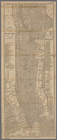
Map of New-York City / prepar…
New bond paper map of New-Yor…
Plan of New York City between…
m
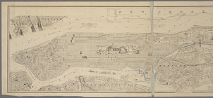
Map of the City & County of N…
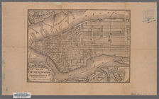
Map of the City of New York
m
Rand, McNally & Co.'s map of …
m
Colton's street map of the Ci…
m
Map of New York City south of…
Proposed iron viaduct from Sa…
Map of part of New York City …
m
Map of the city of Brooklyn ;…
m
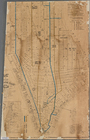
Map showing the lines of the …
Country residence of Leon. Li…
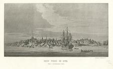
New York.
Various places of meeting of …
Sir Henry Clinton's house, Br…
Broadway from the Bowling Gre…
American Museum.
Turtle Bay and Blackwell's Is…
View of the Bowling-Green, Br…
View of St. John's Chapel, fr…
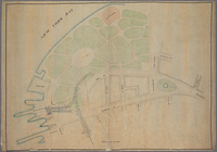
Union Park.
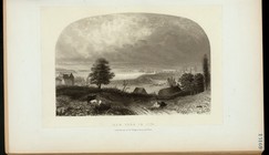
Manhattanville from Claremont.
Harper's, Franklin Square fro…
The Cliff Street front.
Old jail.
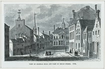
View of Federal Hall and part…
New York in 1776, from the re…
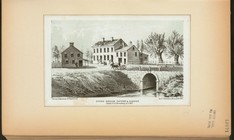
Stone Bridge Tavern and Garde…
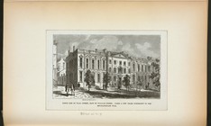
North side of Wall Street, ea…
New York.
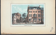
Tammany Hall, 1830.
New York in 1776.
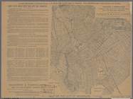
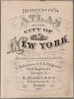
Atlas of the city of New York…
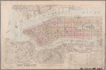
Outline & Index Map of New Yo…
Outline & Index Map of New Yo…
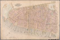
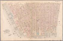
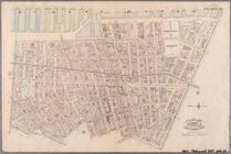
Plate 1: Bounded by Battery P…
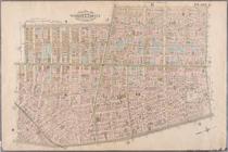
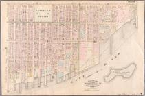
Plate 2: Bounded by West Stre…
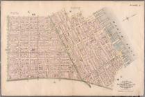
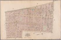
Plate 3: Bounded by West Stre…
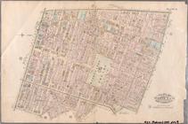
Plate 4: West Broadway, Canal…
Plate 5: Bounded by Clinton S…
Plate 6: Bounded by Rutgers S…
Plate 7: Bounded by Avenue A,…
Plate 8: Bounded by Bowery, F…
Plate 9: Bounded by Fourth Av…
Plate 10: Bounded by West Str…
Plate 11: Bounded by W. 27th …
1
2
3
4
5
6
7
8
9
10
11
12
Previous
Next
1
2
3
4
5
6
7
8
9
10
11
12
Previous
Next