Click to visit the main New York Public Library Homepage
The New York Public Library
Digital Collections
About Digital Collections
Browse
Search only public domain materials
Items
Collections
Divisions
Home
Search
Browse
About
Search only public domain materials
Items
Collections
Divisions
Digital Collections
Using Images
Using Data
Search
Filtered search
Show filters
Hide filters
Show Only Public Domain
topic
Real property
7003
Fire insurance
4397
Cities & towns
4317
City planning
955
Social conditions
944
More
Less
name
Sanborn Map Company
4410
G.W. Bromley & Co
2173
New York (N.Y.). City Planning Commission
978
M.I.T. Press
942
Austro-Hungarian Monarchy. Militärgeographisches Institut
633
More
Less
collection
Atlases of New York City
9135
Atlases of the United States
1097
Spezialkarte der Osterreichisch-Ungarischen Monarchie
633
Maps of New York City and State
436
Maps of Asia
58
More
Less
place
New York (State)
8449
New York
3357
New York (N.Y.)
2401
Manhattan (New York, N.Y.)
1474
Maps
545
More
Less
genre
x
Maps
Atlases
1083
Topographic maps
759
Cadastral maps
86
Indexes
58
More
Less
publisher
Sanborn Map Company
4446
G.W. Bromley & Co
2075
MIT Press
942
E. Belcher Hyde
706
K.u.K. Militargeographisches Institut
633
More
Less
division
Map Division
11371
General Research Division
68
Manuscripts and Archives Division
56
George Arents Collection
51
Milstein Division
34
More
Less
type
cartographic
10615
still image
1028
text
232
Date Range
to
11,623 results found
Filtering on:
x
Date
: 1904 - 1974
x
Genre
: Maps
Sort by:
Title
Date created
Date digitized
Sequence
m
Map of the Cedar Knolls, at B…
An old map of Heijokyo (Heijo…
An old map of Heiankyo (Heian…
Paris, ses monuments : guide …
m
Knickerbocker Village
m
Maps
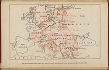
Map of Europe, showing in Red…
Map of the borough of Brookly…
m
Il dirigibile "Norge" alla sc…
m
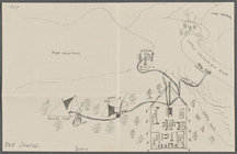
Drawing of campsite on the Li…
m
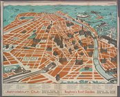
Visitor's Map of Florence
m
Map of Rome
m
Italian State Tourist Departm…
m
Hammond's complete map of Bro…
Map of the borough of Brookly…
Hammond's handy reference map…
m
Map of the borough of Brookly…
m
Freight map of the metropolit…
Hammond's complete map of New…
m
Map of property belonging to …
Map of Brooklyn Manor
Map of New York City and vici…
m
Map of Brooklyn
The Cord Meyer Development Co…
m
Petersen's map of Brooklyn
Map of Flatbush Meadows : sit…
Educational extension work of…
Map of the comprehensive plan…
Rand, McNally & Co.'s new aut…
Williams' map of Borough of B…
m
Metropolitan district local a…
Map and profile showing sourc…
The Evening Mail's complete m…
Tracts and farms with street …
m
The John Wanamaker automobile…
New York and vicinity roads a…
Brooklyn
m
Official map covering territo…
Rosedale Square, Rosedale : 4…
Opening Hell Gate at a cost o…
Map of Jamaica in the 4th war…
Rail terminal facilities in G…
m
Flushing Bay, Long Island, N.…
Railroads in Manhattan, Jerse…
Map of the suburban territory…
Road map of the New York dist…
Map of property New York Dock…
Carl Schurz Park
Brooklyn, from Rand McNally m…
Park between 35th and 36th St…
1
2
3
4
5
6
7
8
9
10
…
46
47
Previous
Next
1
2
3
4
5
6
7
8
9
10
…
46
47
Previous
Next