


- The Library Shop
- Privacy Policy
- Rules and Regulations
- Using the Internet
- Website Terms and Conditions
- Gifts of Materials to NYPL
-
© The New York Public Library, 2024
The New York Public Library is a 501(c)(3) | EIN 13-1887440
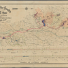
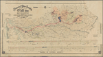
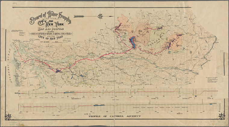
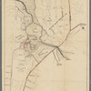
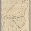
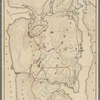
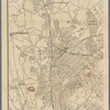
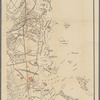
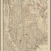
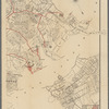
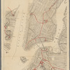
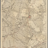
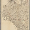
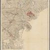
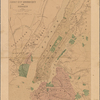
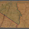
Lionel Pincus and Princess Firyal Map Division, The New York Public Library. "Map and profile showing sources of, and manner of obtaining, an additional supply of water for the city of New York, Oct. 9th, 1905 " The New York Public Library Digital Collections. 1905. https://digitalcollections.nypl.org/items/98502d00-757e-0131-09a2-58d385a7bbd0
Lionel Pincus and Princess Firyal Map Division, The New York Public Library. "Map and profile showing sources of, and manner of obtaining, an additional supply of water for the city of New York, Oct. 9th, 1905 " New York Public Library Digital Collections. Accessed April 26, 2024. https://digitalcollections.nypl.org/items/98502d00-757e-0131-09a2-58d385a7bbd0
Lionel Pincus and Princess Firyal Map Division, The New York Public Library. (1905). Map and profile showing sources of, and manner of obtaining, an additional supply of water for the city of New York, Oct. 9th, 1905 Retrieved from https://digitalcollections.nypl.org/items/98502d00-757e-0131-09a2-58d385a7bbd0
<ref name=NYPL>{{cite web | url=https://digitalcollections.nypl.org/items/98502d00-757e-0131-09a2-58d385a7bbd0 | title=
(cartographic)
Map and profile showing sources of, and manner of obtaining, an additional supply of water for the city of New York, Oct. 9th, 1905 , (1905)
|author=Digital Collections, The New York Public Library |accessdate=April 26, 2024 |publisher=The New York Public Library, Astor, Lenox, and Tilden Foundations}}</ref>