Click to visit the main New York Public Library Homepage
The New York Public Library
Digital Collections
About Digital Collections
Browse
Search only public domain materials
Items
Collections
Divisions
Home
Search
Browse
About
Search only public domain materials
Items
Collections
Divisions
Digital Collections
Using Images
Using Data
Search
Filtered search
Show filters
Hide filters
Show Only Public Domain
topic
Indian trails
12
Indians of North America
12
Local transit
6
Railroads
5
Roads
2
More
Less
name
G.W. Bromley & Co
139
Bromley, George Washington
85
Bromley, Walter Scott
85
A.R. Ohman Map Co
12
Bolton, Reginald Pelham, 1856-1942
12
More
Less
collection
Atlases of New York City
139
Maps of New York City and State
23
William J. Wilgus papers
1
place
x
New York (N.Y.)
Bronx (New York, N.Y.)
94
New York
77
New York (State)
76
Manhattan (New York, N.Y.)
65
More
Less
genre
Maps
163
Aerial views
2
Index maps
2
Indexes
2
Bird's-eye views
1
More
Less
publisher
G.W. Bromley & Co
139
Museum of the American Indian, Heye Foundation
12
Brooklyn Daily Eagle
2
C.S. Hammond
2
New York Times Co
2
More
Less
division
Map Division
162
Manuscripts and Archives Division
1
type
x
cartographic
text
2
still image
1
Date Range
to
163 results found
Filtering on:
x
Date
: 1910 - 1912
x
Place
: New York (N.Y.)
x
Type
: cartographic
Sort by:
Title
Date created
Date digitized
Sequence
Panoramic view of New York Ci…
Williams' map of boroughs of …
Map of boroughs of Manhattan …
m
Hammond's new guide map of Ma…
Freight terminal map of the P…
Upper Manhattan, comprising t…
The lower end of Manhattan Is…
The southeastern part of the …
The southwestern part of the …
The northwesterly part of the…
The district of Pelham Neck, …
Southeastern part of the boro…
Werpoes, a village of the Man…
Yorkville and East Harlem in …
Southern part of the borough …
The Long Island City and Newt…
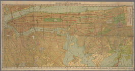
Greater New York and contigou…
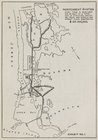
The subway problem: map of in…
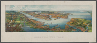
Greatest New York , [panorami…
Hammond's new guide map of Ma…
Block distribution of childre…
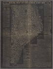
Social map of the Lower East …
Queens Borough, City of New Y…
Map of the southern part of t…
Atlas of the city of New York…
STREET INDEX. Arlington Squar…
Street Index. High Bridge Ter…
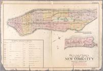
Index: Borough of Manhattan. …
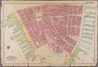
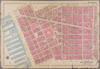
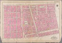
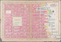
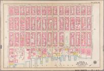
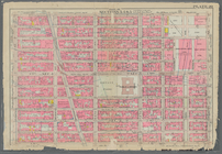
Plate 1: Bounded by Liberty S…
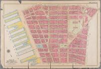
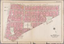
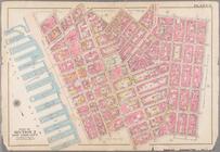
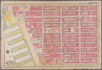
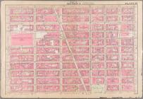
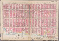
Plate 2: Bounded by Jay Stree…
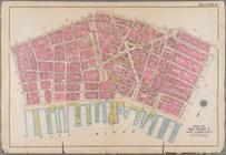
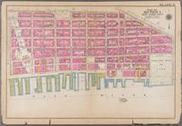
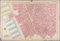
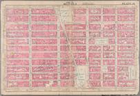
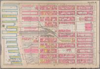
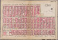
Plate 3: Bounded by William S…
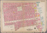
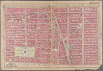
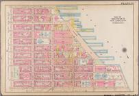
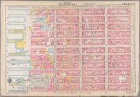
Plate 4: Bounded by Spring St…
Plate 5: Bounded by Broome St…
Plate 6: Bounded by Division …
Plate 7: Bounded by E. 3rd St…
Plate 8: Bounded by W. 3rd St…
Plate 9: Bounded by Charles S…
Plate 10: Bounded by W. 14th …
Plate 11: Bounded by W. 14th …
Plate 12: Bounded by E. 14th …
Plate 13: Bounded by W. 25th …
Plate 14: Bounded by W. 25th …
Plate 15: Bounded by [Plate 3…
Plate 16: Bounded by Lexingto…
Plate 17: Bounded by W. 36th …
Plate 18: Bounded by W. 36th …
Plate 19: Bounded by W. 47th …
Bounded by W. 47th Street, E.…
Plate 21: Bounded by Lexingto…
Plate 22: Bounded by Sixth Av…