Click to visit the main New York Public Library Homepage
The New York Public Library
Digital Collections
About Digital Collections
Browse
Search only public domain materials
Items
Collections
Divisions
Home
Search
Browse
About
Search only public domain materials
Items
Collections
Divisions
Digital Collections
Using Images
Using Data
Search
Filtered keyword search
Show filters
Hide filters
Show Only Public Domain
topic
History
100
Real property
33
Landowners
25
Administrative and political divisions
16
Geography
12
More
Less
name
Montanus, Arnoldus, 1625?-1683
97
Ogilby, John, 1600-1676
97
United States. War Department. Office of P.R.R. Surveys
10
Arbuckle Bros
8
Blake, William P. (William Phipps), 1826-1910
7
More
Less
collection
Lawrence H. Slaughter Collection of English maps, charts, globes, books and atlases
114
Maps of North America
93
Maps of New York City and State
27
Atlases, gazetteers, guidebooks and other books
20
Atlases of New York City
8
More
Less
place
America
97
West Indies, British
97
New York (State)
24
California
15
New York (N.Y.)
14
More
Less
genre
Maps
244
Illustrations
40
Aerial views
29
Cadastral maps
20
Diagrams
13
More
Less
publisher
Printed by the author, and are to be had at his house
97
War Dept., U.S. Pacific Rail Road Explorations & Surveys
8
publisher not identified
7
Printed for Robert Sayer, No. 53, Fleet-Street
5
Arbuckle Bros. Coffee Co
5
More
Less
division
x
Map Division
type
x
still image
cartographic
123
text
33
Date Range
to
Looking for this collection?
Lawrence H. Slaughter Collection of English maps, charts, globes, books and atlases
1,252 items
280 results found for:
x
map
Filtering on:
x
Division
: Map Division
x
Rights
: Public Domain
x
Type
: still image
Sort by:
Relevance
Title
Date created
Date digitized
Sequence
Portugal.
image:
ps_
map
_179
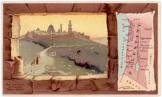
Palestine.
image:
ps_
map
_180
Florida.
image:
ps_
map
_174
Denmark.
image:
ps_
map
_178
Indian Territory [Oklahoma].
image:
ps_
map
_175
Title page
image:
ps_
map
_191
Allen's outline
map
of Ottumwa, Iowa
note:
… catalog of the
Map
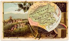
Chinese Empire.
image:
ps_
map
_181
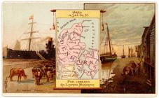
New York.
image:
ps_
map
_176
Map
of the territory of Idaho
note:
Mapping
the Nation (NEH grant, 2015-2018)…
m
Map
of Columbiana County, Ohio, 1860 …
note:
… along center of
map
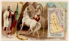
Arabia.
image:
ps_
map
_177
Map
of the city of San Francisco
note:
… catalog of the
Map
Octagonal
map
of the environs of Richmond
note:
Mapping
the Nation (NEH grant, 2015-2018)…
Colton's
map
of Oregon & Washington
note:
… catalog of the
Map
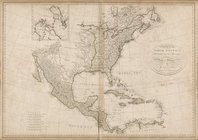
Map
of North America, published under
Plan of the city of Philadelp…
note:
NYPL
Map
Div. copy: margins trimmed; sheet 51
Mines of the Kansas Ridge, Mo…
note:
… catalog of the
Map
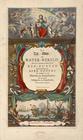
De zee-atlas ofte water-werel…
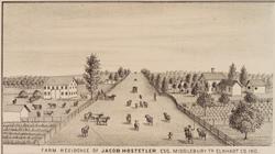
Farm residence of Jacob Hoste…
image:
ps_
map
_215
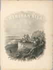
American atlas
m
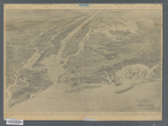
Bird's eye view of Chicago, 1…
note:
NYPL
Map
Div. copy has accession no
The new empire of western Col…
note:
NYPL
Map
Div. copy mounted on muslin; verso
View of Savannah as it stood …
note:
Includes key to numbered places on
map
Most extraordinary [camera sh…
collection:
Maps
of New York City and State
The city of San Francisco, 18…
note:
NYPL
Map
Div. copy has accession no
Map
of the Forest Hill Divide, Placer
note:
NYPL
Map
Div. copy has only 1 of 2 sheets
Map
of the state of California …
note:
NYPL
Map
Div. copy has accession no
Map
of the city of Davenport and its suburbs
note:
… catalog of the
Map
Map
of the State of Georgia …
note:
Partial cadastral
map
showing names
m
A new and accurat[e] detail
map
(nearly eight
note:
Mapping
the Nation (NEH grant, 2015-2018)…
m
King's bird's eye view of Gre…
collection:
Maps
of New York City and State
m
Map
of Multnomah County, Oregon …
note:
NYPL
Map
Div. copy includes manuscript
Hyde Park : [Chicago, Illinoi…
note:
Mapping
the Nation (NEH grant, 2015-2018)…
m
A topographical
map
of Lincoln Co. Maine
note:
NYPL
Map
Div. copy
m
Map
of the Buffalo Hump mining country …
note:
NYPL
Map
Div. copy has accession no
Leavitt's
map
with views of the White
note:
Pictorial
map
of the White Mountains with 4
Map
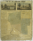
of the Lakeland farms, near the villages
note:
… a
map
of the farms
m
A correct
map
of the state of Vermont, from
note:
NYPL
Map
Div. copy
m
Map
of the county of Berkshire, Massachusetts
note:
NYPL
Map
Div. copy divided into 2 sheets 158
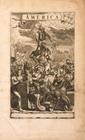
America
collection:
… of English
maps
, charts
Christofel Colonus
collection:
… of English
maps
, charts
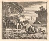
Scene viewed by Columbus.
collection:
… of English
maps
, charts
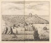
Angra op Tercera
collection:
… of English
maps
, charts
Americus Vesputius
collection:
… of English
maps
, charts
Ferdinand Magellanus
collection:
… of English
maps
, charts
Vetus Mexico
collection:
… of English
maps
, charts
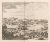
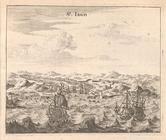
St. Iago
collection:
… of English
maps
, charts
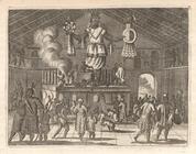
Native Temple
collection:
… of English
maps
, charts
Pagus Hispanorum
collection:
… of English
maps
, charts
1
2
Previous
Next
1
2
Previous
Next