Click to visit the main New York Public Library Homepage
The New York Public Library
Digital Collections
About Digital Collections
Browse
Search only public domain materials
Items
Collections
Divisions
Home
Search
Browse
About
Search only public domain materials
Items
Collections
Divisions
Digital Collections
Using Images
Using Data
Search
Filtered keyword search
Show filters
Hide filters
Show Only Public Domain
topic
Real property
1830
Business enterprises
467
Description and travel
157
History
90
Fire insurance
86
More
Less
name
Beers, F. W. (Frederick W.)
435
G.M. Hopkins & Co
286
Everts, Ensign & Everts
231
Hyde, E. Belcher
175
Beers, D. G. (Daniel G.)
172
More
Less
collection
x
Atlases of the United States
place
New York (State)
2037
New Jersey
299
Erie County (N.Y.)
197
Suffolk County (N.Y.)
181
Jersey City (N.J.)
178
More
Less
genre
Atlases
3755
Maps
3652
Plans
84
Prints
71
Surveys
44
More
Less
publisher
F. W. Beers & Co
148
A.H. Mueller
133
G.M. Hopkins
127
E. Belcher Hyde
118
E. Belcher-Hyde
112
More
Less
division
x
Map Division
type
cartographic
3720
text
139
still image
8
Date Range
to
Looking for this collection?
Atlases of the United States
3,868 items
3,839 results found for:
x
map
Filtering on:
x
Division
: Map Division
x
Collection
: Atlases of the United States
For more collection details, visit the
Atlases of the United States collection page
.
Sort by:
Relevance
Title
Date created
Date digitized
Sequence
Results 3001 - 3050
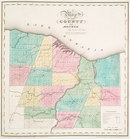
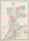
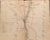
Map
of the county of Monroe
note:
… to Early
Maps
of the Middle
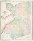
Map
of the county of Orleans
note:
… to Early
Maps
of the Middle
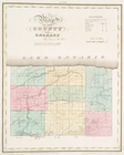
Map
of the county of Niagara
note:
… to Early
Maps
of the Middle
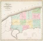
Map
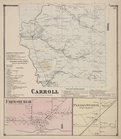
of the county of Erie
note:
… to Early
Maps
of the Middle
Map
of the county of Westchester
note:
… to Early
Maps
of the Middle
Map
of the county of Ulster
note:
… to Early
Maps
of the Middle
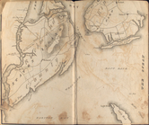
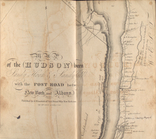
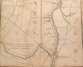
Map
of the Hudson ... from Sandy Hook to New
note:
… to Early
Maps
of the Middle
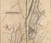
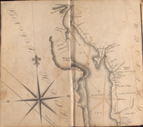
Map
of the Hudson ... from New York Harbor
note:
… to Early
Maps
of the Middle
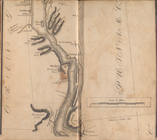
Map
of the Hudson ... from Spuyten Duyvil
note:
… to Early
Maps
of the Middle
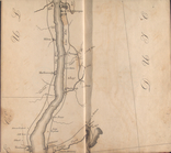
Map
of the Hudson ... from Tarrytown
note:
… to Early
Maps
of the Middle
Map
of the Hudson ... from Peekskill to site
note:
… to Early
Maps
of the Middle
Map
of the Hudson ... from Newburgh
note:
… to Early
Maps
of the Middle
Map
of the Hudson ... from Poughkeepsie to P
note:
… to Early
Maps
of the Middle
Map
of the Hudson ... from Rhynbeck
note:
… to Early
Maps
of the Middle
Map
of the Hudson ... from Germantown
note:
… to Early
Maps
of the Middle
Map
of the Hudson ... from Coxackie
note:
… to Early
Maps
of the Middle
Map
of the Hudson ... from Castleton to Troy
note:
… to Early
Maps
of the Middle
Map
of the Hudson ... from Lansingburgh
note:
… to Early
Maps
of the Middle
Map
of the Hudson ... from Bemiss' Heights
note:
… to Early
Maps
of the Middle
Map
of the Hudson ... from Ft. Miller
note:
… to Early
Maps
of the Middle
Outline
Map
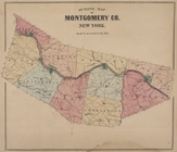
of Montgomery Co. New York
Outline
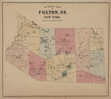
Map
of Fulton Co. New York
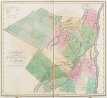
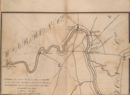
Map
of Saratoga County
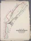
Plan of Weehawken township
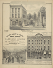
Barnes, Blanding & Co., Marbl…
collection:
Combination atlas
map
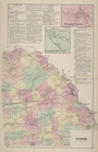
of Broome County
Atlas of the City of Buffalo,…
Howes, Babcock & Co. Foundry …
Mina Corners [Village]; Findl…
Busti Business Directory; Oak…
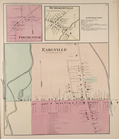
Fentonville Business Director…
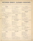
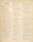
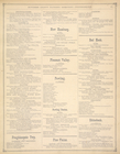
Dutchess County Patron's Dire…
Dutchess County Patron's Dire…
Dutchess County Patron's Dire…
Dutchess County Patron's Dire…
New Woodstock [Village]; Chit…
Town of Eaton Business Notice…
Georgetown [Village]; Georget…
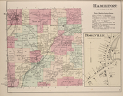
Hamilton [Township]; Town of …
Colchester [Village]; Hubbard…
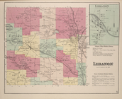
Lebanon [Village]; Lebanon Vi…
Lenox [Township]; Upper South…
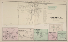
Canastota [Village]; Clockvil…
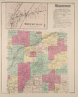
Bouckville [Village]; Madison…
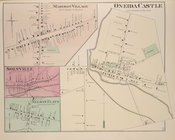
Oneida Castle [Village]; Madi…
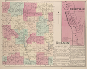
Erieville [Village]; Nelson […
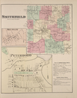
Smithfield [Township]; Siloam…
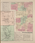
Stockbridge Business Notices;…
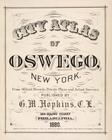
City Atlas of Oswego, New York
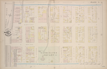
Part of Ward 4 [Plate A]
Part of Ward 6 [Plate B]
1
2
…
7
8
9
10
11
12
13
14
15
16
Previous
Next
1
2
…
7
8
9
10
11
12
13
14
15
16
Previous
Next