Click to visit the main New York Public Library Homepage
The New York Public Library
Digital Collections
About Digital Collections
Browse
Search only public domain materials
Items
Collections
Divisions
Home
Search
Browse
About
Search only public domain materials
Items
Collections
Divisions
Digital Collections
Using Images
Using Data
Search
Filtered keyword search
Show filters
Hide filters
Show Only Public Domain
topic
Geography
3
Colonies
2
Discovery and exploration
2
Nautical charts
2
Atlases, British
1
More
Less
name
Childe, Timothy
2
Churchill, John
2
Coignet, Michel, 1549-1623
2
Green, John, fl. 1730-1753
2
Jefferys, Thomas, d. 1771
2
More
Less
collection
x
Lawrence H. Slaughter Collection of English maps, charts, globes, books and atlases
place
America
4
North America
3
Africa, North
2
Atlantic Ocean
2
Great Britain
2
More
Less
genre
Maps
14
publisher
Printed for Ieames Shawe, and are to be solde at his shoppe nigh Ludgate,
2
Printed for and [sic] J. Churchil, in Pater-Noster-Row and T. Childe in St. Paul's Church-yard,
2
Gedruckt ... durch Matthaeum Becker,
1
J. Senex
1
Joannes van Keulen boeckverkooper en graed-boogh maecker aende nieuwe brug in de gekroonde Lootsman
1
More
Less
division
x
Map Division
type
cartographic
14
text
1
Date Range
to
14 results found for:
x
North Africa Maps
Filtering on:
x
Division
: Map Division
x
Collection
: Lawrence H. Slaughter Collection of English maps, charts, globes, books and atlases
For more collection details, visit the
Lawrence H. Slaughter Collection of English maps, charts, globes, books and atlases collection page
.
Sort by:
Relevance
Title
Date created
Date digitized
Sequence
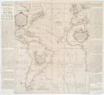
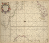
Mare del Nort.
note:
Burden, P.D.
Mapping
of
North
America
… of the
north
part of antient
Africa
shewing the chiefe
topic:
Maps
in education
A new and correct chart shewi…
note:
Shows
North
… of Europe,
Africa
note:
… to Early
Maps
of the Middle
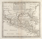
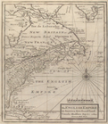
Mexico, or, New Spain : divid…
note:
Covers
North
America as far
north
m
North
America : …
note:
… to Early
Maps
of the Middle
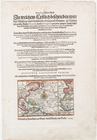
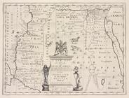
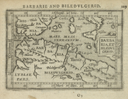
Barbaria, et Biledulgerid.
note:
… to Early
Maps
of the Middle
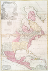
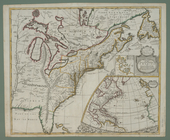
The English empire in America…
note:
… to Early
Maps
of the Middle
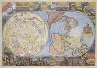
Map
of the heavens and the earth
note:
… centered on
North
Pole
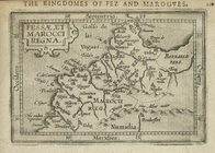
Fessae, et Marocci Regna.
note:
… to Early
Maps
of the Middle
m
A chart of
North
and South America
note:
… to the
north
& Chart
A chart of
North
and South America
image:
psnypl_
map
_226
… de custen van
Africa
note:
Oriented with
north
to the right.
A new
map
of the English empire in America
note:
…,
Africa
and America.
End of results
|
Top