Click to visit the main New York Public Library Homepage
The New York Public Library
Digital Collections
About Digital Collections
Browse
Search only public domain materials
Items
Collections
Divisions
Home
Search
Browse
About
Search only public domain materials
Items
Collections
Divisions
Digital Collections
Using Images
Using Data
Search
Filtered keyword search
Show filters
Hide filters
Show Only Public Domain
topic
History
21
Nautical charts
19
Harbors
16
Administrative and political divisions
11
Railroads
6
More
Less
name
United States Coast Survey
16
Bache, A. D. (Alexander Dallas), 1806-1867
11
Hassler, F. R. (Ferdinand Rudolph), 1770-1843
11
Knight, John, approximately 1802-1872
6
Mathiot, G
6
More
Less
collection
x
Maps of New York City and State
place
New York (State)
69
United States
34
New York (N.Y.)
26
Manhattan (New York, N.Y.)
15
New York
15
More
Less
genre
Maps
105
Nautical charts
10
Facsimiles
5
Bathymetric maps
3
Early works to 1800
3
More
Less
publisher
The Survey
6
publisher not identified
5
Ferdinand Andrews
4
U.S. Coast Survey office
4
Survey of the Coast of the United States
3
More
Less
division
x
Map Division
type
cartographic
104
text
1
Date Range
to
105 results found for:
x
United States
Filtering on:
x
Division
: Map Division
x
Collection
: Maps of New York City and State
For more collection details, visit the
Maps of New York City and State collection page
.
Sort by:
Relevance
Title
Date created
Date digitized
Sequence
m
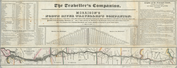
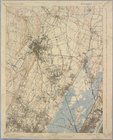
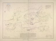
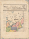
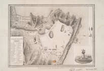
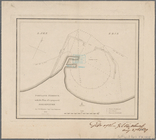
Niagara 1819
note:
… the
United
States
The second section of the sur…
note:
… the
United
States
… in the
United
States
from each
note:
… the
United
States
.
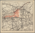
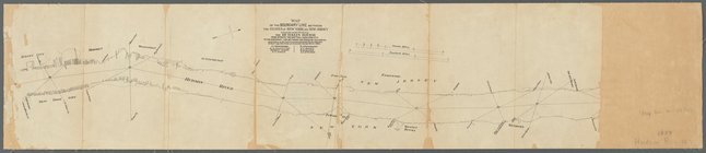
Map of the Rome, Watertown an…
note:
…
states
of the
United
States
and part of Canada.
…, to Manicouagan Point ;
United
States
of America.
note:
United
States
map covers area east
m
Flushing Bay, Long Island, N.…
note:
…"
United
States
Engineer Office, District
Map of the mouth of Genessee …
collection:
Maps of New York City and
State
Paterson, N.J. - N.Y., ed. of…
collection:
Maps of New York City and
State
Staten Island, N.Y., ed. of F…
topic:
New York (
State
)…
Santanoni, ed. of Mar. 1904, …
topic:
New York (
State
)…
Mt. Marcy, ed. of June 1902, …
topic:
New York (
State
)…
De Noord Rivier anders R. Man…
collection:
Maps of New York City and
State
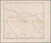
Hell Gate and its approaches
note:
… of the Coast of the
United
States
.
Sketch of West Pier, Oswego H…
collection:
Senate executive document (
United
States
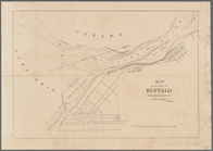
Map of Buffalo Harbor, N.Y., …
collection:
Maps of New York City and
State
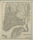
New map of New York City: fro…
note:
On bottom left corner: "
United
States
1889, Larchmont Harbor, N.Y.:…
collection:
Maps of New York City and
State
Map of the mouth of Great Sod…
collection:
Maps of New York City and
State
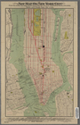
Elevated railway map of New Y…
note:
… for
United
States
Life
m
Map of New-York Bay and Harbo…
note:
… of the Coast of the
United
States
; triangulation
Western part of the southern …
note:
… of the
United
States
.
m
Panoramic view of New York Ci…
collection:
Maps of New York City and
State
Middle part of the southern c…
note:
… of the Coast of the
United
States
.
… erected by the
United
States
and the plan
m
Post route map of the
State
of New York
note:
… Department,
United
States
Map of New-York Bay and Harbo…
note:
… of the Coast of the
United
States
; triangulation
m
Map of New-York Bay and Harbo…
note:
… of the Coast of the
United
States
; triangulation
Eastern part of the southern …
note:
… of the Coast of the
United
States
.
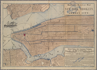
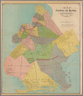
Map of the county of Kings, s…
collection:
Maps of New York City and
State
Map of New-York Bay and Harbo…
note:
… of the Coast of the
United
States
; triangulation
Map of the city of New York, …
topic:
Buildings -- New York (
State
) -- New
Carte pour servir à l'itinéra…
abstract:
Shows the Northeastern
States
and part
Map of the boundary line between the
states
note:
… of their respective
states
on December
m
Data for population from cens…
collection:
Census of the
United
States
(1910)…
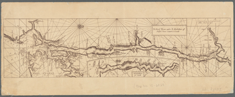
Position of the American Army…
collection:
Maps of New York City and
State
New-York.
note:
… the
United
States
.
West Point
collection:
Maps of New York City and
State
Attack on forts Clinton and M…
collection:
Maps of New York City and
State
Operations on the Hudson River
collection:
Maps of New York City and
State
Map of the vicinity of Buffal…
collection:
Maps of New York City and
State
Works at Stony Point and Verp…
collection:
Maps of New York City and
State
Portland Harbour: with the pl…
collection:
Maps of New York City and
State
Middle part of Long Island So…
note:
… of the Coast of the
United
States
; A.D. Bache
Operations on Hudson's River
collection:
Maps of New York City and
State
New York Harbor and entrance …
collection:
Maps of New York City and
State
Map of New York, New England,…
note:
… part of the
United
States
or Canada
Battle of Long Island: from S…
collection:
Maps of New York City and
State
m
Eastern part of Long Island S…
note:
… of the Coast of the
United
States
; A.D. Bache
Pierhead and bulkhead lines f…
collection:
Maps of New York City and
State
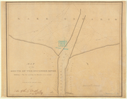
Sketch illustrating the progr…
collection:
Maps of New York City and
State