Click to visit the main New York Public Library Homepage
The New York Public Library
Digital Collections
About Digital Collections
Browse
Search only public domain materials
Items
Collections
Divisions
Home
Search
Browse
About
Search only public domain materials
Items
Collections
Divisions
Digital Collections
Using Images
Using Data
Search
Filtered keyword search
Show filters
Hide filters
Show Only Public Domain
topic
Harbors
29
Nautical charts
20
Piers
7
Real property
7
Landowners
6
More
Less
name
United States Coast Survey
8
Hassler, F. R. (Ferdinand Rudolph), 1770-1843
5
Bache, A. D. (Alexander Dallas), 1806-1867
4
Ferguson, James, 1710-1776
4
Gedney, Thomas R
4
More
Less
collection
x
Maps of New York City and State
place
New York (State)
38
New York Harbor (N.Y. and N.J.)
26
New York (N.Y.)
19
New York
16
New York Metropolitan Area
14
More
Less
genre
Maps
65
Nautical charts
6
Bathymetric maps
4
Cadastral maps
4
Aerial views
1
More
Less
publisher
publisher not identified
4
Survey of the Coast of the United States
3
U.S. House of Representatives
3
G.W. & C.B. Colton & Co
2
Government Printing Office
2
More
Less
division
x
Map Division
type
cartographic
65
text
1
Date Range
to
65 results found for:
x
new york harbor
Filtering on:
x
Division
: Map Division
x
Collection
: Maps of New York City and State
For more collection details, visit the
Maps of New York City and State collection page
.
Sort by:
Relevance
Title
Date created
Date digitized
Sequence
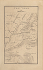
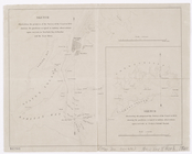
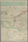
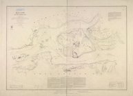
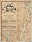
Outline map of
New
York
Harbor
& vicinity
use:
… partner (e.g.,
New
York
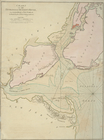
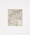
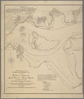
Map of the
Harbor
of
New
York
use:
… partner (e.g.,
New
York
m
… coast,
New
York
--
New
Jersey,
New
York
Harbor
use:
… partner (e.g.,
New
York
New
York
med trakten däromkring.
use:
… partner (e.g.,
New
York
New
York
Harbor
and entrance : from the U.S
use:
… partner (e.g.,
New
York
New
York
und Umgebungen.
use:
… partner (e.g.,
New
York
… of the harbour of
New
York
use:
… partner (e.g.,
New
York
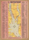
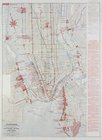
N.Y. City's waterfront.
use:
… partner (e.g.,
New
York
Map of the port & vicinity of
New
York
use:
… partner (e.g.,
New
York
…, from Sandy Hook to
New
York
: with the banks
use:
… partner (e.g.,
New
York
… to
New
York
Town
use:
… partner (e.g.,
New
York
… in
New
York
Bay &
Harbor
use:
… partner (e.g.,
New
York
New
York
and Perthamboy Harbours.
use:
… partner (e.g.,
New
York
… to the Battery,
New
York
City
use:
… partner (e.g.,
New
York
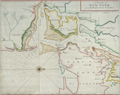
A chart of
New
York
Harbour
use:
… partner (e.g.,
New
York
Ports de la Nouvelle
York
et Pertamboy
use:
… partner (e.g.,
New
York
A chart of
New
York
Harbour
use:
… partner (e.g.,
New
York
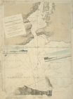
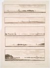
Views of the entrance to
New
York
use:
… partner (e.g.,
New
York
Greater
New
York
and its
harbor
…
use:
… partner (e.g.,
New
York
m
Map of
New
-
York
Bay and
Harbor
and the environs
use:
… partner (e.g.,
New
York
Bay and
harbor
of
New
York
use:
… partner (e.g.,
New
York
m
Map of
New
-
York
Bay and
Harbor
and the environs
use:
… partner (e.g.,
New
York
Map of the Harlem River and S…
use:
… partner (e.g.,
New
York
m
Map of the Harlem River and S…
use:
… partner (e.g.,
New
York
Map of
New
-
York
Bay and
Harbor
and the environs
use:
… partner (e.g.,
New
York
m
Sea Gate,
New
York
Harbor
use:
… partner (e.g.,
New
York
m
… for the Port of
New
York
use:
… partner (e.g.,
New
York
Map of the city of
New
-
York
.
use:
… partner (e.g.,
New
York
… St.
New
York
use:
… partner (e.g.,
New
York
Hell Gate and its approaches
use:
… partner (e.g.,
New
York
… thirty miles around
New
York
showing railroads
use:
… partner (e.g.,
New
York
…, East River,
New
York
, as recommended by the
New
York
use:
… partner (e.g.,
New
York
m
… to the port of
New
York
use:
… partner (e.g.,
New
York
Map of
New
-
York
Bay and
Harbor
and the environs
use:
… partner (e.g.,
New
York
… of the bays,
harbors
and rivers around
New
York
use:
… partner (e.g.,
New
York
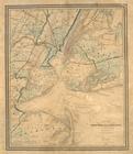
Map of
New
-
York
and its vicinity
use:
… partner (e.g.,
New
York
Plan de
New
-
York
et des environs
use:
… partner (e.g.,
New
York
… in the province of
New
Jersey
use:
… partner (e.g.,
New
York
m
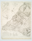
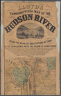
Lloyd's Topographical map of …
use:
… partner (e.g.,
New
York
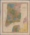
Map of
New
York
use:
… partner (e.g.,
New
York
Map of the City of
New
York
.
use:
… partner (e.g.,
New
York
m
Lloyd's topographical map of …
use:
… partner (e.g.,
New
York
A sketch of the operations of…
use:
… partner (e.g.,
New
York
1889, Larchmont
Harbor
, N.Y.
use:
… partner (e.g.,
New
York
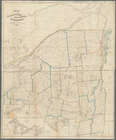
Map of the Sacketts
Harbor
and Saratoga Rail
use:
… partner (e.g.,
New
York
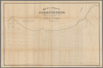
… and
harbor
of Ogdensburgh
use:
… partner (e.g.,
New
York
m
Map of Suffolk Co., L.I.,
New
York
use:
… partner (e.g.,
New
York
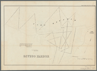
Oswego
Harbor
use:
… partner (e.g.,
New
York
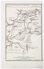
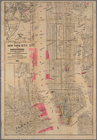
Map of the
Harbor
of
New
York
to accompany
use:
… partner (e.g.,
New
York
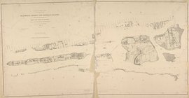
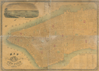
City of
New
Manhattan : proposed May
use:
… partner (e.g.,
New
York