Click to visit the main New York Public Library Homepage
The New York Public Library
Digital Collections
About Digital Collections
Browse
Search only public domain materials
Items
Collections
Divisions
Home
Search
Browse
About
Search only public domain materials
Items
Collections
Divisions
Digital Collections
Using Images
Using Data
Search
Filtered keyword search
Show filters
Hide filters
Show Only Public Domain
topic
Real property
200
Geography
192
Nautical charts
144
Maps in education
102
Landowners
96
More
Less
name
Robinson, E. (Elisha)
137
A.H. Mueller (Publisher)
133
United States Coast Survey
110
Moll, Herman, -1732
100
J.M. Lathrop & Co
95
More
Less
collection
Lawrence H. Slaughter Collection of English maps, charts, globes, books and atlases
712
Atlases of the United States
369
Maps of North America
363
Maps of New York City and State
153
Atlases of New York City
70
More
Less
place
New York (State)
256
United States
185
New York (N.Y.)
164
Great Britain
131
England
104
More
Less
genre
Maps
1671
Atlases
369
Nautical charts
78
Cadastral maps
67
Bathymetric maps
40
More
Less
publisher
A.H. Mueller
133
Reading Publishing House
78
E. Robinson Co
70
Published by Wm. Faden, geographer to His Majesty, and His R.H. the Prince of Wales
58
Printed for John Cary
57
More
Less
division
x
Map Division
type
cartographic
1629
text
87
still image
66
Date Range
to
Looking for this collection?
Lawrence H. Slaughter Collection of English maps, charts, globes, books and atlases
1,252 items
1,711 results found for:
x
A. H
Filtering on:
x
Division
: Map Division
Sort by:
Relevance
Title
Date created
Date digitized
Sequence
m
1896 Connecticut River, Conn.…
parent:
39e72dc0-19f9-0134-5bb4-00505686
a
51c
64 Central Park Lots, New Yor…
parent:
bfe1f6e0-c5aa-012f-f02d-58d385
a
7bc34
A chart of Delawar Bay : with…
parent:
4f3b2160-c5d5-012f-9245-58d385
a
7bc34
A chart of Delawar River from…
parent:
503
a
2300-c5d5-012f-4d9
a
-58d385
a
7bc34
A chart of Delaware Bay and R…
parent:
4fb19cb0-c5d5-012f-e699-58d385
a
7bc34
A chart of Delaware Bay and R…
parent:
50b7f400-c5d5-012f-
a
84d-58d385
a
7bc34
A chart of Delaware Bay and R…
parent:
4b009e80-c5d5-012f-
a
000-58d385
a
7bc34
A chart of Delaware Bay and R…
parent:
4d2684f0-c5d5-012f-932f-58d385
a
7bc34
A chart of Delaware Bay and R…
parent:
e4e3d7
a
0-c5d3-012f-9c95-58d385
a
7bc34
A chart of Delaware Bay and R…
parent:
4c568e60-c5d5-012f-978
a
-58d385
a
7bc34
A chart of Delaware Bay and R…
parent:
4ba4f580-c5d5-012f-fd69-58d385
a
7bc34
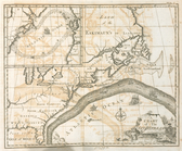
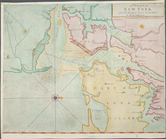
A chart of New York Harbour :…
parent:
873b60e0-c5d5-012f-7084-58d385
a
7bc34
A chart of New York Island & …
parent:
89202d60-c5d5-012f-af15-58d385
a
7bc34
[
A
chart of New York Island & North
parent:
87db1950-c5d5-012f-63bc-58d385
a
7bc34
m
A chart of North and South Am…
parent:
75fcc5d0-c5d5-012f-aab9-58d385
a
7bc34
A chart of North and South Am…
parent:
757d1d50-c5d5-012f-00d1-58d385
a
7bc34
A chart of the Atlantic Ocean…
parent:
19dbe300-c5d5-012f-5bf4-58d385
a
7bc34
A Chart of the Atlantic or We…
parent:
1c9b2570-c5d5-012f-005f-58d385
a
7bc34
[
A
Chart of the Atlantic or Western Ocean]
parent:
1d37e480-c5d5-012f-8630-58d385
a
7bc34
A chart of the Atlantick Ocea…
parent:
27fbfd30-c5d5-012f-fbe9-58d385
a
7bc34
A chart of the bar of Sandy H…
parent:
9075e170-c5d5-012f-19
a
4-58d385
a
7bc34
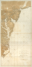
A chart of the coast of Ameri…
parent:
0b6fd3f0-c5d5-012f-dfb3-58d385
a
7bc34
A chart of the coast of New Y…
parent:
063e9970-c5d5-012f-c5e2-58d385
a
7bc34
A chart of the coast of New Y…
parent:
41f65640-c5d5-012f-d436-58d385
a
7bc34
m
A chart of the discoveries of
H
.M.S. Hecla
parent:
86
a
90ec0-c604-012f-68af-58d385
a
7bc34
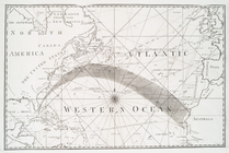
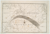
A chart of the Gulf Stream
parent:
dc44e0
a
0-c5d4-012f-9
a
5e-58d385
a
7bc34
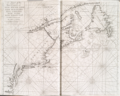
A chart of the sea coast of N…
parent:
7f0f8aa0-c5d3-012f-f21e-58d385
a
7bc34
A chart of the sea coast of N…
parent:
54
a
2
a
270-c5d5-012f-053b-58d385
a
7bc34
A chart of the sea coasts of …
parent:
05621200-c5d4-012f-5e7b-58d385
a
7bc34
A chart of the sea coasts of …
parent:
df21
a
560-c5d3-012f-1973-58d385
a
7bc34
m
A chart of the West Indias fr…
parent:
04990850-c5d4-012f-7652-58d385
a
7bc34
m
A chart of the West Indias fr…
parent:
04990850-c5d4-012f-7652-58d385
a
7bc34
A chart of the West Indies fr…
parent:
dfb1b1
a
0-c5d3-012f-
a
049-58d385
a
7bc34
A chart of the world : exhibi…
parent:
66b34f80-c6b6-012f-9d8c-58d385
a
7bc34
A Chart of ye coast of New En…
parent:
54066970-c5d5-012f-6695-58d385
a
7bc34
A chorographical map of the c…
parent:
7b0
a
2650-c52b-012f-c914-3c075448cc4b
A chorographical map of the p…
parent:
fac8faa0-
a
829-0133-92be-00505686
a
51c
A chorographical map of the p…
parent:
5becf3f0-
a
828-0133-8c63-00505686
a
51c
A chorographical map of the p…
parent:
82159c30-c5d5-012f-4897-58d385
a
7bc34
A compleat chart of the coast…
first:
510d47db-aff8-
a
3d9-e040-e00
a
18064
a
99
A correct map of the Bay of S…
parent:
f75
a
9390-1359-0136-bd2f-2d6e6013
a
320
A correct map of the city of …
parent:
e4c15150-c5d4-012f-d54b-58d385
a
7bc34
A correct map of the city of …
parent:
e421c4b0-c5d4-012f-c7bc-58d385
a
7bc34
A correct map of the Oklahoma…
parent:
b98efaa0-dea0-0135-b199-061522332
a
4b
A diagram of the State of Ala…
parent:
8
a
3e1600-b142-0132-52da-58d385
a
7bbd0
A draught of New York and Per…
parent:
8532f170-c5d5-012f-9
a
06-58d385
a
7bc34
A draught of New York from th…
first:
510d47da-f118-
a
3d9-e040-e00
a
18064
a
99
A draught of New York from th…
parent:
7f57b270-c5d3-012f-3fcc-58d385
a
7bc34
A draught of New York from th…
parent:
8040adb0-c5d5-012f-f500-58d385
a
7bc34
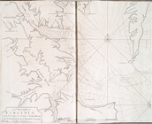
A draught of Virginia from th…
parent:
80186070-c5d3-012f-5f1
a
-58d385
a
7bc34
1
2
3
4
5
6
7
Previous
Next
1
2
3
4
5
6
7
Previous
Next