Click to visit the main New York Public Library Homepage
The New York Public Library
Digital Collections
About Digital Collections
Browse
Search only public domain materials
Items
Collections
Divisions
Home
Search
Browse
About
Search only public domain materials
Items
Collections
Divisions
Digital Collections
Using Images
Using Data
Search
Filtered search
Show filters
Hide filters
Show Only Public Domain
topic
Real property
4496
Fire insurance
2668
Cities & towns
2563
Administrative and political divisions
349
Railroads
313
More
Less
name
Sanborn Map Company
2581
G.W. Bromley & Co
1045
Bromley, George Washington
517
Bromley, Walter Scott
516
Ullitz, Hugo
388
More
Less
collection
Atlases of New York City
4809
Maps of New York City and State
1253
Atlases of the United States
676
Maps of North America
545
Lawrence H. Slaughter Collection of English maps, charts, globes, books and atlases
311
More
Less
place
New York (State)
5472
New York
2056
Manhattan (New York, N.Y.)
1180
New York (N.Y.)
1142
Brooklyn (New York, N.Y.)
560
More
Less
genre
Maps
7585
Atlases
658
Cadastral maps
162
Title pages
105
Topographic maps
81
More
Less
publisher
Sanborn Map Company
2593
G.W. Bromley & Co
973
E. Belcher Hyde
324
E. Robinson Co
224
MIT Press
115
More
Less
division
x
Map Division
type
cartographic
7490
text
206
still image
154
Date Range
to
7,752 results found
Filtering on:
x
Division
: Map Division
x
Note
: Inscribed in pencil on front free endpaper: "George of Russia, presented by Mr. Perlstein, March 19th, 1937, New York."
Sort by:
Title
Date created
Date digitized
Sequence
m
Map of the Cedar Knolls, at B…
Plan of the Central Park, Cit…
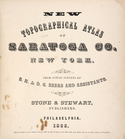
New topographical atlas of Sa…
Acres of Land, Population, Dw…
Galway [Township]; Yorks Corn…
Map of the borough of Brookly…
Russia in Europe, Part X, gen…
Russia, Part III
Russia in Europe, Part VI
Russia in Europe, Part IX and…
The northern provinces of Swe…
Russia, Part IV
Russia in Europe, Part V
Russia in Europe, Part VIII
Russia in Europe, Part VII
Russia in Europe, Part II
Ethnographic map of the world…
Records of searches in relati…
Map of the borough of Brookly…
Hammond's handy reference map…
m
Map of the borough of Brookly…
Hammond's complete map of New…
Map of New York City and vici…
m
The Blanchard Press correctly…
Educational extension work of…
Map of the comprehensive plan…
Rand, McNally & Co.'s new aut…
Map and profile showing sourc…
The Evening Mail's complete m…
Tracts and farms with street …
m
The John Wanamaker automobile…
New York and vicinity roads a…
m
Official map covering territo…
Map of Jamaica in the 4th war…
Rail terminal facilities in G…
m
Rand, McNally & Co.'s complet…
Map of the suburban territory…
Road map of the New York dist…
Map of property New York Dock…
Brooklyn, from Rand McNally m…
m
New York City and vicinity
Park between 35th and 36th St…
Birdseye view of greater New …
m
Map showing 100 miles around …
Hagstrom's map of lower New Y…
Rand McNally official 1921 au…
Hammond's handy reference map…
Map of Kissena Park, third wa…
Map showing suggested connect…
Block sketch 1679, New York C…
1
2
3
4
5
6
7
8
9
10
…
31
32
Previous
Next
1
2
3
4
5
6
7
8
9
10
…
31
32
Previous
Next