Click to visit the main New York Public Library Homepage
The New York Public Library
Digital Collections
About Digital Collections
Browse
Search only public domain materials
Items
Collections
Divisions
Home
Search
Browse
About
Search only public domain materials
Items
Collections
Divisions
Digital Collections
Using Images
Using Data
Search
Filtered search
Show filters
Hide filters
Show Only Public Domain
topic
Real property
356
Fire insurance
147
Cities & towns
112
City planning
65
Social conditions
56
More
Less
name
Sanborn Map Company
112
G.W. Bromley & Co
93
M.I.T. Press
56
New York (N.Y.). City Planning Commission
56
Bromley, George Washington
41
More
Less
collection
Atlases of New York City
442
Maps of North America
278
Atlases of the United States
252
Lawrence H. Slaughter Collection of English maps, charts, globes, books and atlases
102
Maps of New York City and State
66
More
Less
place
New York (State)
453
New York
194
New York (N.Y.)
130
North America
92
Manhattan (New York, N.Y.)
79
More
Less
genre
Maps
1172
Atlases
251
Nautical charts
48
Bathymetric maps
26
Cadastral maps
22
More
Less
publisher
Sanborn Map Company
121
G.W. Bromley & Co
80
MIT Press
56
E. Belcher Hyde
50
E. Belcher Hyde
23
More
Less
division
x
Map Division
type
cartographic
1116
still image
63
text
26
Date Range
to
1,185 results found
Filtering on:
x
Division
: Map Division
x
Note
: NYPL Map Div. copy: manuscript additions in black ink show "North Concourse," "South Concourse," and 2 loops of possible viaduct with stations and trestle. Stamped in lower right margin: D. McN. Stauffer Collection and Gift
Sort by:
Title
Date created
Date digitized
Sequence
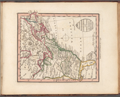
Factory Village [Village]; Fa…
Conklingville [Village]; Conk…
Bush Terminal, map showing bu…
Map of the City of New York a…
Map of New York City, south o…
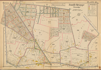
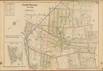
South Orange Township, Double…
South Orange Township, Double…
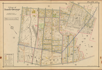
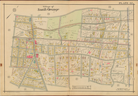
Village of South Orange, Doub…
Village of South Orange, Doub…
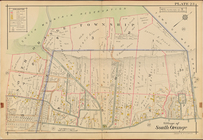
Village of South Orange, Doub…
Village of South Orange, Doub…
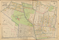
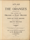
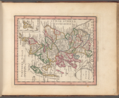
Atlas of the Oranges embracin…
The lower end of Manhattan Is…
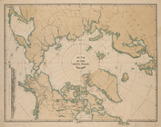
Map of the North Polar Region
m
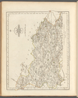
North Wales
m
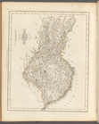
South Wales
South part of the West Riding…
South Britain, [Frontispiece]
m
North part of the West Riding…
m
North Riding of Yorkshire
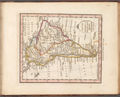
South America from the latest…
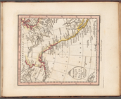
Western Coast of North Americ…
British possessions in North …
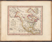
North America, including the …
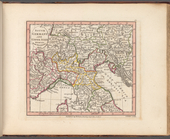
South Germany and Upper Italy…
Scotland, or North Britain
England and Wales or South Br…
Map of the boundary lines bet…
Plan of South Bay: showing ch…
Plan for the occupation of th…
Coney Island. Bounded by Cana…
Map of the Indiana North and …
m
Peremptory sale of lots, on T…
A compleat map of North-Carol…
Ohio boundary, no. 111, south…
Township no. 20 North, Range …
Rand McNally & Co.'s North Da…
Plan of the French and Americ…
Sketch of the public surveys …
m
Map showing land grant of Nor…
A topographical map of the no…
Map of the South West
Map of Township 51, North, R…
Preliminary map to a geologic…
Plan and section of the north…
The North End Mines : field …
The state of North Carolina :…
Mountain region of North Caro…
Half of an unidentified map s…
Eastern Tennessee, with parts…
1
2
3
4
5
Previous
Next
1
2
3
4
5
Previous
Next