Click to visit the main New York Public Library Homepage
The New York Public Library
Digital Collections
About Digital Collections
Browse
Search only public domain materials
Items
Collections
Divisions
Home
Search
Browse
About
Search only public domain materials
Items
Collections
Divisions
Digital Collections
Using Images
Using Data
Search
Filtered keyword search
Show filters
Hide filters
Show Only Public Domain
topic
Real property
2262
Administrative and political divisions
574
Business enterprises
470
Railroads
464
Landowners
415
More
Less
name
Beers, F. W. (Frederick W.)
443
G.M. Hopkins & Co
286
United States Coast Survey
267
Everts, Ensign & Everts
231
Bache, A. D. (Alexander Dallas), 1806-1867
209
More
Less
collection
Atlases of the United States
3839
Maps of North America
3186
Lawrence H. Slaughter Collection of English maps, charts, globes, books and atlases
176
Maps of New York City and State
105
Collection of broadside real estate maps announcing auctions of lots in early 19th century New York City
67
More
Less
place
New York (State)
2226
United States
740
New Jersey
480
Massachusetts
300
Maps
240
More
Less
genre
Maps
7223
Atlases
3755
Cadastral maps
360
Nautical charts
214
Topographic maps
130
More
Less
publisher
publisher not identified
334
F. W. Beers & Co
148
U.S. Coast Survey
134
A.H. Mueller
133
G.M. Hopkins
132
More
Less
division
x
Map Division
type
cartographic
7284
text
219
still image
108
Date Range
to
Looking for one of these collections?
Atlases of the United States
3,868 items
Maps of North America
3,345 items
7,437 results found for:
x
United States
Filtering on:
x
Division
: Map Division
Sort by:
Relevance
Title
Date created
Date digitized
Sequence
Results 751 - 800
From Annapolis (63) to Bladen…
note:
… of the roads of the
United
States
of America
From Annapolis (64) to Alexan…
note:
… of the roads of the
United
States
of America
From Annapolis (65) to Alexan…
note:
… of the roads of the
United
States
of America
From Annapolis (64) to Dumfri…
note:
… of the roads of the
United
States
of America
From Annapolis (67) to Freder…
note:
… of the roads of the
United
States
of America
Nevada [Basin]: [shaded relie…
abstract:
Covers western portion of
state
including
A diagram of Oregon
collection:
United
States
(except New York)…
Preliminary sketch of Galvest…
collection:
United
States
(except New York)…
Map of the northern peninsula…
collection:
United
States
(except New York)…
Map of roads from Fort Dodge,…
collection:
United
States
(except New York)…
Township no. 20 North, Range …
collection:
United
States
(except New York)…
Montana territory
collection:
United
States
(except New York)…
Plan of Gettysburg with the b…
collection:
United
States
(except New York)…
Eastern Virginia showing the …
collection:
United
States
(except New York)…
Leavitt's map with views of t…
note:
… and
United
States
.
Preliminary Chart of entrance…
collection:
United
States
(except New York)…
Diagram of part of the
State
of Michigan …
collection:
United
States
(except New York)…
Preliminary chart of Bull's B…
collection:
United
States
(except New York)…
State
of Nebraska …
collection:
United
States
(except New York)…
State
of Missouri …
collection:
United
States
(except New York)…
Reconnaissance of Pass Fourch…
collection:
United
States
(except New York)…
Territory of Idaho
collection:
United
States
(except New York)…
Preliminary chart of St. Mark…
note:
… of the Coast of the
United
States
.
Map of Sacramento River and b…
collection:
United
States
(except New York)…
State
of Colorado …
collection:
United
States
(except New York)…
Lovisiana by de Rivier Missis…
abstract:
… portion of the
United
States
is condensed
Preliminary chart of Ossabaw …
note:
… of the Coast of the
United
States
.
State
of Wisconsin …
collection:
United
States
(except New York)…
Plan of the western seat of w…
collection:
United
States
(except New York)…
Map of the
United
States
and Mexico
Carte des Etats-Unis.
collection:
United
States
(except New York)…
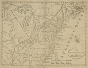
The
United
States
of America
The field of the American Hom…
collection:
United
States
(except New York)…
Map showing condition and pro…
collection:
United
States
(except New York)…
Map of the city of Washington…
collection:
United
States
(except New York)…
… part of the
United
States
collection:
United
States
(except New York)…
A new map of part of the
United
States
of North
topic:
Middle Atlantic
States
Harbor of New London and the…
collection:
United
States
(except New York)…
Portion of the Military depar…
collection:
United
States
(except New York)…
Map of Passamaquoddy Bay: fro…
note:
…, in treating with the
United
States
of America."…
Sketch D showing the progress…
collection:
United
States
(except New York)…
Map of the Parish of Carroll,…
collection:
United
States
(except New York)…
Middle Georgia & South Caroli…
abstract:
Shows
state
boundaries, railroads, roads
Topographical map of Monadnoc…
collection:
United
States
(except New York)…
m
Colton's map of the southern
states
note:
… of the
United
States
showing
Johnson's Nebraska, Dakota, I…
note:
… Court of the
United
States
for the southern
… of the
United
States
note:
… between
United
States
m
… of the territory of the
United
States
from
collection:
United
States
(except New York)…
m
Territory of the
United
States
, from
m
… of the territory of the
United
States
from
collection:
United
States
(except New York)…
1
2
3
4
5
6
7
8
9
10
…
29
30
Previous
Next
1
2
3
4
5
6
7
8
9
10
…
29
30
Previous
Next