Click to visit the main New York Public Library Homepage
The New York Public Library
Digital Collections
About Digital Collections
Browse
Search only public domain materials
Items
Collections
Divisions
Home
Search
Browse
About
Search only public domain materials
Items
Collections
Divisions
Digital Collections
Using Images
Using Data
Search
Filtered keyword search
Show filters
Hide filters
Show Only Public Domain
topic
Real property
469
Administrative and political divisions
14
Landowners
13
Local transit
9
Piers
9
More
Less
name
G.W. Bromley & Co
450
Bromley, George Washington
389
Bromley, Walter Scott
389
Perris, William
8
James Bleecker & Sons
7
More
Less
collection
Atlases of New York City
458
Maps of New York City and State
29
Collection of broadside real estate maps announcing auctions of lots in early 19th century New York City
9
Lawrence H. Slaughter Collection of English maps, charts, globes, books and atlases
1
place
x
Manhattan (New York, N.Y.)
New York (State)
494
New York
462
New York (N.Y.)
131
United States
10
More
Less
genre
x
Maps
Cadastral maps
12
Index maps
10
Outline maps
7
Indexes
3
More
Less
publisher
G.W. Bromley & Co
404
G.W. Bromley
46
Lith. by Korff Brothers
4
William Perris, Civil Engineer
4
Cushing & Bardua
3
More
Less
division
Map Division
495
type
cartographic
497
text
3
Date Range
to
497 results found for:
x
Washington (State)
Filtering on:
x
Genre
: Maps
x
Place
: Manhattan (New York, N.Y.)
Sort by:
Relevance
Title
Date created
Date digitized
Sequence
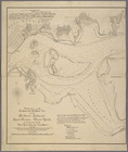
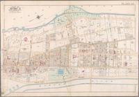
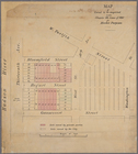
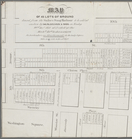
Modification in the pierhead…
note:
….,
Washington
, D.C., dated New
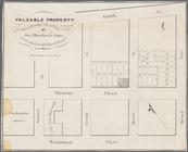
Valuable property for sale on…
abstract:
Washington
Square
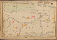
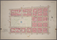
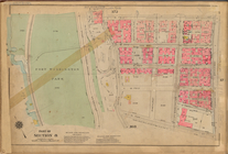
Plate 178: [Bounded by (Hudso…
Map (A) of West
Washington
Market
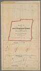
Plate 178, Part of Section 8:…
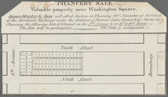
Chancery sale, Nov. 30th, 183…
abstract:
Greenwich Street, Barrow Street,
Washington
… River, Fort
Washington
Plate 178, Part of Section 8:…
… River, Fort
Washington
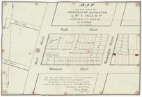
Map of lots to be sold at the…
abstract:
West Street, Bank Street,
Washington
Street
… the plan of Fort
Washington
abstract:
… to the Battle of Fort
Washington
… and
Washington
Square West
… Street,
Washington
Street
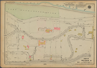
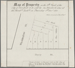
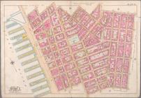
Map of property in the 9th wa…
abstract:
Washington
Street, Perry Street
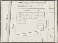
Map of property in the 9th wa…
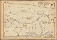
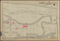
abstract:
Washington
Street, Bethune Street, West
… of the
state
of New York
note:
Prime meridian:
Washington
.
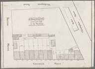
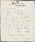
Map of 14 lots in the 9th war…
abstract:
…, Bethune Street,
Washington
m
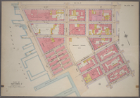
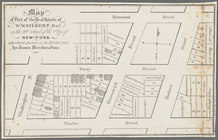
Map of part of the real estat…
abstract:
Washington
Street, Greenwich Street, Hudson
Map of land to be acquired un…
note:
th Street,
Washington
Bounded by Charles Street,
Washington
Street
…,
Washington
Street, Charles
Bounded by Jane Street,
Washington
Street
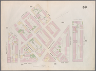
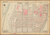
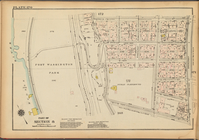
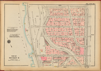
Plate 170: [Bounded by W. 178…
Rand, McNally & Co.'s map of …
note:
… City from
Washington
…
Washington
Square, James
Plate 176: [Bounded by W. 193…
…, West
Washington
Place
…, West
Washington
Place
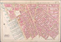
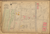
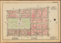
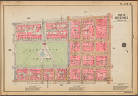
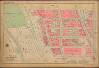
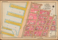
Plate 31, Part of Section 2: …
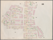
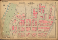
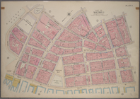
Plate 38: [Bounded by W. 14th…
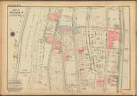
Plate 172: [Bounded by W. 184…
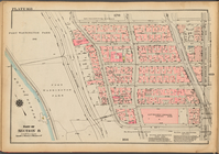
Plate 174: [Bounded by W. 187…
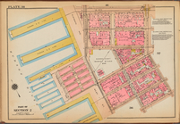
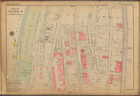
Plate 31: [Bounded by W. 8th …
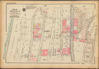
Plate 172, Part of Section 8:…
Plate 170, Part of Section 8:…
Plate 174, Part of Section 8:…
Plate 176, Part of Section 8:…
Plate 168, Part of Section 8:…
Plate 163, Part of Section 8:…
Plate 168: [Bounded by W. 173…
m
Map of 45 lots of ground leas…
abstract:
… Place,
Washington
Square
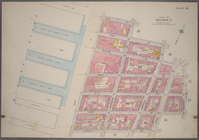
Pierhead and bulkhead lines f…
note:
….,
Washington
, D.C., dated New
… Street,
State
Street
…, Whitehall Street,
State
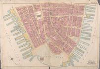
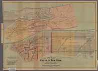
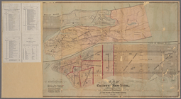
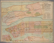
Map of the County of New York…
note:
… at
Washington
."…
Map of the County of New York…
note:
… at
Washington
."…
m
Colton's street map of the Ci…
note:
… of Congress at
Washington
."…
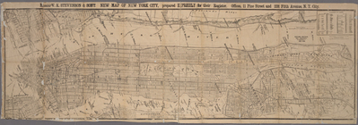
Messrs. V.K. Stevenson & Son'…
note:
…, at
Washington
."…
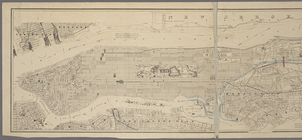
Map of the city of New York s…
note:
… of Congress,
Washington
, D.C."…
Plate 36: [Bounded by Jane St…
1
2
Previous
Next
1
2
Previous
Next