Click to visit the main New York Public Library Homepage
The New York Public Library
Digital Collections
About Digital Collections
Browse
Search only public domain materials
Items
Collections
Divisions
Home
Search
Browse
About
Search only public domain materials
Items
Collections
Divisions
Digital Collections
Using Images
Using Data
Search
Filtered keyword search
Show filters
Hide filters
Show Only Public Domain
topic
x
Nautical charts
Harbors
27
Coasts
19
Navigation
14
Inlets
3
More
Less
name
United States Coast Survey
76
Bache, A. D. (Alexander Dallas), 1806-1867
67
Hilgard, J. E. (Julius Erasmus), 1825-1891
15
Mathiot, G
14
Yeager, E. (Edward)
14
More
Less
collection
Maps of North America
86
Maps of New York City and State
9
Lawrence H. Slaughter Collection of English maps, charts, globes, books and atlases
6
Atlases, gazetteers, guidebooks and other books
1
Maps of the Oceans
1
place
Massachusetts
12
South Carolina
12
Atlantic Ocean
11
Atlantic Coast
10
Virginia
10
More
Less
genre
x
Maps
Nautical charts
77
Bathymetric maps
36
Illustrations
2
Prints
1
More
Less
publisher
U.S. Coast Survey
27
U.S. Coast Survey Office
27
United States Coast Survey
8
U.S. Coast Survey office
3
publisher not identified
3
More
Less
division
Map Division
103
type
cartographic
103
still image
5
Date Range
to
103 results found for:
x
E. S
Filtering on:
x
Genre
: Maps
x
Topic
: Nautical charts
Sort by:
Relevance
Title
Date created
Date digitized
Sequence
Preliminary chart of San Luis…
parent:
7b35bed0-
e
815-0135-7
e
7c-15719c1bd174
Preliminary chart of the sea …
parent:
b8
e
12c20-c52a-012f-11bb-3c075448cc4b
Preliminary chart of the Rigo…
parent:
10
e
975a0-22
e
8-0135-fa4f-0f7d35d66c28
Grand Island Pass, Mississipp…
parent:
353fe620-2ea6-0135-51b3-1bf73969
e
3aa
Preliminary chart of Stellwag…
parent:
4162
e
680-c52b-012f-c2dc-3c075448cc4b
St. Louis Bay and Shieldsboro…
parent:
e
54fee50-2ead-0135-1aa7-3df4c09b86ae
Bass River Harbor, Massachuse…
parent:
4162
e
680-c52b-012f-c2dc-3c075448cc4b
Galveston entrance, Texas: fr…
parent:
62c19f00-
e
81a-0135-983d-078a44
e
2ad92
Preliminary survey of Winyah …
parent:
4162
e
680-c52b-012f-c2dc-3c075448cc4b
Galveston entrance, Texas
parent:
f5a23a70-
e
81b-0135-b7
e
6-396757a6328d
Preliminary chart of Bass Riv…
parent:
4162
e
680-c52b-012f-c2dc-3c075448cc4b
Preliminary chart of Plymouth…
parent:
4162
e
680-c52b-012f-c2dc-3c075448cc4b
Biloxi Bay, Mississippi : fro…
parent:
4162
e
680-c52b-012f-c2dc-3c075448cc4b
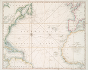
… Indies of
E
. Wright
parent:
1f63
e
9b0-c5d5-012f-
e
19f-58d385a7bc34
A chart of the Atlantic or We…
use:
Release Source File for Free (i.
e
., high-res
Preliminary chart of Cedar Ke…
parent:
c1d2ef30-13d2-0135-d440-3f4da83
e
2bb8
Lynn Harbor, Massachusetts 18…
parent:
4162
e
680-c52b-012f-c2dc-3c075448cc4b
Beaufort River,
S
.C. …
parent:
4162
e
680-c52b-012f-c2dc-3c075448cc4b
m
Eastern part of Long Island S…
parent:
45ed47
e
0-793c-0135-6bfd-47d71542dbac
Preliminary chart of Ship Isl…
parent:
fc8149f0-22eb-0135-a5
e
4-0d3536a34ca6
Preliminary chart of Monomoy …
parent:
aca131
e
0-738c-0134-8a3c-00505686a51c
Plan of the entrance into Cap…
parent:
2b2
e
08
e
0-4233-0135-f389-079c70f75c7b
Preliminary chart of Winyah B…
parent:
fc77bb40-4ed4-0135-02d2-09d03
e
9ff581
… Indies, of
E
. Wrights
parent:
e
09da2d0-c5d4-012f-8138-58d385a7bc34
Passe A Loutre, Mississippi D…
parent:
af813990-22
e
3-0135-11f1-3b7eb8fe3d7
e
Preliminary chart of Muskeget…
parent:
4162
e
680-c52b-012f-c2dc-3c075448cc4b
Boston Harbor, Massachusetts:…
parent:
9b408420-8f40-0134-1
e
9f-00505686a51c
Reconnaissance of Doboy Bar a…
parent:
4162
e
680-c52b-012f-c2dc-3c075448cc4b
Harbors of Sheffield Island a…
parent:
4162
e
680-c52b-012f-c2dc-3c075448cc4b
New York Harbor and entrance : from the U.
S
parent:
6cea9
e
80-c5aa-012f-63d6-58d385a7bc34
Preliminary Chart of entrance…
parent:
a3b3bb30-2ac3-0136-079
e
-3b652
e
95b2
e
3
Preliminary chart of part of …
parent:
26
e
1a660-52b7-0135-36fa-6d276ace48eb
Sea Coast of Delaware, Maryla…
parent:
4162
e
680-c52b-012f-c2dc-3c075448cc4b
The coast of the United State…
parent:
e
4
e
33da0-fcae-0132-5f1d-58d385a7bbd0
Key West Harbor and its appro…
parent:
4162
e
680-c52b-012f-c2dc-3c075448cc4b
… Indies of
E
. Wright
parent:
6a7
e
1820-c5d3-012f-4af4-58d385a7bc34
A chart of New York Harbour :…
parent:
01953230-c5ab-012f-23
e
5-58d385a7bc34
Reconnaissance of Doboy Bar a…
parent:
3dc01150-01
e
2-0135-7707-01d46a94db77
A chart of New York Harbour :…
parent:
012cbf70-c5ab-012f-
e
3bc-58d385a7bc34
Preliminary sketch of Mobile …
parent:
8a3
e
1600-b142-0132-52da-58d385a7bbd0
Long Island Sound (western sh…
use:
Release Source File for Free (i.
e
., high-res
Preliminary chart of Gray's H…
parent:
4162
e
680-c52b-012f-c2dc-3c075448cc4b
Preliminary chart of Portsmou…
parent:
8b101b60-a5
e
5-0134-6b47-00505686a51c
Preliminary chart of North Ed…
parent:
3
e
57f880-4ebb-0135-94cc-095522ebbddd
Preliminary sketch of Wachapr…
parent:
4162
e
680-c52b-012f-c2dc-3c075448cc4b
Preliminary chart of North Ed…
parent:
4162
e
680-c52b-012f-c2dc-3c075448cc4b
Reconnaissance of the western…
parent:
4162
e
680-c52b-012f-c2dc-3c075448cc4b
The harbor of Wood's Hole, Ma…
parent:
30d2c2
e
0-6bce-0134-65
e
7-00505686a51c
Preliminary chart of Tomales …
parent:
4162
e
680-c52b-012f-c2dc-3c075448cc4b
Coast chart no. 10 Cape Cod B…
parent:
4162
e
680-c52b-012f-c2dc-3c075448cc4b