Click to visit the main New York Public Library Homepage
The New York Public Library
Digital Collections
About Digital Collections
Browse
Search only public domain materials
Items
Collections
Divisions
Home
Search
Browse
About
Search only public domain materials
Items
Collections
Divisions
Digital Collections
Using Images
Using Data
Search
Filtered keyword search
Show filters
Hide filters
Show Only Public Domain
topic
Administrative and political divisions
11
History
11
Nautical charts
11
Real property
8
Geography
7
More
Less
name
Burr, David H., 1803-1875
10
Hooker, William
9
Moll, Herman, -1732
6
S. Stiles & Co
6
Faden, William, 1749-1836
5
More
Less
collection
Maps of New York City and State
53
Lawrence H. Slaughter Collection of English maps, charts, globes, books and atlases
29
Maps of North America
23
Atlases of the United States
3
John H. Levine Collection
3
More
Less
place
New York (N.Y.)
37
Manhattan (New York, N.Y.) -- Maps
33
New York (N.Y.) -- Maps
32
New York (N.Y.) -- Administrative and political divisions -- Maps
19
New York (State)
17
More
Less
genre
x
Maps
Manuscripts
2
Atlases
1
Guidebooks
1
Pictorial works
1
More
Less
publisher
W. Hooker
4
Printed by James Parker, and a few Copies are to be Sold by him, and Benjamin Franklin, in Philadelphia;
3
... Sold ... by Tho. Bowles, print and map-seller in St. Paul's-Churchyard
2
A. Jombert
2
Printed for Ieames Shawe, and are to be solde at his shoppe nigh Ludgate,
2
More
Less
division
Map Division
113
General Research Division
2
Manuscripts and Archives Division
2
Spencer Collection
1
type
cartographic
118
text
10
still image
3
Date Range
to
118 results found for:
x
Middle East
Filtering on:
x
Genre
: Maps
Sort by:
Relevance
Title
Date created
Date digitized
Sequence
…, and
East
& West New Jersey
note:
… to Early Maps of the
Middle
…,
East
River, passage
note:
… to Early Maps of the
Middle
… River,
East
River
note:
… to Early Maps of the
Middle
A chart of the Atlantick Ocea…
note:
Covers
east
coast of North America from
A map of a portion of the Indian country lying
east
… in
East
Jersey to Elk Head
note:
… to Early Maps of the
Middle
A map of the
East
and West Florida.
note:
… to Early Maps of the
Middle
A map of the
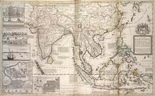
East
-Indies and the adjacent
note:
… to Early Maps of the
Middle
A map of the roads leading to…
note:
Covers Pa.
east
of the Susquehanna River and most
… the Spanish provinces of
east
note:
… to Early Maps of the
Middle
… the Spanish provinces of
East
note:
… to Early Maps of the
Middle
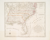
A map of the United States of…
note:
Covers the area
east
of the Mississippi
A map of the United States of…
note:
Covers the area
east
of the Mississippi
m
… and north-
east
note:
… on the north-
east
current
A new and exact map of the do…
note:
… and the
east
part of Florida ...
m
A new and exact map of the do…
note:
… and the
east
part of Florida ...
m
A new and exact map of the do…
note:
… of Carolina and the
east
part
A new chart of America with t…
note:
Nautical chart of the
east
coast of the U.S
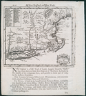
A new map of New England and …
note:
Covers New England as far north and
east
A new map of the city of New …
note:
…. on the
east
side.
A new map of the city of New …
note:
…. on the
east
side.
A new map of the city of New …
note:
…. on the
east
side.
… &
east
New Jersey
note:
… to Early Maps of the
Middle
… &
east
New Jersey
note:
… to Early Maps of the
Middle
A plan of part of Mount Verno…
note:
… for the
East
. Dist. of Penn
A plan of the city of New-Yor…
note:
… to Early Maps of the
Middle
A plan of the operations of t…
note:
… to Early Maps of the
Middle
A plan of the operations of t…
note:
… to Early Maps of the
Middle
A sketch of the operations of…
note:
… to Stony Point,
east
as far
An actual survey of the sea c…
note:
Shows longitude
east
and west from
… & Georgia : with
east
note:
… to Early Maps of the
Middle
An exact mapp of New England …
note:
Covers area from the Hudson River Valley
east
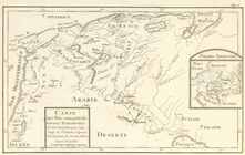
Carte de la Louisiane cours d…
note:
Covers United States
east
of Rio Grande
Carte de la Nouvelle Angleter…
note:
…, the dividing line between
East
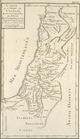
Carte de la terre de Chanaan,…
Carte des pays frequentés par…
Carte du Mexique et de la Flo…
note:
… as Nova Scotia in the
east
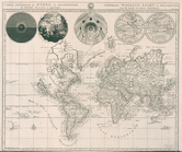
Carte generale du monde, ou, …
note:
…, and the west and
east
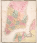
City of New York, 1843.
note:
… Street on the
east
side.
City of New York.
note:
… on
east
side, and a small
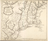
City of New-York
note:
…. on the
east
side. Also covers
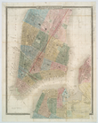
City of New-York
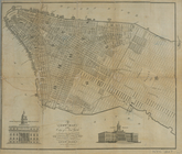
note:
Covers Manhattan up to
East
40th St
City of New-York
note:
…. on the
east
side, and portions
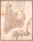
City of New-York
note:
…. on the
east
side. Also covers
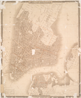
City of New-York
note:
…. on the
east
side. Also covers
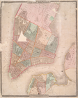
City of New-York
note:
…. on the
east
side. Also covers
City of New-York
note:
…. on the
east
side. Also covers
m
City of New-York, and, New-Yo…
note:
…. on the
east
side. Also covers
City of New-York.
note:
…. on the
east
side. Also covers
Complete railway map designed…
note:
Covers primarily the U.S.
east