Click to visit the main New York Public Library Homepage
The New York Public Library
Digital Collections
About Digital Collections
Browse
Search only public domain materials
Items
Collections
Divisions
Home
Search
Browse
About
Search only public domain materials
Items
Collections
Divisions
Digital Collections
Using Images
Using Data
Search
Filtered keyword search
Show filters
Hide filters
Show Only Public Domain
topic
Discovery and exploration
9
Real property
8
Administrative and political divisions
7
Parks
7
Railroads
6
More
Less
name
Austro-Hungarian Monarchy. Militärgeographisches Institut
773
Geological Survey (U.S.)
41
Julius Bien & Co
32
New York (N.Y.). Department of Parks. Topographical Division
29
Bien, Julius, 1826-1909
22
More
Less
collection
Spezialkarte der Osterreichisch-Ungarischen Monarchie
773
Atlases of New York City
120
Maps of North America
113
Maps of New York City and State
28
Atlases of the United States
15
More
Less
place
Staten Island (New York, N.Y.)
90
Central Park (New York, N.Y.)
29
New York (State)
25
New York (N.Y.)
22
New York Metropolitan Area
22
More
Less
genre
x
Topographic maps
Maps
1062
Atlases
15
Cadastral maps
6
Bathymetric maps
4
More
Less
publisher
K.u.K. Militargeographisches Institut
773
The Division
29
U.S. Geological Survey
22
Julius Bien & Co
15
Impr. impériale
10
More
Less
division
Map Division
1050
Rare Book Division
11
General Research Division
1
type
cartographic
1062
text
3
still image
2
Date Range
to
Looking for one of these collections?
Spezialkarte der Osterreichisch-Ungarischen Monarchie
774 items
Maps of North America
3,345 items
1,062 results found for:
x
map
Filtering on:
x
Genre
: Topographic maps
Sort by:
Relevance
Title
Date created
Date digitized
Sequence
Results 1001 - 1050
[Photographic copy of a printed
map
of
note:
Mapping
the Nation (NEH grant, 2015-2018)…
m
Topographical
map
of the District of Columbia
note:
Mapping
the Nation (NEH grant, 2015-2018)…
Yellowstone National Park
note:
… catalog of the
Map
Sheet No. 98. [Includes Satte…
m
Military
map
of Cuba
Perrine's new topographical war
map
note:
Map
indicates state boundaries and shore lines
A topographical
map
of a part of northern New
note:
Mapping
the Nation (NEH grant, 2015-2018)…
Geological
map
of the environs of Orbisonia
note:
… color, the
map
shows
Map
of Utah territory
note:
… catalog of the
Map
m
Map
or plan of streets, roads, avenues
Topographical
map
made from surveys
note:
…
map
to 1874.
Topographical
map
in thirty-foot contour
note:
Mapping
the Nation (NEH grant, 2015-2018)…
Forest
map
of the Yakima Region, Washington
note:
… catalog of the
Map
Topographical
map
of Fairmount Park, Philadelphia …
note:
NYPL
Map
Div. copy: manuscript additions in black
The Hawaiian Islands: compile…
note:
NYPL
Map
Div. 2 copies have accession
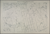
Map
or plan of section 10 [Crotona Park]
abstract:
… lines. Source:
Maps
Topographical
map
of Seneca County, N.Y.
note:
Mapping
the Nation (NEH grant, 2015-2018)…
Mt. Washington and vicinity: …
note:
Mapping
the Nation (NEH grant, 2015-2018)…
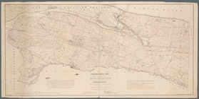
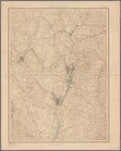
A topographical
map
of Lewis Co., New York
note:
Cadastral
map
showing property owners
Montana and Wyoming Territori…
note:
… catalog of the
Map
Hawaiian Islands
note:
… catalog of the
Map
California (Los Angeles Co.) …
note:
… catalog of the
Map
The Louisiana State University topographical
map
note:
Mapping
the Nation (NEH grant, 2015-2018)…
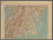
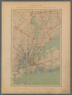
Plate No. 1: Index Map
collection:
… in a series of
maps
New York City and environs : …
collection:
Maps
of New York City and State
Lloyd's
map
of the Great Oil Region
note:
Specially surveyed for this
map
by B.M. Hanks, A.M
m
Topographical
map
of the state of New Jersey
note:
…: Meteorological
map
of the state
Lloyd's
map
of the Great Oil Region
note:
Specially surveyed for this
map
by our own
m
Preliminary agricultural
map
of Yakima
note:
… catalog of the
Map
Philadelphia and vicinity : P…
note:
… catalog of the
Map
Topographical
map
of the state of New Jersey
note:
…: Meteorological
map
of the state
m
Map
of n. eastern Virginia and vicinity
note:
Mapping
the Nation (NEH grant, 2015-2018)…
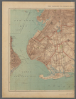
Albany and vicinity
note:
Mapping
the Nation (NEH grant, 2015-2018)…
Topographical
map
in ten-foot contour
note:
Mapping
the Nation (NEH grant, 2015-2018)…
A
map
of the extremity of Cape Cod
note:
Mapping
the Nation (NEH grant, 2015-2018)…
m
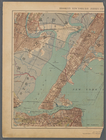
Double Page Plate No. 12: Wes…
collection:
… in a series of
maps
m
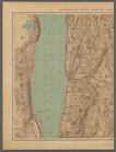
Double Page Plate No. 5: Rich…
collection:
… in a series of
maps
m
Double Page Plate No. 13: Wes…
collection:
… in a series of
maps
m
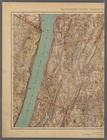
Double Page Plate No. 6: Newa…
collection:
… in a series of
maps
m
Double Page Plate No. 2: City…
collection:
… in a series of
maps
m
Double Page Plate No. 11: Wes…
collection:
… in a series of
maps
m
Double Page Plate No. 7: Newa…
collection:
… in a series of
maps
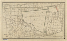
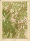
Land classification
map
, New York, Mt
note:
Mapping
the Nation (NEH grant, 2015-2018)…
m
Double Page Plate No. 8: Long…
collection:
… in a series of
maps
m
Double Page Plate No. 3: Broo…
collection:
… in a series of
maps
m
Double Page Plate No. 10: Wes…
collection:
… in a series of
maps
m
Double Page Plate No. 9: West…
collection:
… in a series of
maps
m
Double Page Plate No. 4: The …
collection:
… in a series of
maps
List of Plates and References
collection:
… in a series of
maps
Atlas of the Metropolitan Dis…
collection:
… in a series of
maps
1
2
3
4
5
Previous
Next
1
2
3
4
5
Previous
Next