Click to visit the main New York Public Library Homepage
The New York Public Library
Digital Collections
About Digital Collections
Browse
Search only public domain materials
Items
Collections
Divisions
Home
Search
Browse
About
Search only public domain materials
Items
Collections
Divisions
Digital Collections
Using Images
Using Data
Search
Filtered keyword search
Show filters
Hide filters
Show Only Public Domain
topic
Real property
1677
Business enterprises
467
Description and travel
111
History
90
Landowners
33
More
Less
name
Beers, F. W. (Frederick W.)
303
Everts, Ensign & Everts
175
F.W. Beers & Co
168
D.G. Beers & Co
155
Beers, D. G. (Daniel G.)
143
More
Less
collection
Atlases of the United States
2036
place
x
New York (State)
Erie County
151
Erie County (N.Y.)
148
Westchester County
134
Westchester County (N.Y.)
134
More
Less
genre
x
Atlases
Maps
1869
Prints
70
Title pages
16
publisher
F. W. Beers & Co
148
E. Belcher-Hyde
112
Century Map Company
111
Andreas, Baskin & Burr
90
G.W. Bromley & Co
89
More
Less
division
Map Division
2036
type
cartographic
1937
text
109
still image
2
Date Range
to
Looking for this collection?
Atlases of the United States
3,868 items
2,036 results found for:
x
map
Filtering on:
x
Genre
: Atlases
x
Place
: New York (State)
Sort by:
Relevance
Title
Date created
Date digitized
Sequence
Results 501 - 550
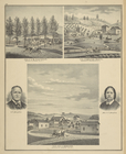
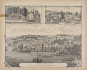
Res. of Julius S. Corbett, Co…
collection:
Combination atlas
map
of Broome County
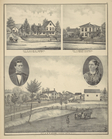
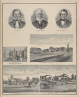
Horace Dwight, Mrs.Horace Dwi…
collection:
Combination atlas
map
of Broome County
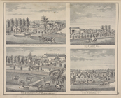
Res. of S.J. Poole, Colesvill…
collection:
Combination atlas
map
of Broome County
Res. of George Dusenbury, Win…
collection:
Combination atlas
map
of Broome County
Res. of J.M. Fletcher, Sanfor…
collection:
Combination atlas
map
of Broome County
John Drake. ; Samuel Drake. ;…
collection:
Combination atlas
map
of Genesee County
Res. of Albert Hill, Le Roy, …
collection:
Combination atlas
map
of Genesee County
Woodruff and Rathbone, Dealer…
collection:
Combination atlas
map
of Genesee County
W. E. Babcock. ; Res. of John…
collection:
Combination atlas
map
of Genesee County
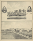
John W. Brown, Born May 1817 …
collection:
Combination atlas
map
of Genesee County
John Garwood, Bushville Mills…
collection:
Combination atlas
map
of Genesee County
Res. of C. B. Thomson, Le Roy…
collection:
Combination atlas
map
of Genesee County
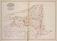
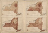
Meteorological
Map
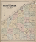
Map
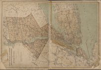
of Chautauqua County
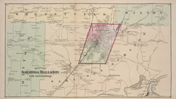
Map
of Saratoga and Ballston with Surroundings
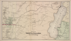
Map
of Saratoga and Ballston with Surroundings
… [
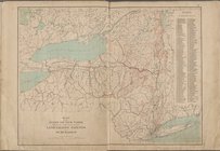
Map
of the State
… [
Map
of New York Kings
Map
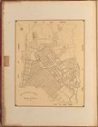
of city of Mount Vernon
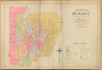
Outline and Index
map
of the Rochester
… [
Map
of the state
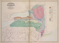
Geological
Map
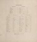
Index.
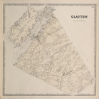
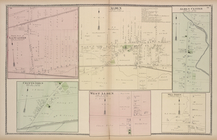
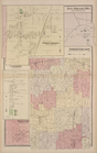
Clayton [Township]
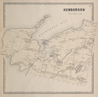
Henderson [Township]
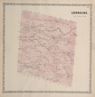
Lorraine. [Township]
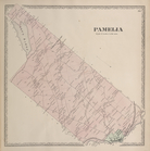
Pamela [Township]
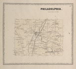
Philadelphia. [Township]
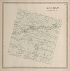
Rodman [Township]
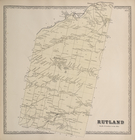
Rutland [Township]
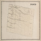
Worth. [Township]
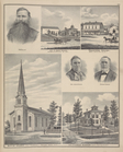
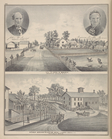
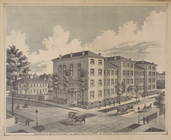
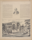
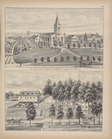
Le Couteulx St. Mary's Instit…
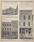
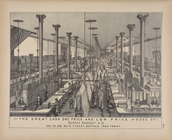
The Great cash one price andd…
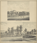
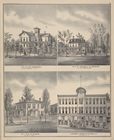
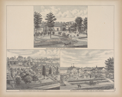
Ervin H. Ewell. ; Residence o…
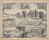
Parlor; Main Entrance; Dining…
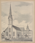
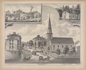
Erected bt Rev. Francis S. Uh…
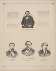
Capt. Orson Shepard. ; F. G. …
St. Mary's Church, Schools an…
North Part of Lancaster [Vill…
Residence of Geo. B. Ely, Esq…
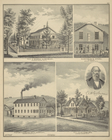
Factory and Electrotype Found…
Residence of H. C. Jewett - R…
New Oregon P.O. [Village]; No…
Alexandria [Township]
Index continued (Left Page)
Index continued (Right Page)
Index continued (Left Page)
Index continued (Right Page)
Index continued (Left Page)
Index continued (Right Page)
1
2
3
4
5
6
7
8
9
Previous
Next
1
2
3
4
5
6
7
8
9
Previous
Next