Click to visit the main New York Public Library Homepage
The New York Public Library
Digital Collections
About Digital Collections
Browse
Search only public domain materials
Items
Collections
Divisions
Home
Search
Browse
About
Search only public domain materials
Items
Collections
Divisions
Digital Collections
Using Images
Using Data
Search
Filtered keyword search
Show filters
Hide filters
Show Only Public Domain
topic
Real property
6
Landowners
5
Cities and towns
3
Administrative and political divisions
1
Fugitive slaves
1
More
Less
name
H.F. Walling's Map Establishment
2
Walling, Henry Francis, 1825-1888
2
Browne, P. J
1
Carhart, Mead & Co
1
Gillette, Matthews & Co
1
More
Less
collection
Maps of North America
7
The underground railroad from slavery to freedom
1
place
Ohio
8
Cleveland
2
Cleveland (Ohio)
2
Clinton County
1
Clinton County (Ohio)
1
More
Less
genre
x
Illustrations
Maps
8
Cadastral maps
6
publisher
Ahaz Merchant
1
Carhart, Mead, & Co
1
Gillette, Matthews & Co
1
Henry Hart
1
Macmillan
1
More
Less
division
Map Division
7
Schomburg Jean Blackwell Hutson Research and Reference Division
1
type
cartographic
8
still image
7
Date Range
to
8 results found for:
x
ohio map
Filtering on:
x
Genre
: Illustrations
Sort by:
Relevance
Title
Date created
Date digitized
Sequence
m
Map
of Columbiana County,
Ohio
, 1860 …
note:
… along center of
map
Map
of Perry County,
Ohio
…
note:
…. Walling's
Map
m
Map
of Trumbull County,
Ohio
…
note:
Library of Congress. Land ownership
maps
m
City of Toledo, Lucas Co.,
Ohio
…
note:
… catalog of the
Map
Map
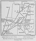
of Clinton County,
Ohio
…
note:
NYPL
Map
Div. copy imperfect: brittle
Map
of the city of Cleveland,
Ohio
…
note:
NYPL
Map
Div. copy has accession no
Map
of Cleveland and its environs …
note:
… catalog of the
Map
… and Clinton counties,
Ohio
.