Click to visit the main New York Public Library Homepage
The New York Public Library
Digital Collections
About Digital Collections
Browse
Search only public domain materials
Items
Collections
Divisions
Home
Search
Browse
About
Search only public domain materials
Items
Collections
Divisions
Digital Collections
Using Images
Using Data
Search
Filtered keyword search
Show filters
Hide filters
Show Only Public Domain
topic
Real property
252
Fire insurance
50
Cities & towns
47
Administrative and political divisions
41
Nautical charts
34
More
Less
name
Ullitz, Hugo
95
E.B. Hyde & Co
92
E. Belcher Hyde Map Company
72
Sanborn Map Company
48
G.W. Bromley & Co
33
More
Less
collection
Atlases of New York City
235
Maps of North America
210
Maps of New York City and State
103
Atlases of the United States
43
Bancker plans
32
More
Less
place
New York (State)
306
New York
182
Brooklyn (New York, N.Y.)
110
Maps
88
New York (N.Y.)
84
More
Less
genre
x
Maps
Atlases
42
Surveys
34
land surveys
29
Cadastral maps
22
More
Less
publisher
E. Belcher Hyde
76
Sanborn Map Company
49
G.W. Bromley & Co
29
publisher not identified
28
Lith. by Korff Brothers
22
More
Less
division
Map Division
630
Manuscripts and Archives Division
35
Wallach Division: Print Collection
6
Schomburg Jean Blackwell Hutson Research and Reference Division
4
General Research Division
3
More
Less
type
cartographic
683
text
15
still image
8
Date Range
to
684 results found for:
x
30
Filtering on:
x
Genre
: Maps
Sort by:
Relevance
Title
Date created
Date digitized
Sequence
Results 251 - 300
Plate
30
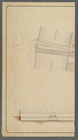
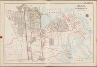
[Map bounded by E. 208th St
Plate
30
[Map bounded by Zulette Ave
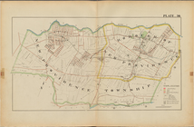
Westchester, V. 1, Double Page Plate No.
30
Westchester, V. 2, Double Page Plate No.
30
Buffalo, V. 2, Double Page Plate No.
30
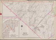
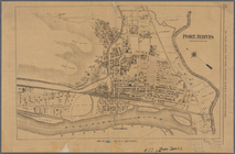
Port Jervis
first:
b
30
bbcf0-153e-0134-288e-00505686a51c
Union County, Double Page Plate No.
30
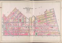
Map of the taxing district of…
parent:
c5895d
30
-b144-0132-773e-58d385a7bbd0
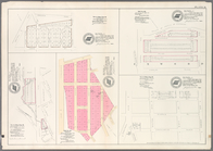
Height District Map Section No.
30
parent:
30593990-bc6a-0132-4f
30
-58d385a7bbd0
Hollis Terrace addition no. 1…
Plate 36: Vol. 3 of Maps, Page
30
[Bounded
note:
Vol. 3 of Maps, Page
30
: Mortgage map
Map of Cincinnati and suburbs…
first:
8bbcfe
30
-208f-0136-2c24-052c42d140e3
m
Plan and profile showing the …
note:
…"Profile horizontal & vertical scale =
30
feet
Map of the city of Chicago
Adirondack survey, 1873: Bald…
… ending June
30
, 1895
Representation du cours ordin…
Map of the Albany Rural Cemet…
Plan der Descente und der Aff…
City of Washington
Map of the city of Washington…
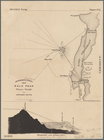
Adirondack survey, Sketch in …
… ending June
30
, 1891
Plan of the siege of York Tow…
Sketch E no. 2 : showing the …
British possessions in North …
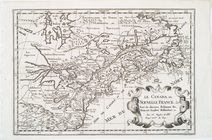
Le Canada, ou Nouvelle France…
Carta della Nuova Inghilterra…
Improved plan of the city of …
Delaware and Mary-Land
New York.
Plan von New-York, 1844.
A map of Philadelphia and par…
Map of the city of New-York.
Moral and political chart of …
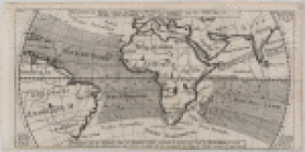
A chart of the world : exhibi…
A new chart of the vast Atlan…
Plate
30
: Bounded by Nassau Road, Broadway
Plate
30
: Town of Greenburgh, Westchester Co. N
parent:
30593990-bc6a-0132-4f
30
-58d385a7bbd0
m
Plates
30
& 31: Mount Vernon, Town
Plate
30
: [Bounded by Ditmas Avenue, E. 98th
Plate
30
, Part of Section 4: [Bounded by W
Plate
30
, Part of Section 5: [Bounded by E
Plate
30
, Part of Section 5: [Bounded by E
Plate
30
, Part of Ward 3
The Matthews-Northrup up-to-d…
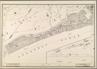
Map of the Sea-Coast of South…
note:
…"762, Harper's Weekly, November
30
, 1861
1st & 2nd Wards. [Map bounded…
2nd & 4th Wards. [Map bounded…
Map of the township of Spring…
1
2
3
Previous
Next
1
2
3
Previous
Next