Click to visit the main New York Public Library Homepage
The New York Public Library
Digital Collections
About Digital Collections
Browse
Search only public domain materials
Items
Collections
Divisions
Home
Search
Browse
About
Search only public domain materials
Items
Collections
Divisions
Digital Collections
Using Images
Using Data
Search
Filtered keyword search
Show filters
Hide filters
Show Only Public Domain
topic
Real property
252
Fire insurance
50
Cities & towns
47
Administrative and political divisions
41
Nautical charts
34
More
Less
name
Ullitz, Hugo
95
E.B. Hyde & Co
92
E. Belcher Hyde Map Company
72
Sanborn Map Company
48
G.W. Bromley & Co
33
More
Less
collection
Atlases of New York City
235
Maps of North America
210
Maps of New York City and State
103
Atlases of the United States
43
Bancker plans
32
More
Less
place
New York (State)
306
New York
182
Brooklyn (New York, N.Y.)
110
Maps
88
New York (N.Y.)
84
More
Less
genre
x
Maps
Atlases
42
Surveys
34
land surveys
29
Cadastral maps
22
More
Less
publisher
E. Belcher Hyde
76
Sanborn Map Company
49
G.W. Bromley & Co
29
publisher not identified
28
Lith. by Korff Brothers
22
More
Less
division
Map Division
630
Manuscripts and Archives Division
35
Wallach Division: Print Collection
6
Schomburg Jean Blackwell Hutson Research and Reference Division
4
General Research Division
3
More
Less
type
cartographic
683
text
15
still image
8
Date Range
to
684 results found for:
x
30
Filtering on:
x
Genre
: Maps
Sort by:
Relevance
Title
Date created
Date digitized
Sequence
Results 501 - 550
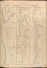
Map of comparison of Maffitt'…
abstract:
….
30
" --Upper left
…, in T 58 N. R.
30
W.
note:
Scale not given (W 88°18ʹ--W 87°48ʹ/N 47°
30
m
Missouri
abstract:
… corner:
30
.
m
Mississippi
note:
…°--N
30
°).
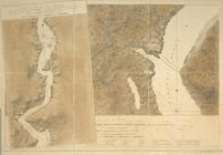
Geological plan of the Coast …
This colour'd map exhibits a …
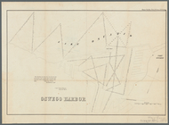
Oswego Harbor, 33d Congress, …
The territory of Alaska : -- …
Territorial groups of the Uni…
The tourist's pocket map of t…
The tourist's pocket map of t…
The tourist's pocket map of P…
parent:
6a1cce
30
-c52b-012f-7dbc-3c075448cc4b
From Albany (
30
) to Newborough.
A plan of Fort Montgomery & F…
note:
…]. Hand col. ; 45 x
30
cm
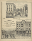
Barnes, Blanding & Co., Marbl…
collection:
…, Shoes, and Rubbers,
30
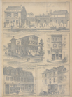
William L. Bamber's Marble & Granite Works
30
Survey of the mouth of Clinto…
Map of the centennial grounds…
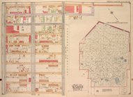
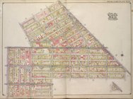
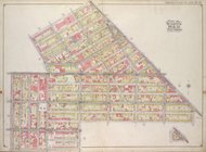
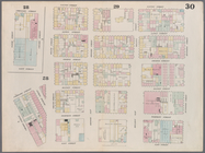
Queens, Vol. 1, Double Page Plate No.
30
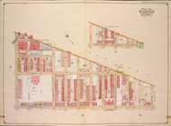
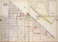
Brooklyn, Vol. 1, Double Page Plate No.
30
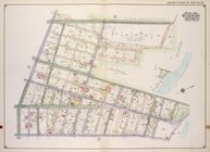
Brooklyn, Vol. 3, Double Page Plate No.
30
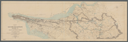
Map of the New York and North…
… Plate No.
30
; Part
… Plate No.
30
; Part
…; Part of Wards 29,
30
…; Part of Ward
30
… of Sec.
30
T39 R14
m
Map of Roanoke, Virginia : sh…
Map of the northern peninsula…
note:
Scale not given (W 90°
30
ʹ--W 82°15ʹ/N 48°15
Savannah River, reconnaissanc…
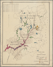
Water shed of the Croton River
Harbor of Michigan City, Indi…
Reconnaissance of Pass Fourch…
m
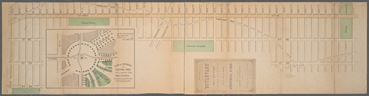
Map of the Boulevard : and pl…
first:
ebbb76e0-f14f-0130-
30
a9-58d385a7bbd0
Eleventh l. h. district
note:
…"Corrected to June
30
, 1898."…
Map bounded by Rivington Stre…
m
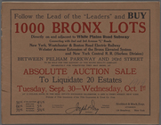
Follow the Lead of the "Leade…
collection:
… to liquidate
30
estates.
Nova Belgica et Anglia Nova.
note:
… x
30
cm.). NN
The tourist's pocket map of t…
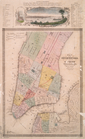
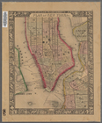
Map of the City of New-York w…
Long Island Sound from New Yo…
note:
surveyed in the years 1828, 29, &
30
Long Island Sound from New Yo…
note:
surveyed in the years 1828, 29, &
30
Survey of the entrance to Mil…
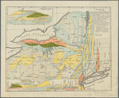
North America
A new map of the state of Ohio
York River and Cape Neddick h…
[Maps of the Washington Aqued…
Tenth l. h. district
note:
…"Corrected to June
30
, 1898."…
Plan of New York &c.
Map of the centennial grounds…
1
2
3
Previous
Next
1
2
3
Previous
Next