Click to visit the main New York Public Library Homepage
The New York Public Library
Digital Collections
About Digital Collections
Browse
Search only public domain materials
Items
Collections
Divisions
Home
Search
Browse
About
Search only public domain materials
Items
Collections
Divisions
Digital Collections
Using Images
Using Data
Search
Filtered keyword search
Show filters
Hide filters
Show Only Public Domain
topic
Real property
122
Fire insurance
49
Cities & towns
46
History
34
Railroads
34
More
Less
name
Sanborn Map Company
47
G.W. Bromley & Co
32
United States Coast Survey
17
Bromley, George Washington
16
Bromley, Walter Scott
16
More
Less
collection
Maps of North America
213
Atlases of New York City
100
Maps of New York City and State
59
Lawrence H. Slaughter Collection of English maps, charts, globes, books and atlases
23
Atlases of the United States
21
More
Less
place
New York (State)
140
New York
58
New York (N.Y.)
57
United States
50
Manhattan (New York, N.Y.)
27
More
Less
genre
x
Maps
Atlases
21
Cadastral maps
15
Prints
14
Nautical charts
12
More
Less
publisher
Sanborn Map Company
48
G.W. Bromley & Co
29
publisher not identified
19
U.S. Coast Survey
8
s.n
7
More
Less
division
Map Division
422
Wallach Division: Print Collection
14
Manuscripts and Archives Division
4
Schomburg Jean Blackwell Hutson Research and Reference Division
4
General Research Division
1
More
Less
type
cartographic
449
text
10
still image
8
Date Range
to
449 results found for:
x
38
Filtering on:
x
Genre
: Maps
Sort by:
Relevance
Title
Date created
Date digitized
Sequence
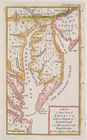
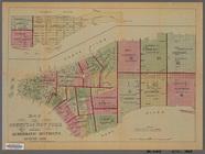
A map of that part of America…
note:
Lawrence H. Slaughter Collection ;
38
.
Plate
38
: [Bounded by Jefferson Street, Duryea
Map of Stockholm
note:
Dobson 14; Paulson
38
; Tilden II:52[b]
Parts of Ohio & Pennsylvania …
note:
…°--N
38
°).
Plan of the city of Washingto…
note:
… pasted on sheet
38
x 39
m
Pine Street
note:
Blocks 37,
38
.
m
Lot and house in Wall Street …
note:
Block
38
.
Chautauque County.
m
Mr. Maxwell's store and J. De…
note:
Block
38
or 39.
Showing the progressive chang…
Grundriss des nördlichen Thei…
abstract:
…. 1 map ;
38
x 29 cm.
A new map of North America fr…
Map of Africa from the latest…
L' Afrique avec ses divisions…
Bounded by Snediker Avenue, L…
collection:
Plate
38
Plate
38
: Vol. 3 of Maps, Page 31. - Vol. 2
note:
Plate
38
: Vol. 3 of Maps, Page 31: Map
m
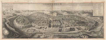
View of Jerusalem
An exact map of North America…
Map of South America, extendi…
parent:
b8ab1d50-c627-012f-bf
38
-58d385a7bc34
Africa
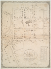
Map of the Woodlawn Cemetery
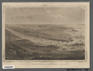
The country twenty five miles…
Sketch of The Narrows in Bost…
note:
… Commissioners. 2nd (1868). p.
38
.
North America.
Bounded by Avenue K., Ralph A…
collection:
Plate
38
Map of the County of New York…
Map of the United States and …
New York and environs : desig…
New York and environs : desig…
British possessions in North …
Sheet No.
38
. [Includes Port Richmond Road
m
Vicinity of New York
Plate
38
A plan of the town of New Hav…
note:
… of the first
38
grantees.
Map of the city of Albany
Acurate charte von Nord-Ameri…
America noviter delineata
Pianta del reale giardino di …
Map of New York City, south o…
Map of North America showing …
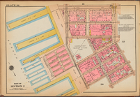
Bronx, V. A, Plate No.
38
[Map bounded
Bronx, V. B, Plate No.
38
[Map bounded
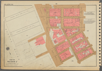
Plate
38
, Part of Section 2
St. Petersburg
parent:
65a81890-c6e7-012f-dd
38
-58d385a7bc34
County of Monroe
Map of Brooklyn Manor
Map of Jamaica Fells : fourth…
Vineyard Sound from Wood's Ho…
Plate
38
, Part of Section 2
Railway map of the New Englan…
1
2
Previous
Next
1
2
Previous
Next