Click to visit the main New York Public Library Homepage
The New York Public Library
Digital Collections
About Digital Collections
Browse
Search only public domain materials
Items
Collections
Divisions
Home
Search
Browse
About
Search only public domain materials
Items
Collections
Divisions
Digital Collections
Using Images
Using Data
Search
Filtered keyword search
Show filters
Hide filters
Show Only Public Domain
topic
Nautical charts
5
Coasts
1
name
Bache, A. D. (Alexander Dallas), 1806-1867
4
Hassler, F. R. (Ferdinand Rudolph), 1770-1843
4
Knight, John, approximately 1802-1872
4
United States Coast Survey
4
Mathiot, G
3
More
Less
collection
Maps of New York City and State
5
place
x
New York (State)
Long Island (N.Y.)
4
Suffolk County
4
Block Island (Island)
2
Rhode Island
2
More
Less
genre
x
Nautical charts
Maps
5
publisher
U.S. Coast Survey office
2
The Survey
1
United States Army Corps of Engineers?
1
United States Coast Survey
1
division
Map Division
5
type
cartographic
5
Date Range
to
5 results found for:
x
A. R., engraver
Filtering on:
x
Genre
: Nautical charts
x
Place
: New York (State)
Sort by:
Relevance
Title
Date created
Date digitized
Sequence
Western part of the southern …
parent:
f7188db0-d341-0133-92e4-00505686
a
51c
Middle part of the southern c…
parent:
fed80240-cd18-0133-4b02-00505686
a
51c
Eastern part of the southern …
parent:
dc3aad90-cd16-0133-c7db-00505686
a
51c
m
Eastern part of Long Island S…
parent:
587bdb60-c5aa-012f-f824-58d385
a
7bc34
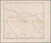
Map of the mouth of Great Sod…
parent:
ad1c9990-1ae9-0134-5c81-00505686
a
51c