Click to visit the main New York Public Library Homepage
The New York Public Library
Digital Collections
About Digital Collections
Browse
Search only public domain materials
Items
Collections
Divisions
Home
Search
Browse
About
Search only public domain materials
Items
Collections
Divisions
Digital Collections
Using Images
Using Data
Search
Filtered search
Show filters
Hide filters
Show Only Public Domain
topic
Real property
10739
Fire insurance
5290
Cities & towns
5001
City planning
1098
Social conditions
945
More
Less
name
Sanborn Map Company
5093
G.W. Bromley & Co
2475
New York (N.Y.). City Planning Commission
978
M.I.T. Press
942
Bromley, George Washington
830
More
Less
collection
Atlases of New York City
11510
Atlases of the United States
3681
Maps of North America
3345
Maps of New York City and State
2054
Lawrence H. Slaughter Collection of English maps, charts, globes, books and atlases
1218
More
Less
place
New York (State)
13020
New York
4917
New York (N.Y.)
3356
Manhattan (New York, N.Y.)
2327
Brooklyn (New York, N.Y.)
1151
More
Less
genre
x
Maps
Atlases
3610
Topographic maps
1062
Surveys
1032
land surveys
849
More
Less
publisher
Sanborn Map Company
5129
G.W. Bromley & Co
2297
MIT Press
942
K.u.K. Militargeographisches Institut
773
E. Belcher Hyde
770
More
Less
division
Map Division
23265
Manuscripts and Archives Division
1081
General Research Division
360
Rare Book Division
328
Schomburg Jean Blackwell Hutson Research and Reference Division
177
More
Less
type
cartographic
24593
still image
1430
text
672
Date Range
to
25,787 results found
Filtering on:
x
Genre
: Maps
Sort by:
Title
Date created
Date digitized
Sequence
Results 3001 - 3050
m
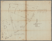
Sherbrook
m
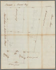
Survey for Matthew Buys at Gr…
m
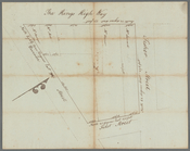
Fly Market water lots
m
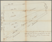
Fletcher Street
m
Fair Street
m
Plan of Dye Street
m
Survey of the encroachments o…
m
Dock Street and Cruger's Wharf
m
Water lots on Dey and Divisio…
m
Isaac Depeyster's two lots in…
m
New grant fronting Cruger's W…
m
Crown Point
m
Plan of Evert Byvanck's land …
m
Cove
m
Corlears Hook
m
Sketch of Corlears Hook
m
Peter Van Brugh Livingston's …
m
Hospital
m
Survey of the fields
m
Rear of City Hall
m
Abijah Hammond's meadow, Ches…
m
Cedar Street near Williams St…
m
Near the stone arch in Broadw…
m
List of lots near the powder …
m
Hospital, Broadway and Church…
m
Broadway and Fair Street
m
Northwest side of Broadway
m
Broadway, Greenwich, Oyster P…
m
Lots on the west side of Broa…
m
Farm on Broadway
m
Broadway, Nassau, Green and C…
m
Broadway
m
Broadway, Amity Street, Marga…
m
Distances of the squares and …
m
Ground contiguous to the poor…
m
Between Broadway, New Street,…
m
Between Broadway, New Street,…
m
Dow and Ten Eyck lots east si…
m
Negroes Burying Ground
m
Six and a half acres near Fre…
m
Marston's lots east side Broa…
m
Erroneous draft of Marston's …
m
Broad Street
m
Two lots east side Broad Stre…
m
Broad Street
m
Survey of the Old House near …
m
Samuel Bayard's ground near t…
m
Plan of square A of James De …
m
Plan of lots number one to fo…
m
Captain De Lancey's ground - …
1
2
…
10
11
12
13
14
15
16
17
…
103
104
Previous
Next
1
2
…
10
11
12
13
14
15
16
17
…
103
104
Previous
Next