Click to visit the main New York Public Library Homepage
The New York Public Library
Digital Collections
About Digital Collections
Browse
Search only public domain materials
Items
Collections
Divisions
Home
Search
Browse
About
Search only public domain materials
Items
Collections
Divisions
Digital Collections
Using Images
Using Data
Search
Filtered keyword search
Show filters
Hide filters
Show Only Public Domain
topic
x
Atlases
Historical geography
1
Maps in education
1
name
x
Palmer, W. (William), 1739-1812
Faden, William, 1749-1836
1
collection
x
Lawrence H. Slaughter Collection of English maps, charts, globes, books and atlases
place
England
1
Great Britain
1
Ireland
1
genre
Maps
1
publisher
Published by Wm. Faden, geographer to His Majesty, and His R.H. the Prince of Wales
1
division
Map Division
1
type
cartographic
1
Date Range
to
1 result found for:
x
county atlas
Filtering on:
x
Name
: Palmer, W. (William), 1739-1812
x
Collection
: Lawrence H. Slaughter Collection of English maps, charts, globes, books and atlases
x
Topic
: Atlases
For more collection details, visit the
Lawrence H. Slaughter Collection of English maps, charts, globes, books and atlases collection page
.
Sort by:
Relevance
Title
Date created
Date digitized
Sequence
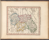
Ireland divided into provinces and
counties
topic:
Atlases