Click to visit the main New York Public Library Homepage
The New York Public Library
Digital Collections
About Digital Collections
Browse
Search only public domain materials
Items
Collections
Divisions
Home
Search
Browse
About
Search only public domain materials
Items
Collections
Divisions
Digital Collections
Using Images
Using Data
Search
Filtered search
Show filters
Hide filters
Show Only Public Domain
topic
Real property
810
Fire insurance
561
Cities & towns
475
Description and travel
28
Maps
14
More
Less
name
Sanborn Map Company
555
Ullitz, Hugo
215
E.B. Hyde & Co
137
E. Belcher Hyde Map Company
133
G.W. Bromley & Co
108
More
Less
collection
x
Atlases of New York City
place
New York (State)
908
New York
403
Brooklyn (New York, N.Y.)
167
Queens (New York, N.Y.)
123
Staten Island (New York, N.Y.)
112
More
Less
genre
Maps
1094
Title pages
6
Indexes
5
Cadastral maps
2
Index maps
2
More
Less
publisher
Sanborn Map Company
477
E. Belcher Hyde
257
G.W. Bromley & Co
100
Sanborn Map Co
80
E. Belcher Hyde
49
More
Less
division
Map Division
1103
type
cartographic
1089
text
13
still image
7
Date Range
to
1,105 results found
Filtering on:
x
Note
: "Verm. Gegenst. L. Melanges L. Miscell. Subj. L. Miscellanea L. Fig. 1."--lettered at top.
x
Collection
: Atlases of New York City
For more collection details, visit the
Atlases of New York City collection page
.
Sort by:
Title
Date created
Date digitized
Sequence
m
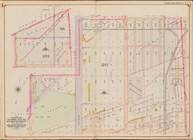
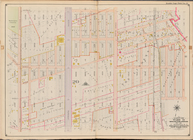
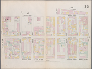
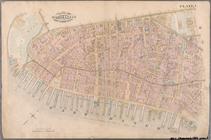
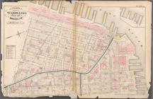
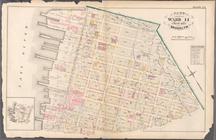
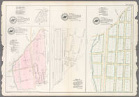
Map 1 - Manhattan and Bronx
Bounded by Avenue K., Ralph A…
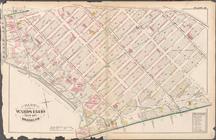
Bounded by E. 103rd Street, A…
Bounded by Avenue D., Ralph A…
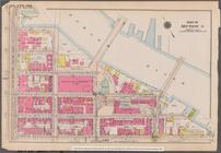
Bounded by 85th Street, 1st A…
Bounded by Mackay Pl., 1st Av…
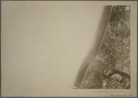
1D - N.Y. City (Aerial Set).
1A - N.Y. City (Aerial Set).
1B - N.Y. City (Aerial Set).
1C - N.Y. City (Aerial Set).
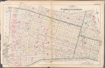
[Bounded by Avenue H, E. 18th…
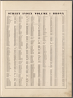
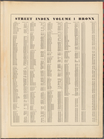
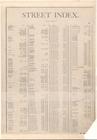
Street Index, Volume 1, Bronx…
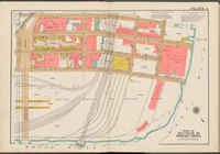
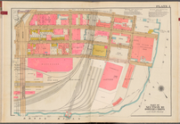
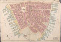
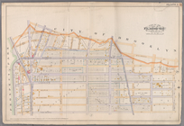
Double Page Plate No. 1, Part…
Bounded by Avenue L, E. 19th …
Street Index, Volume 1, Bronx…
Double Page Plate No. 1, Part…
Double Page Plate No. 1, Part…
Map bounded by Houston Street…
Map bounded by 5th Street, Av…
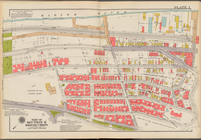
Plate 1: Map bounded by North…
Plate 2: Map bounded by South…
Bounded by Perry Street, West…
Bounded by Corlears Street, P…
Bounded by W. 37th Street, Ni…
Plate 1: Bounded by Liberty S…
Plate 1: Bounded by Battery P…
Plate 2: Bounded by West Stre…
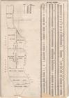
BLOCK INDEX. [Includes the ma…
STREET INDEX [1] [Academy Pl…
Bounded by Liberty Street, Ma…
Plate 1:Bounded by Furman Str…
Plate 20: Bounded by S. 11th …
Bounded by E. 133rd Street, (…
Plate 21: Bounded by Grand St…
Plate 22: Bounded by N. 14th …
m
Plate 1: Bounded by (East Riv…
Plate 9: Bounded by Covert St…
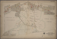
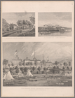
Plate 73: Residence of A.S. D…
Plate 1: [Bounded by Montgome…
Plate 25: Bounded by Avenue C…
Plate 26: [Bounded by Avenue …
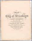
Map of the city of Brooklyn :…
Sheet 1: Map encompassing Sun…
Bounded by E. Hundred & Twent…
Plate 1: Outline Map of Queen…
Plate 23: [Bounded by Bouleva…
Plate 1: Map No. 441 [Bounded…
Plate 19: Map No. 551 [Bounde…
Plate 28: Map No. 8 [Bounded …
Plate 30: Map No. 368 [Bounde…
1
2
3
4
5
Previous
Next
1
2
3
4
5
Previous
Next