Click to visit the main New York Public Library Homepage
The New York Public Library
Digital Collections
About Digital Collections
Browse
Search only public domain materials
Items
Collections
Divisions
Home
Search
Browse
About
Search only public domain materials
Items
Collections
Divisions
Digital Collections
Using Images
Using Data
Search
Filtered search
Show filters
Hide filters
Show Only Public Domain
topic
x
Real property
Fire insurance
122
Cities & towns
112
Business enterprises
21
Landowners
10
More
Less
name
Sanborn Map Company
112
G.W. Bromley & Co
69
Perris, William
27
Beers, F. W. (Frederick W.)
21
Ullitz, Hugo
21
More
Less
collection
Atlases of New York City
234
Atlases of the United States
115
Maps of North America
14
Maps of New York City and State
9
Fred F. French Companies records
4
More
Less
place
New York (State)
334
New York
105
Manhattan (New York, N.Y.)
64
New York (N.Y.)
32
Bronx (New York, N.Y.)
30
More
Less
genre
Maps
366
Atlases
115
Cadastral maps
30
Photographs
7
Index maps
4
More
Less
publisher
Sanborn Map Company
112
G.W. Bromley & Co
56
F. W. Beers & Co
11
G. W. Bromley & Co
11
Hyde & Co
11
More
Less
division
Map Division
356
Milstein Division
12
Manuscripts and Archives Division
4
type
cartographic
369
text
10
still image
8
Date Range
to
381 results found
Filtering on:
x
Note
: NYPL Map Div. copy: manuscript additions in black ink show "North Concourse," "South Concourse," and 2 loops of possible viaduct with stations and trestle. Stamped in lower right margin: D. McN. Stauffer Collection and Gift
x
Topic
: Real property
Sort by:
Title
Date created
Date digitized
Sequence
m
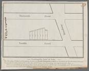
#4321-5 Market and Cherry Sts…
m
4044-2 Market St. lkg. North …
m
4044-6 Lkg. South on Catherin…
m
4044-8 Lkg. South on Market S…
Factory Village [Village]; Fa…
Conklingville [Village]; Conk…
m
Peremptory sale of lots, on T…
A compleat map of North-Carol…
m
Official map of south-west po…
Map of the north western part…
A compleat map of North-Carol…
Map of South Waukegan showing…
m
A map of South Carolina and a…
m
A map of South Carolina and a…
Map of south Florida : showin…
Plan of lands of the South Co…
North Berwick: [Maine]
North Berwick: [Maine]. Limin…
Plan showing land owned by th…
Plan of house lots in South F…
m
Queens: Kissena Boulevard - N…
m
Queens: North Hempstead Turn …
m
Richmond: Arthur Kill Road - …
South Nyack
A chorographical map of the p…
A chorographical map of the p…
m
Draught of 8 3/4 acres of lan…
A chorographical map of the p…
m
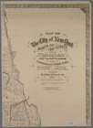
Map of the City of New York n…
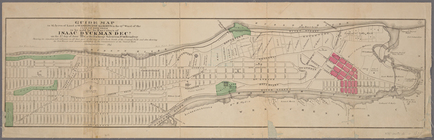
Guide map to 92 acres of land…
Map of the real estate in the…
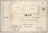
Map of a farm situate in Mont…
m
A chorographical map of the p…
m
Map of the City of New York n…
Plate 72: Town of North Castl…
Plate 80: Town of North Salem…
Bangor [Village]; Bagor Busin…
Dickinson Center [Village]; S…
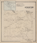
South Stockton [Village]; Sou…
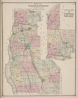
Map of Cayuga County New York…
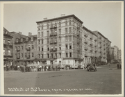
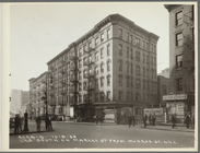
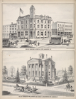
Cor. of Genesee & South Str's…
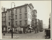
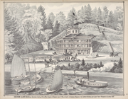
Ensenore Glenn House, on Sout…
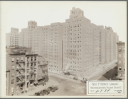
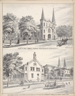
View of Holy Family Church fr…
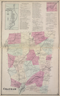
North Chatham [Village]; Chat…
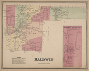
Baldwin Subscriber's Business…
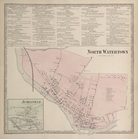
Watertown Business Directory.…
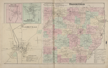
South Brookfield [Village]; N…
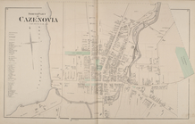
North Part of Cazenovia [Vill…
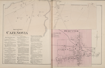
South Part of Cazenovia [Vill…
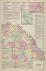
Lenox [Township]; Upper South…
1
2
Previous
Next
1
2
Previous
Next