Click to visit the main New York Public Library Homepage
The New York Public Library
Digital Collections
About Digital Collections
Browse
Search only public domain materials
Items
Collections
Divisions
Home
Search
Browse
About
Search only public domain materials
Items
Collections
Divisions
Digital Collections
Using Images
Using Data
Search
Filtered search
Show filters
Hide filters
Show Only Public Domain
topic
City planning
944
Social conditions
942
History
100
Real property
33
Landowners
25
More
Less
name
M.I.T. Press
942
New York (N.Y.). City Planning Commission
942
Montanus, Arnoldus, 1625?-1683
97
Ogilby, John, 1600-1676
97
United States. War Department. Office of P.R.R. Surveys
10
More
Less
collection
Atlases of New York City
950
Lawrence H. Slaughter Collection of English maps, charts, globes, books and atlases
114
Maps of North America
93
Maps of New York City and State
27
Atlases, gazetteers, guidebooks and other books
20
More
Less
place
New York (State)
966
New York (N.Y.)
956
New York
950
America
97
West Indies, British
97
More
Less
genre
Maps
1186
Illustrations
40
Aerial views
29
Cadastral maps
20
Diagrams
13
More
Less
publisher
MIT Press
942
Printed by the author, and are to be had at his house
97
War Dept., U.S. Pacific Rail Road Explorations & Surveys
8
publisher not identified
7
Printed for Robert Sayer, No. 53, Fleet-Street
5
More
Less
division
Map Division
1222
type
x
still image
cartographic
123
text
33
Date Range
to
1,222 results found
Filtering on:
x
Location
: Lionel Pincus and Princess Firyal Map Division
x
Type
: still image
For more division details, visit the
Lionel Pincus and Princess Firyal Map Division division page
.
Sort by:
Title
Date created
Date digitized
Sequence
m
Maps of the Society for the D…
m
Maps of the Society for the D…
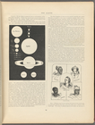
Types of the races of man
Cram's unrivaled atlas of the…
The Earth
Population
m
Il dirigibile "Norge" alla sc…
Most extraordinary [camera sh…
The Narrows tunnel : chart of…
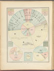
Ethnological Chart of the Wor…
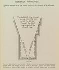
Setback principle
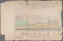
Tableau figuratif du mouvemen…
m
Cary's new and correct Englis…
m
Cary's new and correct Englis…
m
Atlas minimus universalis...…
m
Atlas minimus universalis... …
Map of the Gogebic Iron Range…
Plan of the city of Philadelp…
m
Map of property at Fairmount…
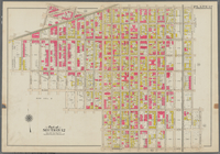
Bounded by Snediker Avenue, L…
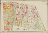
Bounded by Park Place, East N…
Bounded by Saratoga Avenue, E…
New and improved map of the c…
Bird's eye view of Philadelph…
m
Topographical map of the coun…
A new and correct map of Conn…
m
Map of Clinton Co., New York:…
Grand Rapids, Michigan 1868
Perspective map of the city o…
A map of Philadelphia and par…
m
The Centennial--balloon view …
Bird's eye view of the city o…
Plan of the city of Philadelp…
New and improved map of the c…
Barometric profile of the rou…
Mines of the Kansas Ridge, Mo…
Design map of the village of …
m
City of Toledo, Lucas Co., Oh…
Map of Cleveland and its envi…
Map of the city of Cleveland,…
m
A correct map of the state of…
Hyde Park : [Chicago, Illinoi…
Hydrographic map of Elkhart L…
The new empire of western Col…
Territory of Idaho
Map of the state of Californi…
m
Rand, McNally & Co.'s new bus…
Chart of the Columbia River f…
m
Map of Dutchess Co., New York…
Geological plan & section fro…
1
2
3
4
5
Previous
Next
1
2
3
4
5
Previous
Next