Click to visit the main New York Public Library Homepage
The New York Public Library
Digital Collections
About Digital Collections
Browse
Search only public domain materials
Items
Collections
Divisions
Home
Search
Browse
About
Search only public domain materials
Items
Collections
Divisions
Digital Collections
Using Images
Using Data
Search
Filtered keyword search
Show filters
Hide filters
Show Only Public Domain
topic
Real property
3106
Dwellings
305
Apartment houses
304
Fire insurance
212
Railroads
158
More
Less
name
G.W. Bromley & Co
1701
Ullitz, Hugo
735
E.B. Hyde & Co
544
E. Belcher Hyde Map Company
488
Bromley, George Washington
468
More
Less
collection
Atlases of New York City
3309
Maps of New York City and State
555
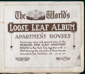
The World's loose leaf album of apartment houses: containing views and ground plans of the principal high class apartment houses in New York City, together with a map showing the situation of these houses, transportation facilities, etc
304
I. N. Phelps Stokes Collection of American Historical Prints
94
Collection of broadside real estate maps announcing auctions of lots in early 19th century New York City
67
More
Less
place
x
New York
New York (State)
4363
Manhattan (New York, N.Y.)
1949
Brooklyn (New York, N.Y.)
975
New York (N.Y.)
568
More
Less
genre
Maps
3838
Photographs
310
Floor plans
305
Indexes
112
Cadastral maps
103
More
Less
publisher
G.W. Bromley & Co
1573
E. Belcher Hyde
557
N.Y. World
304
E. Robinson Co
209
Perris & Browne
124
More
Less
division
Map Division
3808
Milstein Division
305
Wallach Division: Print Collection
97
Rare Book Division
11
Manuscripts and Archives Division
9
More
Less
type
cartographic
3841
text
554
still image
414
Date Range
to
Looking for one of these collections?
Maps of New York City and State
2,059 items
The World's loose leaf album of apartment houses: containing views and ground plans of the principal high class apartment houses in New York City, together with a map showing the situation of these houses, transportation facilities, etc.
304 items
4,367 results found for:
x
map
Filtering on:
x
Place
: New York
x
Rights
: Public Domain
Sort by:
Relevance
Title
Date created
Date digitized
Sequence
m
Petersen's
map
of Brooklyn
note:
…"A.R. Ohman
Map
Co.
Map
Publishers
Hagstrom's
map
of ... New York house-number
note:
Hagstrom
Map
Company.
Map
of Morningside Park
m
Property identification
map
of Inwood Hill
note:
Blueprint of
map
, indicating property owners
Key
Map
m
Hammond's complete
map
of New York City
Block line
map
of the heavy valued district
note:
…"Copyright 1913, by Sanborn
Map
Co."…
m
Brooklyn City Hall
abstract:
Cadastral
map
showing area surrounding
Map
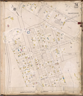
of the borough of Brooklyn, New York
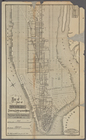
m
Map
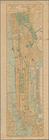
of Manhattan, City of New York
m
Map
of part of New York City : showing
note:
…"This
map
corrected to December 31st, 1892."…
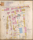
Staten Island, V. 1, Plate No. 6 [
Map
bounded
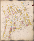
Staten Island, V. 1, Plate No. 14 [
Map
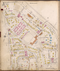
Staten Island, V. 1, Plate No. 19 [
Map
Staten Island, V. 1, Plate No. 20 [
Map
Staten Island, V. 1, Plate No. 22 [
Map
Staten Island, V. 1, Plate No. 25 [
Map
Staten Island, V. 1, Plate No. 26 [
Map
Staten Island, V. 1, Plate No. 28 [
Map
Staten Island, V. 1, Plate No. 29 [
Map
Staten Island, V. 1, Plate No. 30 [
Map
Staten Island, V. 1, Plate No. 31 [
Map
Staten Island, V. 1, Plate No. 34 [
Map
Staten Island, V. 1, Plate No. 36 [
Map
Staten Island, V. 1, Plate No. 49 [
Map
Staten Island, V. 1, Plate No. 50 [
Map
Staten Island, V. 1, Plate No. 67 [
Map
Staten Island, V. 1, Plate No. 71 [
Map
Staten Island, V. 1, Plate No. 74 [
Map
Map
of the city of Brooklyn
note:
Drawn & published by Railway
Map
and Publishing
Williams'
map
of Borough of Brooklyn …
note:
by Wilaims
Map
& Guide co.
Map
of part of New York City
note:
NYPL
Map
Div. copy is damaged along margins
Williams'
map
of boroughs of Manhattan
note:
by Williams
Map
& Guide Co.
m
Hagstrom's
map
of upper New York house
note:
Includes indexes and inset
map
of "Greater
Map
of the borough of Manhattan and part
image:
psnypl_
map
_255
Manhattan borough and part of…
note:
Map
on verso:
Map
of the City of New York ;
Map
m
Map
of part of New York City : area
note:
Manuscript
map
labeled "Population
map
no
m
Map
of part of New York City
note:
…"This
map
corrected to December 31st, 1893."…
m
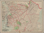
1907 Library
map
of Manhattan, City of New York
note:
A black and white
Map
of Manhattan, City
m
Population and school attendance
map
abstract:
Portion of black and white
map
showing
… Insurance
maps
Staten Island
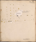
Staten Island, V. 1, Plate No. 1 [
Map
bounded
Staten Island, V. 1, Plate No. 2 [
Map
bounded
Staten Island, V. 1, Plate No. 3 [
Map
bounded
Staten Island, V. 1, Plate No. 4 [
Map
bounded
Staten Island, V. 1, Plate No. 5 [
Map
bounded
Staten Island, V. 1, Plate No. 7 [
Map
bounded
Staten Island, V. 1, Plate No. 9 [
Map
bounded
Staten Island, V. 1, Plate No. 10 [
Map
Staten Island, V. 1, Plate No. 11 [
Map
1
2
3
4
5
6
7
8
9
10
…
17
18
Previous
Next
1
2
3
4
5
6
7
8
9
10
…
17
18
Previous
Next