Click to visit the main New York Public Library Homepage
The New York Public Library
Digital Collections
About Digital Collections
Browse
Search only public domain materials
Items
Collections
Divisions
Home
Search
Browse
About
Search only public domain materials
Items
Collections
Divisions
Digital Collections
Using Images
Using Data
Search
Filtered keyword search
Show filters
Hide filters
Show Only Public Domain
topic
Real property
10399
Fire insurance
5221
Cities & towns
5007
City planning
993
Social conditions
944
More
Less
name
Sanborn Map Company
5095
G.W. Bromley & Co
2180
M.I.T. Press
942
New York (N.Y.). City Planning Commission
942
Ullitz, Hugo
735
More
Less
collection
Atlases of New York City
9795
Atlases of the United States
2037
Maps of New York City and State
1306
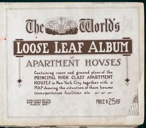
The World's loose leaf album of apartment houses: containing views and ground plans of the principal high class apartment houses in New York City, together with a map showing the situation of these houses, transportation facilities, etc
304
New York World's Fair 1939 and 1940 Incorporated records
151
More
Less
place
x
New York (State)
New York
5619
Manhattan (New York, N.Y.)
2285
New York (N.Y.)
2238
Brooklyn (New York, N.Y.)
999
More
Less
genre
Maps
13020
Atlases
2036
Photographs
557
Floor plans
307
Cadastral maps
247
More
Less
publisher
Sanborn Map Company
5009
G.W. Bromley & Co
2051
MIT Press
942
E. Belcher Hyde
557
N.Y. World
304
More
Less
division
Map Division
13151
Milstein Division
306
Manuscripts and Archives Division
163
Wallach Division: Print Collection
124
Wallach Division: Photography Collection
93
More
Less
type
cartographic
12153
still image
1666
text
704
moving image
1
Date Range
to
Looking for one of these collections?
Atlases of New York City
11,722 items
Atlases of the United States
3,868 items
Maps of New York City and State
2,059 items
The World's loose leaf album of apartment houses: containing views and ground plans of the principal high class apartment houses in New York City, together with a map showing the situation of these houses, transportation facilities, etc.
304 items
14,041 results found for:
x
map
Filtering on:
x
Place
: New York (State)
Sort by:
Relevance
Title
Date created
Date digitized
Sequence
m
Maps
of property in the city of New York
note:
… index,
map
of 277 Pearl Street),
map
leaves 1
m
Map
of the Cedar Knolls, at Bronxville
note:
Topographical
map
of Cedar Knolls. Shows
Plan of the Central Park, Cit…
note:
Map
is oriented with north at right.
m
Knickerbocker Village
Saratoga Springs [Township]
Schuylerville Business Direct…
Saratoga [Township]
Stillwater [Township]
References; Waterford [Villag…
Waterford [Township]
Beechers Hollow [Village]; Be…
Wilton [Township]
Map
of Saratoga County
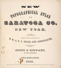
New topographical atlas of Sa…
Residence of James Carrigan, …
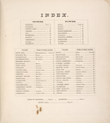
Index
Acres of Land, Population, Dw…
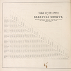
Table of Distances in Saratog…
Ballston [Township]
Ballston Spa Business Directo…
Charlton [Township]
Grangerville [Village]; Grang…
Clifton Park [Township]
Corinth [Township]; Palmer Fa…
Clifton Park [Village]; Clift…
Day Corners Business Director…
Edinburgh [Township]
Crescent [Village]; Crescent …
Galway [Township]; Yorks Corn…
Greenfield [Township]; Pages …
Bloodville [Village]; Bloodvi…
Hadley [Township]; Hadley Bus…
Half Moon [Township]
Factory Village [Village]; Fa…
Malta [Township]
Burnt Hills [Village]; Burnt …
Milton [Township]
Moreau [Township]
Conklingville [Village]; Conk…
Northumberland [Township]
Providence [Township]; Hagedo…
References; Saratoga Springs …
Map
of the borough of Brooklyn, City of New York
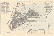
Plan of the City of New York
collection:
New York City --
Maps
Records of searches in relati…
collection:
Maps
of New York City and State
m
Hammond's complete
map
of Brooklyn …
Map
of the borough of Brooklyn, City of New York …
Hammond's handy reference
map
of Brooklyn
Map
of the borough of Brooklyn, 1902
m
Map
of the borough of Brooklyn, New York …
1
2
3
4
5
6
7
8
9
10
…
56
57
Previous
Next
1
2
3
4
5
6
7
8
9
10
…
56
57
Previous
Next